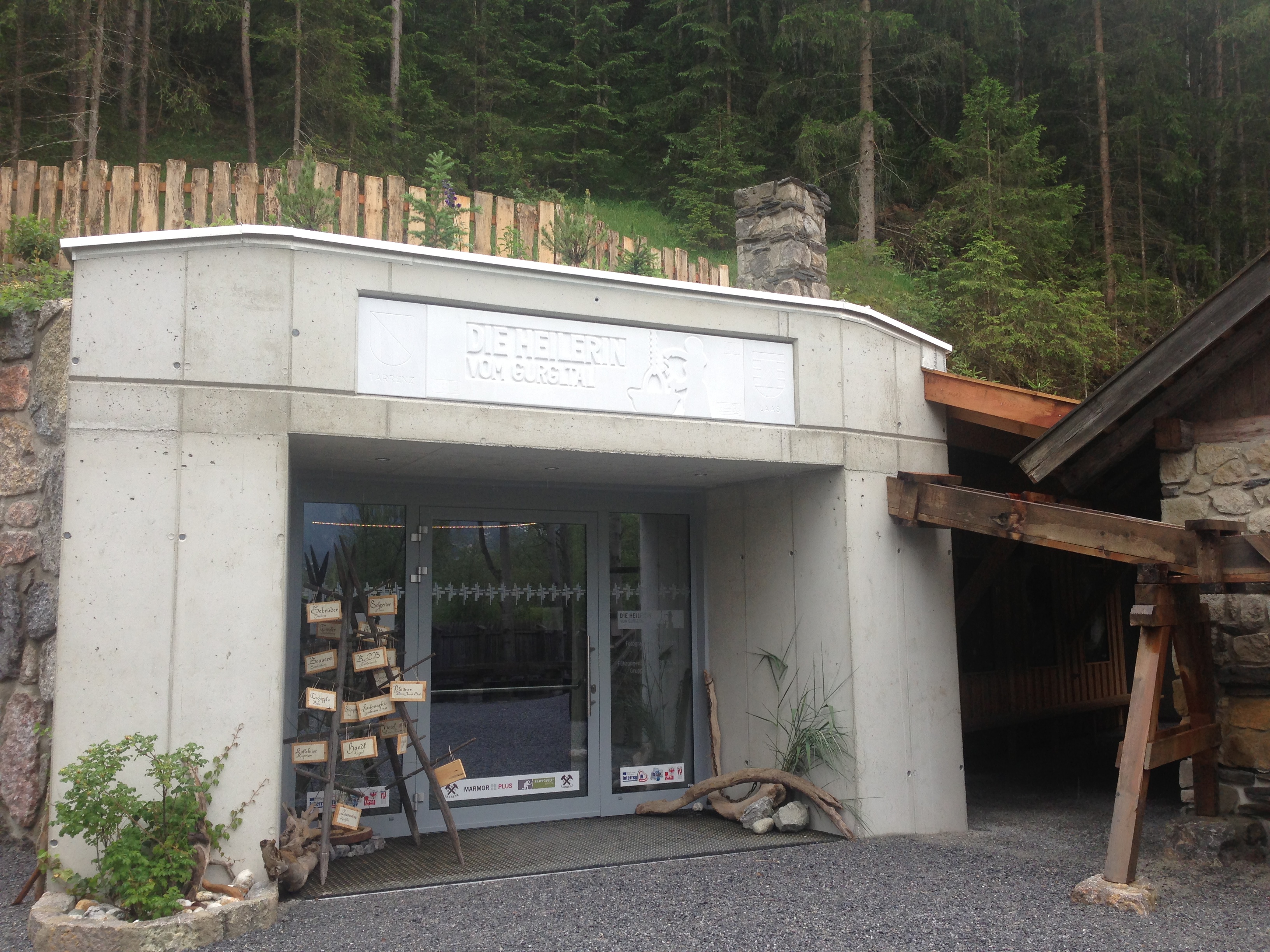
I persuaded a good friend to drive me to the village of Tarrenz (in the Gurgltal, north of Imst) to visit the brand-new museum built to house a fascinating archaeological discovery there — die Heilerin von Gurgltal, which more of less translates as the “Medicine Woman” from the Gurgl Valley. Alternately she’s referenced as being from the Strader Wald, or from the forest in nearby Strad. The story in a nutshell:
Tarrenz lies along the Via Claudia Augusta, one of the old Roman roads over the Alps. Hobby archaeologists are attracted to this area because of the artifacts that can be found along old roads. Some such treasure-hunters were combing the woods with a metal detector, and came across the first signs of something very interesting and ultimately very mysterious.
Eine Freundin fuhr mit mir neulich nach Tarrenz (im Gurgltal, bei Imst), um das nagelneue Museum der Heilerin vom Gurgltal zu besuchen. (Alternativ ist sie die Heilerin vom Strader Wald gennant.) Tarrenz liegt entlang der historische Via Claudia Augusta, ein Ziel für Hobbyarchäologen, wegen der Menge von Artifakten, die man neben alten Strasse finden kann. Ein paar solche Schatzsucher waren vor einige Jahren mit einem Metalldetektor im Strader Wald; dort stießen sie auf einen interessanten und mysteriösen Fund:

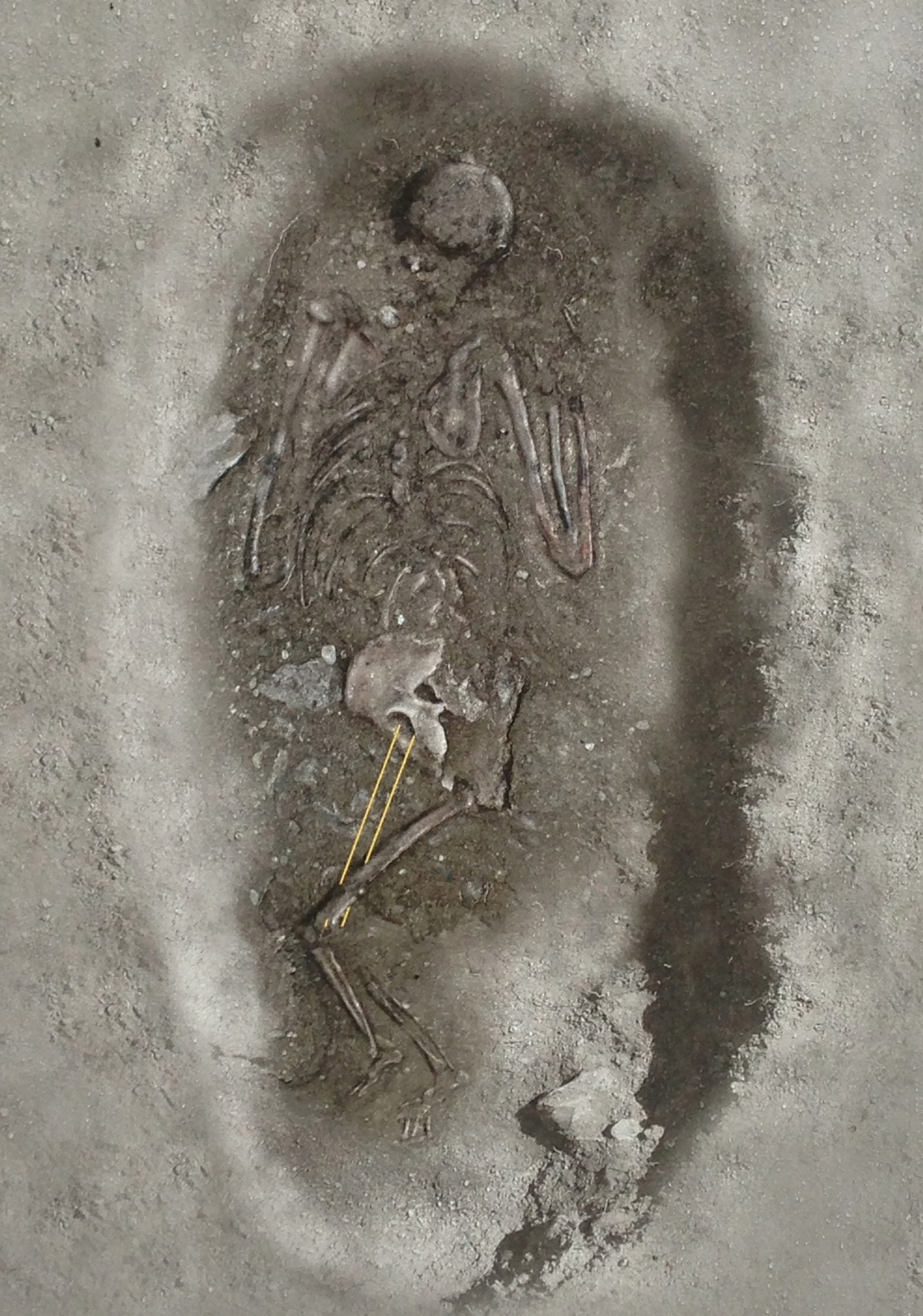
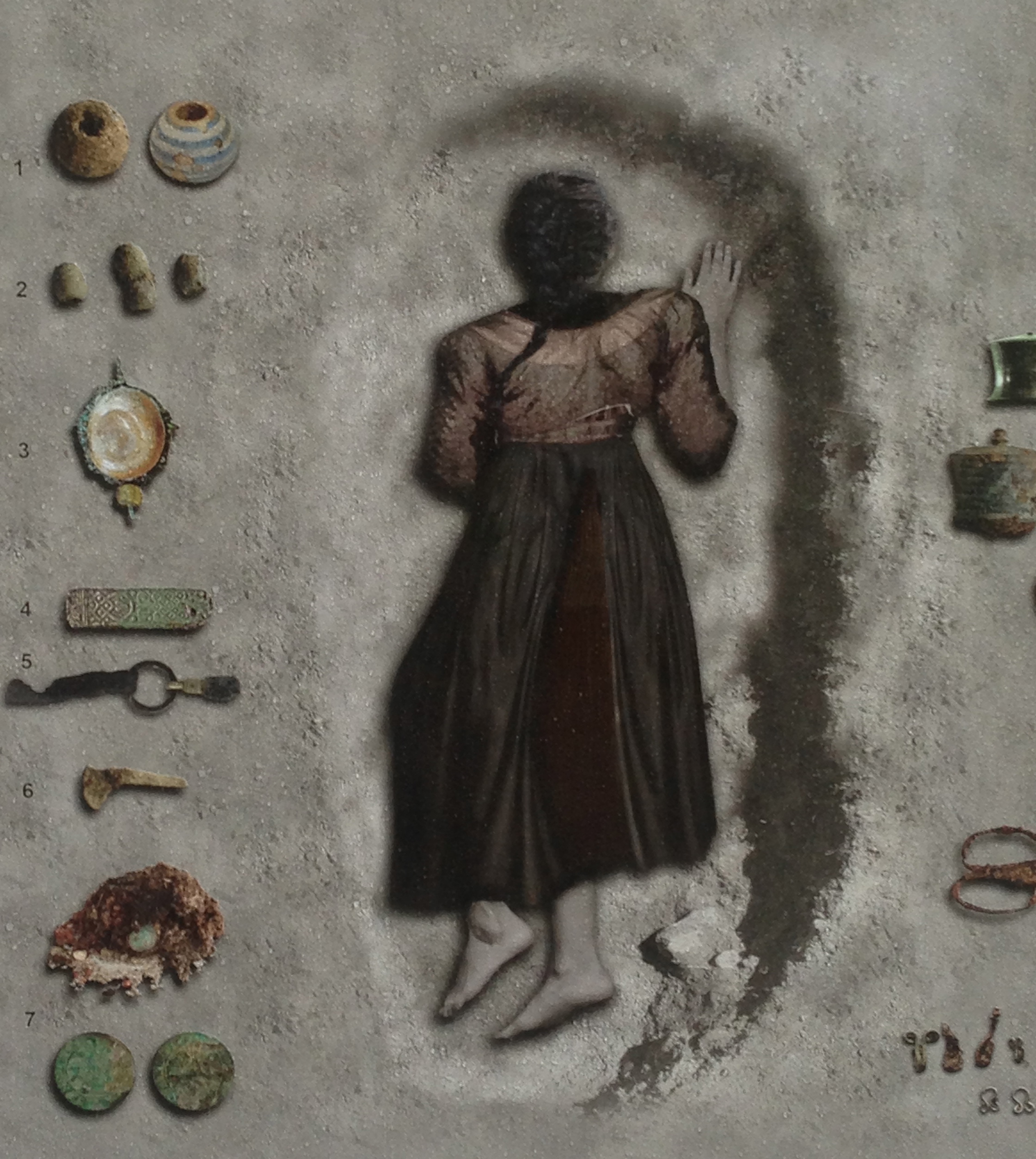
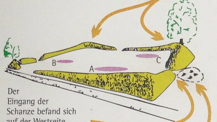
It was the grave of a woman, found lying face-down, along with a bounty of small and valuable objects — metal instruments such as scissors and keys, coins, pearls and crystals, a thimble, and — the headline-grabber —a set of metal cups used for cupping therapy. Dating places her having lived during the time of the 30 Years War, in the first half of the 17th century.
Das Grab einer Frau, in Bauchlage beerdigt, zusammen mit einer Menge kleine wertvolle Gegenstände — ihre Habseligkeiten. Eine Schere, eiserne Schlüssel, Münzen, Perlen, Kristallen, ein Fingerhut, und — meist interessant — ein Set Schröpfköpfe aus Metall. Hier der archäologische Befund. Die Frau lebte während der Zeit des Dreißigjahrigen Krieges.

The circumstances don’t fit together in the usual way. She was buried quite far from the cemetery. A foreigner? A suicide? Possible Jenische*? She had, much like Ötzi did, her whole “professional kit” with her. Added to her grave as a kind of honor? Or thrown into it in a hasty burial? Then there’s the “face down” business, which normally is found to have been the custom for criminals. But she clearly hadn’t been executed as a witch, not with all those valuables in the grave with her, even though witch trials were very much in at the time.
Die Sachen passen nicht zusammen wie erwartet. Die Frau wurde ziehmlich weit weg vom nächsten Friedhof begraben. Eine Fremde? Ein Selbstmord? War sie Jenisch? Wie Ötzi, sie hatte ihre professionelle Werkzeuge dabei — wurden sie mit ihr mitbegraben, als ein Ehrenzeichen? Oder schnell hineingeworfen in Eile? Aber sie wurde gegraben mit Gesicht nach unten, wie man Kriminelle bestattete. Offensichtlich wurde sie nicht hingerichtet, sonst hätte man keine Grabbeigaben gefunden, obwohl die Hexenprozesse damals ganz in Mode war.
The museum tries to bring you in with carefully portioned experiences. First you hear of the arts of healing as practiced in these parts, and how knowledge was handed down through generations. Then you learn about some actual cases from Tirol which involved persecutions due to superstition and fear. The antisemitic source — and consequences — of Anderl of Rinn is an example used.
Das Museum führt den Besucher vorsichtig in kleinen Etappen ein, vermutlich für die sehr junge Besucher. Man lernt von Heilkunde und wie das Wissen von Generation zu Generation übergeben wurde. Dann wird man gelehrt über wahre Öpfer von Aberglaube und Angst in Tirol, zum Beispiel die antisemitische Ursprung — und Folgen — der “Anderl von Rinn” Geschichte.
You are then ushered into to larger room to watch a short film combining the facts of the find (given by the head of the archaeology department at the University of Innsbruck, Professor Harald Stadler) with a dramatized version of what might have happened, using locals as actors. Their version involves a heathen midwife, banned from the community and the church (same thing back then) but nevertheless needed and called whenever someone got sick. A stillbirth is enough to have the villagers accuse her of witchcraft, and then tempers get hot, someone (guess who) gets killed, and a hasty, fearful burial is carried out in the forest. Entirely plausible — although often the truth is a lot more boring (she died of illness, her outsider travelling companion(s) buried her as best they could, and moved on?)
After the film ends, you finally get to see the skeleton and the artifacts, laid out under glass with plenty of information about their provenance and uses. The tour guides — a husband-and-wife team — are very much involved in the project and were able to answer questions in depth.
Man kommt dann in einer Halle und ein Kurzfilm läuft. Archäologische Details (von u.a. Universitätsprofessor Harald Stadler) alternieren mit einer Dramatisation von der Geschichte — also, was hätten passieren könnte — mit einheimische Mitwirkenden. In ihrer Fassung, ist die Frau eine Außenseiterin, eine heidnische Hebamme und Heilerin, aus der Gemeinde verbannt, dennoch in Krankenfälle immer wieder gerufen. Ein Totgeburt führt zur Vorwürfe von Hexerei, die Frau getötet und in Angst und Eile im Wald begraben. Alles schon möglich — obwohl die Wahrheit ist oft weniger interessant.
Dannach darf man den Skelett samt Artifakten (in Vitrinen) -endlich- sehen. Die Führer — ein Ehepaar — sind im Projekt involviert und konnte viele Fragen reichlich antworten.
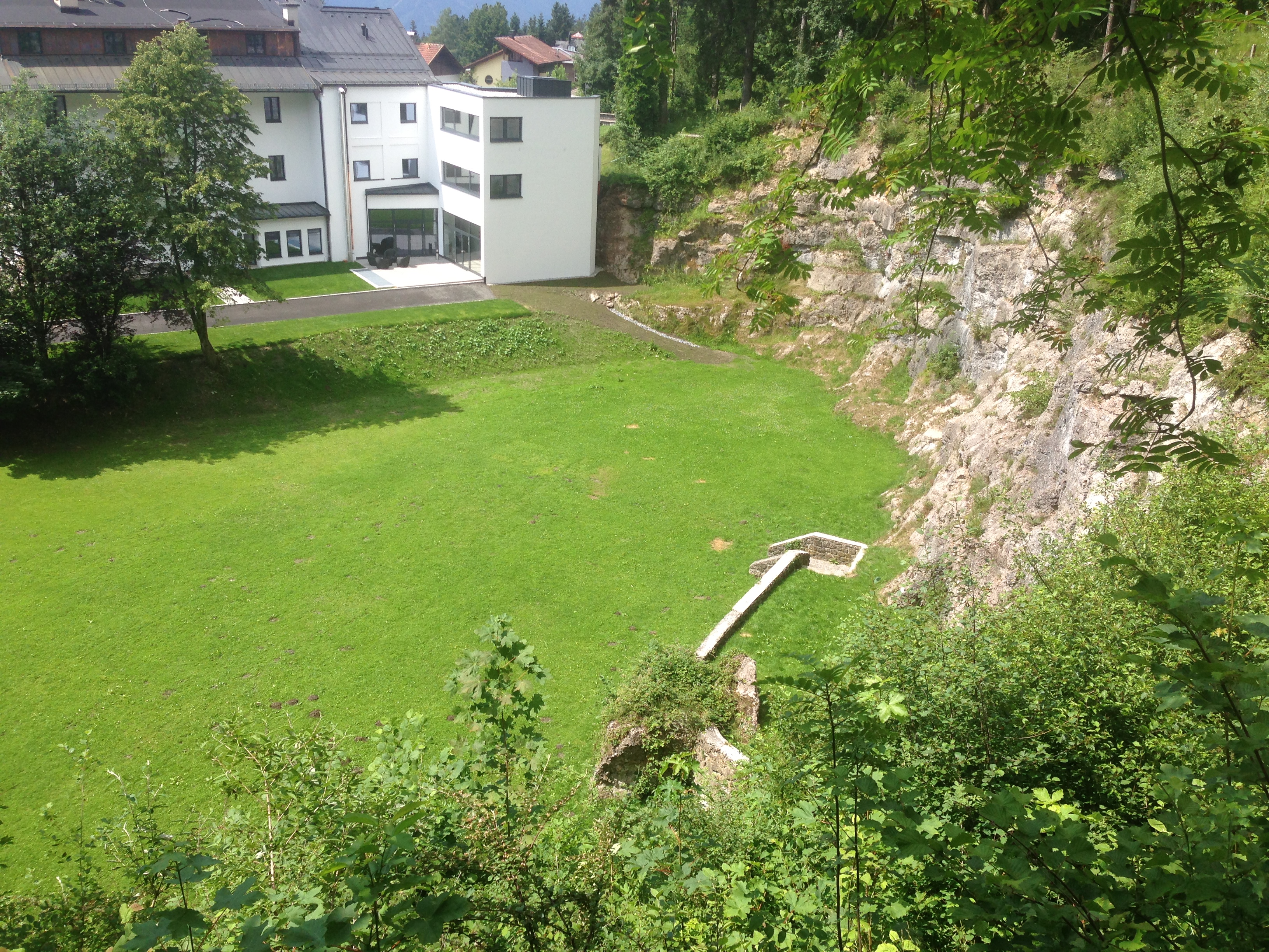
If you go: the Museum der Heilerin von Gurgltal; is located within another, outdoor museum called Knappenwelt, which is a recreation of a small mountain mining industry from the olden days. You can buy a ticket for either, or in combination. Drive to Imst and then north on the 189 toward Fernpass. It’s trickier if you don’t have a car, but apparently this tourist shuttle will get you there from “downtown” Imst to the Knappenwelt. You’ll still have to walk from the Imst station, which is a bit removed from town.
Anfahrt: das Museum befindet sich in der “Knappenwelt”, ein Freilicht Museum. Von Imst kommt man mit dem Strasse Nr. 189 richtung Fernpass nach Tarrenz. Ohne Auto wird’s schwieriger, aber wenn man in Imst von Bahnhof ins Zentrum geht, findet man den Bummelzug “Bummelbär”, der macht einen Tour von Imst nach Strad mit Zwischenstops.
*Jenische is a name used for a certain nomadic people in Europe. They are not related to the Roma or Sinti — in fact they may not be an ethnic group at all but fall under the generic category “gypsy”. Wikipedia likens their language to Cockney.
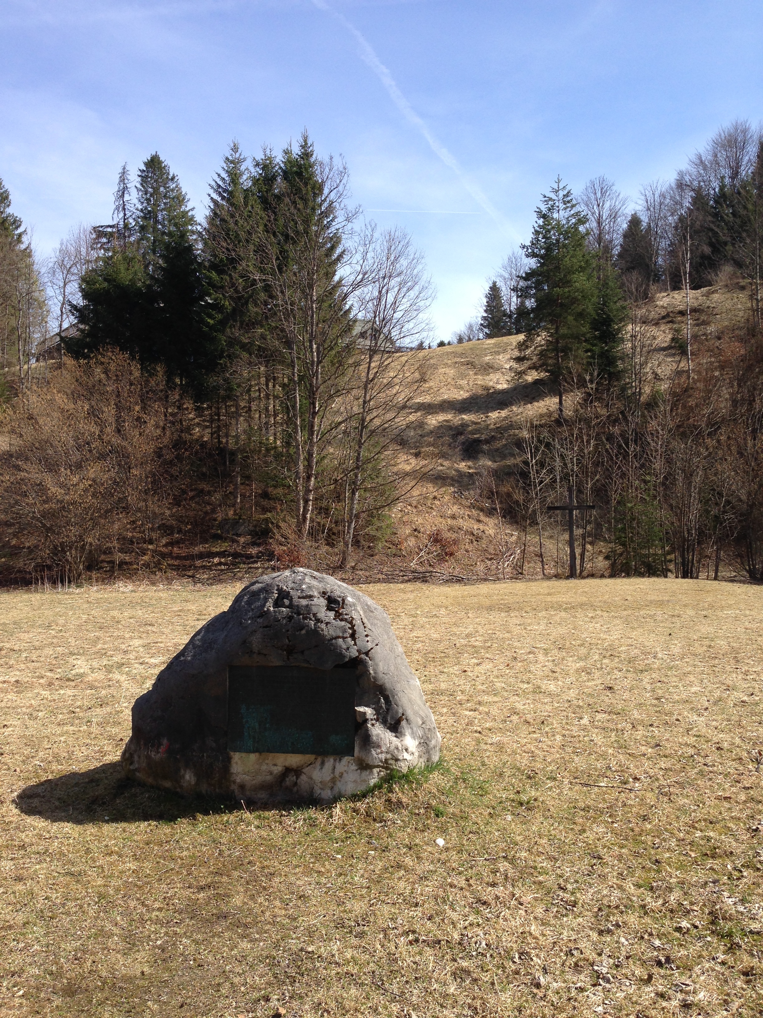 First, along the small path called Römerweg (more on that in a bit), one comes across the Kirchfeld (church field), in which a boulder rests. This is the site of the old original Scharnitz Abbey (g), founded in 763 and whose monks moved to another area in 772. Excavations in the late 20th century found a church foundation, traces of living quarters, and a small graveyard. Just a minute further along the path, however, one comes to this:
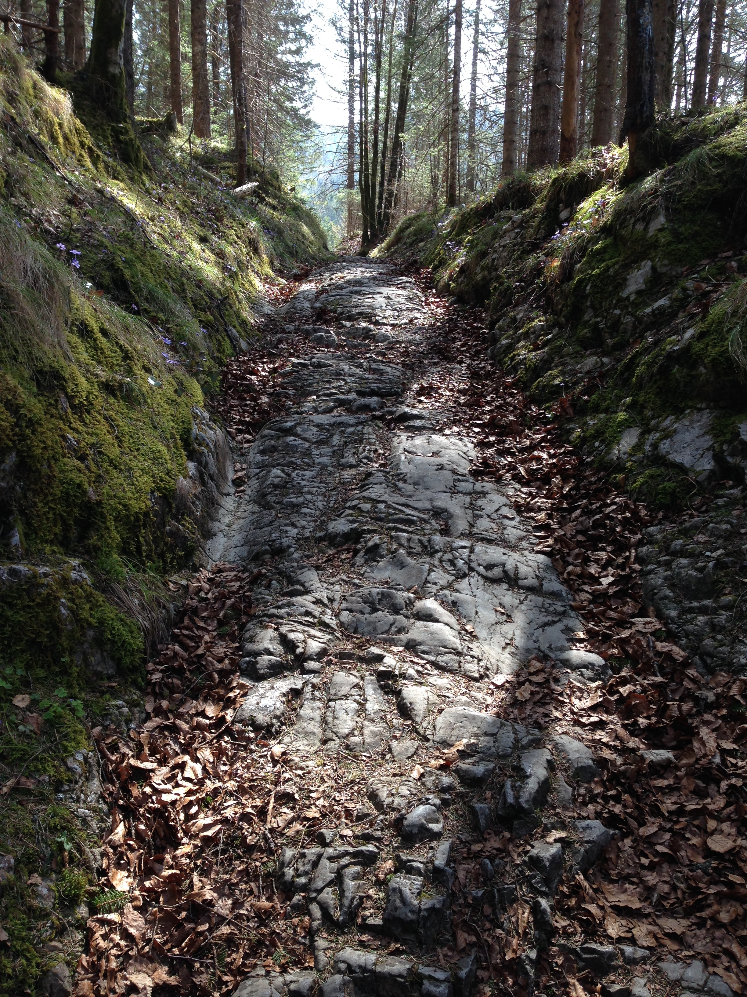
 Römerweg ends here at this unpaved road, which leads to the main road back to Mittenwald. The Via Raetia probably does not lie beneath it, but rather somewhere hidden under pasture. Or maybe it does. One could cycle a bit of the general area of the road, although there is no fixed bike route as there is with parts of the Via Julia. The “Via Raetica Bike Path” is something else altogether, along the Danube near the Roman frontier. This online compendium of the Via Raetia would be useful in planning a route. Perhaps, with some deeper research and field work, I could publish my own someday…