Rooftop Blogging: Final Edition

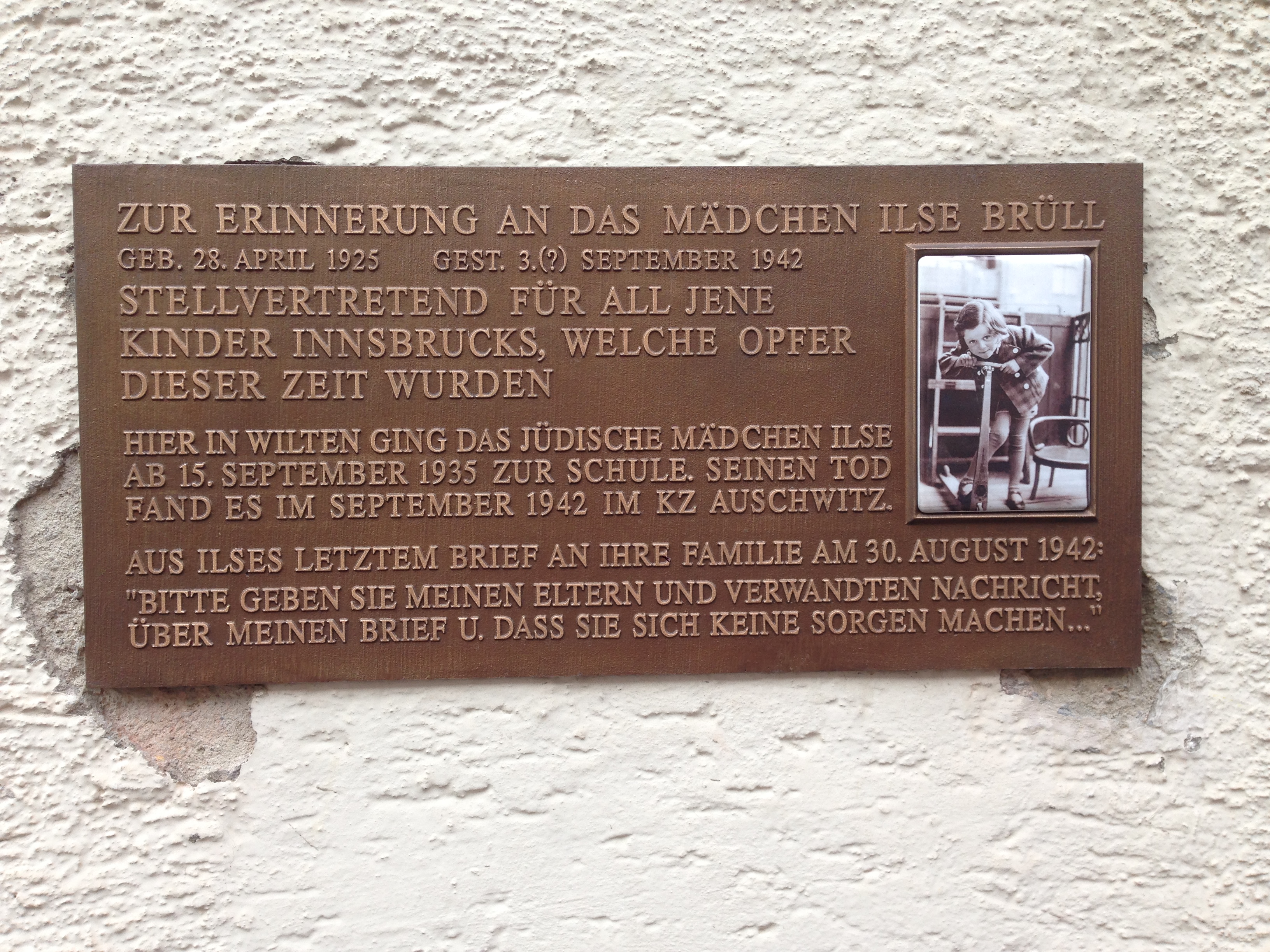
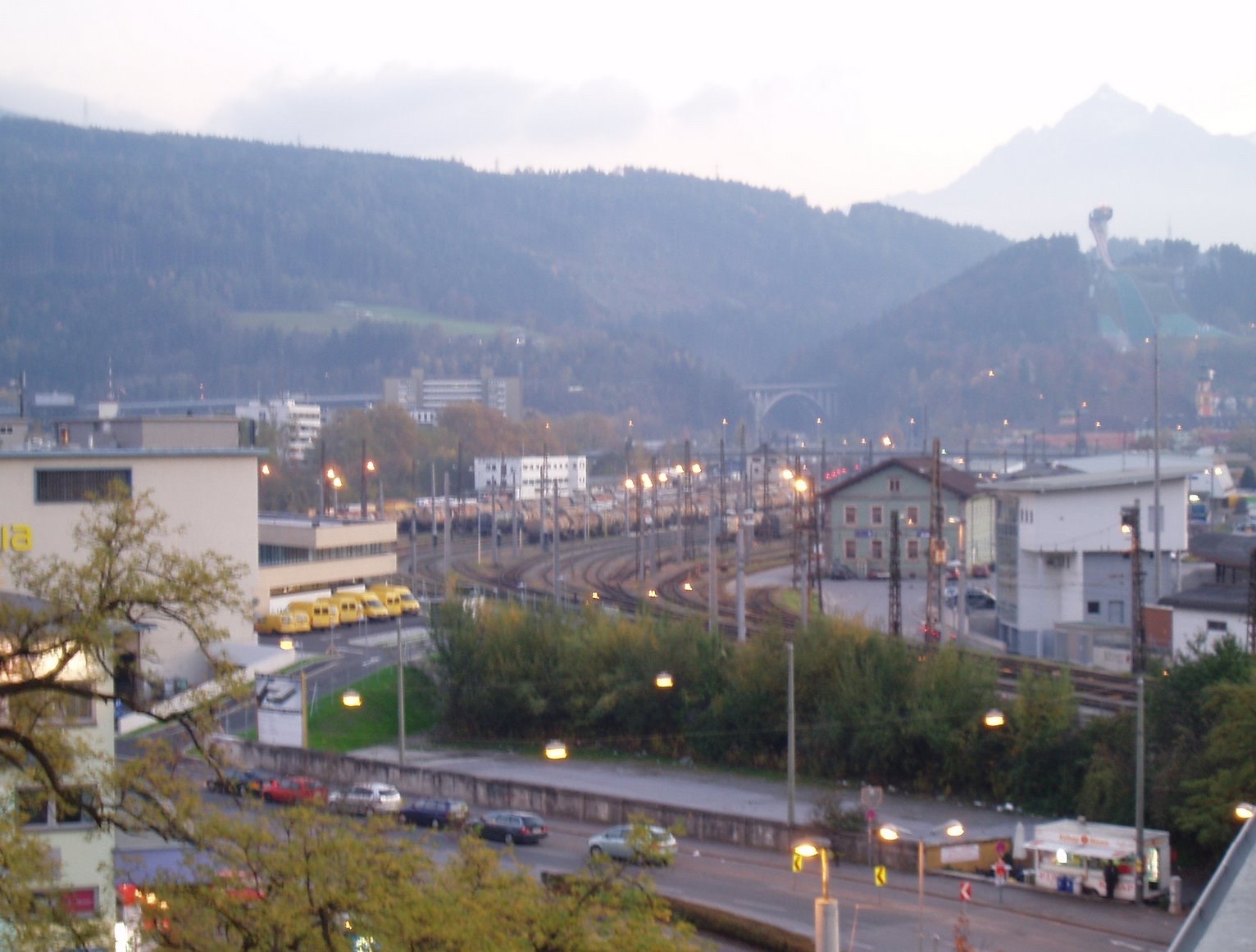
When I began the blog nearly 8 years ago, I wanted to do some kind of photoblogging that could be done on a regular, perhaps weekly basis with ease. A lot of people were doing “Saturday cat blogging”, which I found a little tiresome but it was something amusing to add to the big conversation going on, and I wanted to be part of that conversation by contributing to it. The mountain/city view from my terrace is beautiful and constantly changing, and seemed a good enough choice. So let’s have a last look around.

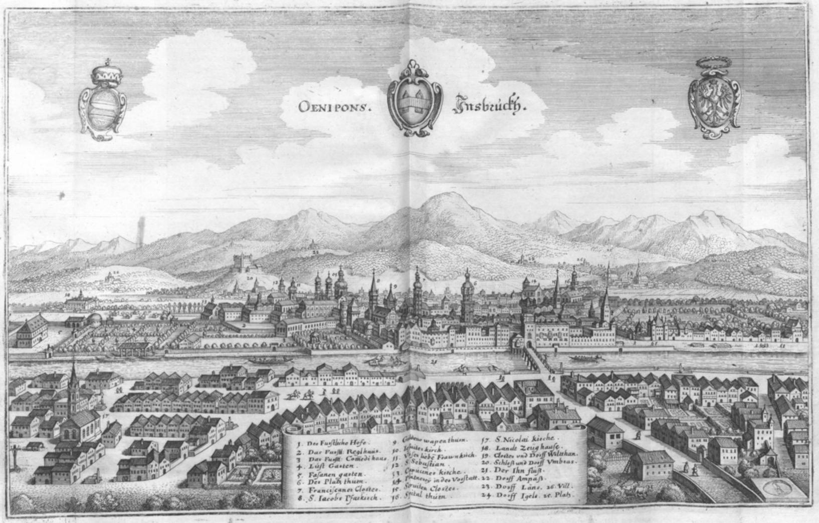
There have been so many changes to Innsbruck, architecturally speaking. While the little Altstadt retains its Medieval look, the areas just outside it have been changing in leaps and bounds. Here are the ones I can remember since 2000, when I arrived, starting with the changes observable right outside my window:

Bergisel Ski Jump
Schanze Before
The old one demolished in 2001 (I watched from my apartment), the new one, by star architect Zaha Hadid, opened in 2002.

OLYMPUS DIGITAL CAMERA

Sillpark Plaza and Annex
Sillpark
I like the extra mall shops (and the green roof!) I don’t like the plaza (Vorplatz) for one reason: its acoustics. The shape of it triggers sound — people talking, music, drumming — to ricochet right up through our windows. It has gotten much louder here over the years. Last night a crowd of twenty-something girls were doing some kind of ritual screaming at the beach bar, over and over. They were there for hours.

Amraserstraße/Museumstraße/Brunecker Straße
An old, antiquated Post Office building stood on Brunecker Straße, and for a time I went there to pick up packages. Now the sleek, golden brown Pema Tower takes up most of that block, provides cover from sun and rain on that side of the street, and holds a few nice new businesses. The empty lot on the Amraserstraße side is currently a construction site for another tower. The bus/tram stop has been fixed up nicely too, and a pedestrian tunnel installed.

OLYMPUS DIGITAL CAMERA

Frachthof now

Die Sill Insel
This was a dirt parking lot, if memory serves me. There was some kind of old loading depot building which had some use in the alternative scene, and a little pink villa of sorts which I believe housed modern art. I often wondered what their original purpose was; they may have belonged to the Ferrari Palace (now a vocational school) across the street. Perhaps cargo was pulled off the Sill Canal and loaded on wagons there. The little house, I have no idea. On that site now stands a new apartment building. (It hasn’t destroyed the view, but I did have to get used to idea that other people now stand on their balconies and look over at me.)
Inntal BeforeInntal now

What else has changed? The Hauptbahnhof is new-ish, having reopened in 2004.
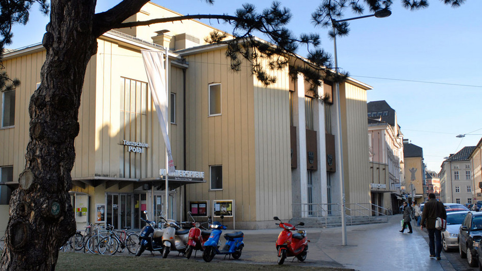
The Tiroler Landestheater opened its new annex in 2003, with rehearsal spaces, offices and workshops.
The Rathaus Passage and Kaufhaus Tyrol, both on the Maria-Theresien-Straße,  are two new urban shopping malls which, judging from the masses who go there, seem to be doing very well, despite my insistence that the latter, formerly Bauer & Schwarz, was cursed. The gods of commerce won that battle. Bauer and Schwarz would probably have approved.)
The Convention Center (Messegelände) was taken down and replaced with a newer, larger one.
The Hungerburgbahn was redesigned, with two new stations also designed by Zaha Hadid. The line was extended over to the Hofgarten, where the city tourists can reach it more easily.
The Tivoli football stadium was renovated to seat the larger crowds of the European Championship in 2008, with extensions which, by design, can be added for larger events and later removed.
The streetcars were replaced with the current red, noiseless version. I missed the old ones for a while but quickly got used to the new ones, especially since the Iglerbahn now quietly slithers through the forest, Innsbruck’s own Tatzlwurm.
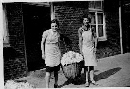
A less-vaunted change was the demolition of the Bürgerbräu brewery on Ingenieur-Etzl-Straße, on which now stands a modern glass building of businesses below and apartments above. The not-unpleasant smell of hops used to waft through the air on warm summer nights. They made Kaiser Bier, and certainly there was a connection with the Kaiserstube restaurant, just around the corner on Museumstrasse. Below, both Bürgerbräu and the old streetcars.
Bürgerbräu

The Stadtsäle is going to come down this summer. This postwar structure was erected after the older Stadtsäle was condemned and demolished. A rather beautiful and ornate palatial hall from 1890,
Alte Stadtsäle
it succumbed to allied bombs that fell over Innsbruck late in the Second World War. I have always thought of the current Stadtsäle as our local version of the Palast der Republik, useful, ugly, but aesthetically interesting in a “retro” way.
dt.common.streams.StreamServer
When it’s razed, the Landestheater’s Kammerspiel will go along with it, and a new Kammerspiel will take its place. I have many fond memories of this 200-seat theater. You can say I cut my teeth on that stage.

Bürgerbräu photo from here.
Image of old Stadtsäle from here.
Image of current Stadtsäle from here.
All other images by the author.

In Memory Of A Girl

IMG_1885

In memory of Ilse Brüll
Born 28 April 1925 Died 3(?) September 1942
and in memory of all those children of Innsbruck who were victims of this time

Ilse Brüll, a Jewish girl, attended school here in Wilten from September 15, 1935. She met her death in September 1942 at Auschwitz Concentration Camp.

From Ilse’s last letter to her family, August 30, 1942: “Please tell my parents and relatives of this letter and that they are not worry…”

thumb_ilsebruell Kopie

The story of Ilse Brüll is one of the saddest in Innsbruck’s Third Reich history. She grew up in an assimilated Jewish family in Anichstrasse in the center of town, her father Rudolf Brüll had a furniture and upholstery business. After the November 1938 pogrom (Kristallnacht) the family looked for ways to leave the country and emigrate to America, but without success.

Bruell_Rudolf_Ilse_l

Ilse Brüll and her cousin Inge Brüll were sent with the Quaker Kindertransports to the Netherlands, expecting to meet up later with their parents. At first brought to a refugee camp there, they sometimes entertained fellow refugees at events, by donning traditional Tyrolean clothing and singing duets. They were brought later to a convent with other children, and learned Dutch.

483

The Kindertransports brought Jewish children out of harm’s way to he Netherlands and Great Britain. When the Nazis invaded the Netherlands in 1942 they immediately began rounding up Jews, and demanded that the convent hand over any unbaptized Jewish children. It seems that Ilse had had the opportunity to be baptized but refused (Inge’s mother was Roman Catholic, and Inge had been baptized as a baby.)

Inge recounted in a taped interview that the convent felt it had no choice — if they had disobeyed the order, the entire colony of 200 children would have been disbanded. Ilse was taken to Westerbork Camp in August 1942 (Anne Frank’s family was just settling into the hidden apartment in Amsterdam, but would also pass through here 2 years later) before “most likely” continuing on to Auschwitz to be gassed. She was 17.

Ilse’s parents, Rudolf and Julie Brüll, were interned in Theresienstadt but survived, and returned to Innsbruck after their liberation. Rudolf Brüll fought for and eventually reclaimed his furniture shop, and was president of the Jewish Community in Innsbruck until his death in 1957.  Ingeborg Brüll died in 2011, also in Innsbruck.

Information in German here images 2, 3 and 4 from here. Image 1 by the author.

A Chapel in Axams

A free Sunday afternoon and it happens to be Tag des Denkmals in Austria. This is a day for  cultural and historical monuments across the country, and often there is the chance to see something not normally open to the public.
That opportunity is what got me on a bus to Axams, a village on the slopes of the mountains southwest of Innsbruck. Axams is a very, very old village; archaeological finds point to human settlement in the area as far back as 1200 BCE and the current name is of Celtic origin (Ouxumenes, “very high place”). (g) Its situation on a sunny plateau high above the Inn Valley certainly made it prime real estate then (and now — it’s both a commuter town, being a 20-minute drive from Innsbruck, and a popular spot for ski tourists). // Ein freier Sonntagnachmittag und Tag des Denkmals in Österreich. Dies ist ein Tag für die kulturellen und historischen Denkmäler im ganzen Land, und oft gibt es die Möglichkeit, etwas in der Regel nicht für die Öffentlichkeit zugängliches zu sehen.
Diese Gelegenheit brachte mich in einem Bus nach Axams, einem Dorf im Mittelgbeirge südwestlich von Innsbruck. Axams ist ein sehr, sehr altes Dorf; archäologische Funde weisen auf menschliche Besiedlung in der Region soweit zurück, wie 1200 v.Chr; und der aktuelle Name ist keltischen Ursprungs (Ouxumenes, “sehr hohen Platz”).  Seine Lage auf einem Sonnenplateau hoch über dem Inntal machte es zu einem attraktiven Siedlungsgebiet (und heute ist es sowohl eine Trabantenstadt, 20 Minuten Fahrt von Innsbruck, alsauch ein beliebter Ort für Ski-Touristen).

But the cultural site on offer today was from an era a bit later in its history. The Widumkapelle (“dower”, or endowment chapel) was built around 1330, originally stood as a stand-alone structure, and then became part of the larger parish offices. Into the late 1990s it was used as a furnished meeting room; after extensive excavation in 2003, the original frescoes (g) were uncovered and restored. These frescoes, interestingly, reveal that the original structure was not simply a chapel. // Aber die Kultstätte im Angebot war heute aus einer etwas jüngeren Zeit. Die Widumkapelle wurde um 1330 erbaut, ursprünglich freistehendes Objekt, das später Teil des Pfarramts wurde. Bis in die  späten 90er Jahre wurde es als möblierten Besprechungsraum verwendet; nach umfangreichen Ausgrabungen im Jahr 2003 wurden die Fresken freigelegt und restauriert. Diese Fresken zeigen interessanterweise, dass die ursprüngliche Anlage nicht einfach nur eine Kapelle war.

IMG_1619IMG_1627While the eastern wall bears sacred images of Saints Christopher and Dorothy (both early Christian martyrs), // An der östlichen Wand befinden sich Bilder der Heiligen Christophorus und Dorothea (beide frühchristlichen Märtyrer),

IMG_1628…the western wall displays two jousting knights representing the Knights of Freundsberg and Starkenberg. // …die Westwand zeigt zwei Turniereritter, die Ritter von Freundsberg und Starkenberg.

IMG_1624The northern wall, meanwhile, bears the image of a kind of doorman/bouncer, ready to pummel any unwelcome visitors as they enter. There are also several crests of Austrian principalities.  Was this small building erected for official business between clergy and ruling nobility? A kind of ceremonial or memorial hall, as our guide today suggested? Historical research has not yet come up with the answer. // Wohingegen die Nordwand, das Bild von einer Art Pförtner / Türsteher zeigt, bereit, allen unerwünschten Gästen eins über die Rübe zu geben. Es gibt auch mehrere Wappen der österreichischen Fürstentümer. Wurde das kleine Gebäude für offizielle Zwecke zwischen Klerus und herrschendem Adel errichtet? Eine Art von Zeremonienraum oder Gedenkhalle (“Widum”, mit dem Wort “Widmung” verwandt) wie es unsere Führerin annahm? Die historische Forschung die Antwort noch nicht gefunden.


Reading the Tabula Peutingeriana

The Tabula Peutingeriana is a 13th century copy of a Roman road map from around the 4th or 5th century CE, judging by the place names on it. It is named for Konrad Peutinger, a man of letters from 16th-century Augsburg, who had bequeathed it to his great-nephew Markus Welser (the Welser clan was a famous banker family in Augsburg, and had an Innsbruck representative in Philippine.) It is a very unusual map in that the road lengths are consistent (“längentreu”) but not the areas between them. In this way it resembles a subway map, where all the rail lines extend in directions beneficial to the space of the map but not true to actual geography. The lands on the Tabula extend from the British Isles to the Ganges Valley in India. // Die Tabula Peutingeriana ist eine im 13. Jhdt. N. Chr. angefertigte Kopie einer römischen Straßenkarte des 4 oder 5 Jhdt. N. Chr, wenn man von den verwendeten Ortsnamen ausgeht. Sie wurde nach Konrad Peutinger, einem Gelehrten des 16. Jahrhunderts in Augsburg, der es seinem Großneffen Markus Welser vermacht hatte, benannt (die Welser-Clan war eine berühmter Bankier-Familie in Augsburg, und hatte in Innsbruck einen Vertreter in Philippine). Es ist eine sehr ungewöhnliche Karte, da die Straßenlängen konsistent sind (“längentreu”), nicht aber die Gebiete zwischen ihnen. Auf diese Weise gleicht sie einer U-Bahn-Karte, in der alle Eisenbahnlinien so gerichtet sind, dass sie ins Papierformat der Karte gut passen, aber nicht tatsächliche Geographie abbilden. Die Länder auf der Tabula erstrecken sich von den Britischen Inseln bis zum Ganges-Tal in Indien.
I recently obtained a copy of Via Claudia Exkursionsführer (Via Claudia Excursion Guide) by Hermann J. Volkmann. It’s a rather academic booklet, put out by scholars of geography didactics, but not difficult to follow. To my delight, it shows with modern maps the presumed route of the Via Claudia from Augsburg to Füssen, almost to the meter, including information on where it is still accessible and where one has to detour. Volkmann says some interesting things about the famously straight Roman roads and their representation on the Tabula Peutingeriana. On the map below you will see that they are drawn as straight lines with kinks. According to Volkmann, these kinks represent stages or segments on the journey, and each joint was probably recognisable by landmarks (grave mounds, viereckschanzen, rivers, lakes) or guesthouses, found at regular intervals along the road and offering bed and board, stalls and supply depots. // Ich habe vor kurzem eine Kopie des Via Claudia Exkursionsführer (Via Claudia Wanderführer) von Hermann J. Volkmann erhalten. Es ist eine eher akademische Broschüre, die von Wissenschaftlern der Geographie erstellt wurde (Lehrstuhl für Didaktik der Geographie an d. Univ. Augsburg), aber nicht schwer zu folgen. Erfreulicherweise zeigt es mit modernen Karten die mutmaßliche Route der Via Claudia von Augsburg nach Füssen, fast auf den Meter, einschließlich Informationen darüber, wo sie noch zugänglich ist und wo man einen Umweg machen muss. Volkmann sagt einige interessante Dinge über die berühmte geraden Römerstraßen und deren Darstellung auf der Tabula Peutingeriana. Auf der Karte sieht man, dass sie als gerade Linien mit Knickstellen gezeichnet werden. Nach Volkmann, stellen Knicke Stufen oder Segmente auf der Reise dar, und jedes Gelenk war wohl erkennbar ein Wahrzeichen (Grabhügel, Viereckschanzen, Flüsse, Seen) oder Pensionen, in regelmäßigen Abständen entlang der Straße, die Unterkunft,Verpflegung, Ställe und Depots bieten.

TPSchnitt

Only two travel segments of the Via Claudia can be found on the Tabula Peutingeriana; from Augusta vindelicum (two towers near the top left corner, above) to Da novalis, and from there to Abodiacum. After that there seems to be a detour somewhere* over to the Via Raetia**, which was built later and runs through Innsbruck and the Brenner Pass. Volkmann posits that the Via Raetia was the more important route at the time, so it would have made sense to include it and not the older, longer route.
Here are the stops between Augusta vindelicum (Augsburg, Bavaria) and Tridentum (Trento, Italy). I have included the names on the Tabula Peutingeriana, a known Roman name (if different), and the modern name for that place. // Nur zwei Reise Segmente der Via Claudia konnten auf der Tabula Peutingeriana gefunden werden; von Augusta Vindelicum (zwei Türme in der Nähe der oberen linken Ecke, oben) nach Da Novalis, und von dort zu Abodiacum. Danach scheint es eine Umleitung irgendwo über der Via Raetia zu geben **, die später gebaut wurde und die durch Innsbruck und über den Brenner * verläuft. Volkmann geht davon aus, dass die Via Raetia zu der Zeit eine wichtigere Route an der Zeit war, so dass es sinnvoll war auf die Darstellung der alten Route zu verzichten. Hier sind die Rastplätze zwischen Augusta Vindelicum (Augsburg, Bayern) und Tridentum (Trento, Italien) zu sehen. Ich habe die Namen auf der Tabula Peutingeriana, bekannten römischen Namen (falls abweichend), und modernen Namen für diesen Ort gegenübergestellt.

Augusta vindelicum — Augsburg
Da novalis — possibly Obermeiting
Avodiaco — Abodiacum— Epfach
Coveliacas — “Köchel”, at Murnauer Moos***.
Tartena — Parthanum  — Partenkirchen
Scarbia  —  Klais, where Scharnitz Abbey once stood. (The story of the name Klais is connected to the Via Raetia.)
“Vetonina” —  Veldidena — Innsbruck – Wilten
Matreio —  Matreium —  Matrei am Brenner
Vipiteno  —  Vipiteno (Sterzing)
Sublavione  — Chiusa (Klaussen)
Pentedrusi  — Pons Drusi — Bolzano (Bozen)
Tredente —  Tridentum  — Trento (Trient)

*An east-west Roman road from Salzburg to Kempten connected Epfach, on the Via Claudia, with Raisting, south of the Ammersee and on the Via Raetia.  Possibly one simply detoured there. // Eine Ost-West-Römerstraße von Salzburg nach Kempten verband Epfach, an der Via Claudia, mit Raisting, südlich des Ammersees und an der Via Raetia gelegen. Möglicherweise wurde sie hier einfach umgeleitet.

** The name Via Raetia is a later invention, the Roman name for this road is forgotten, if indeed it had ever had a name. // Der Name Via Raetia ist eine spätere Erfindung, der römische Name für diese Straße ist vergessen, wenn es denn jemals einen Namen hatte.

***Other researchers point to the Echelsbacher Bridge near Bad Bayersoien, but this doesn’t make sense to me. // Anderer Forscher weisen auf die Echelsbacher brücke bei Bad Bayersoien hin; mir leuchtet das aber nicht ein.

Forgotten Innsbruck: The Irrwurzel

Fellow-blogger Paschberg has posted the following 1966 article from Innsbruck’s local newspaper, about a mysterious root found in certain places  which, should you step on it, will send you wandering through the mountains, completely disoriented. Here is an English translation by me, because I find weird legends like this kind of cool.

MYSTERIOUS “IRRWURZEL” OF MARIA LARCH

from the Tiroler Tageszeitung, Innsbruck, 25 October, 1966, Nr. 247, S.6

“Was terrestrial radiation to blame for the mental state of Johann König from Gnadenwald?

In response to Dr. Dietmar Assmann’s article “300 Years of Pilgrimages to Maria Larch near Terfens” in the October 8 issue of “TT”, I would like to tell a story which is interesting on ethnological, scientific, psychiatric and mountaineering levels.

The history of Maria Larch the legend is exhaustively discussed in the article. In conclusion the author writes, “like many other cultural sites of this kind, we see close ties of nature with the desire for protection from its violence.”

The saga tells of such violence. According to it, a mythical root grows in the Larch valley. The Tyrolean ethnologist Johann N. from Alpenburg wrote over 100 years ago, “in the forests and meadows, on mountain and valley grows a root which possesses such powers, that whoever steps upon it will meander aimlessly for days, just as the witches and masters of the dark arts understand how to distract a person and lead him astray.” Such persons would wander the entire night and came to only by the morning call to prayers. Such instances are said to have been frequent in the Larch Valley, although no one knew anything for certain.

Dr. Guido Hradil, Adjunct Professor at the University of Innsbruck, described such occurrences as terrestrial radiation which, like that which has been measured in the Gastein Valley, may also be observed in Gnadenwald.

On January 4th, 1912, innkeeper Josef Heiss, whose inn stood at the edge of the Larch valley and who also owned a timber business, was busy with his men and horses pulling logs on sleds from the forest near Maria Larch to Gnadenwald on sleds. They had been delayed by the shying of the horses and it was getting dark.  Hansel, a boy from a nearby farm, rode by on his sled as they were bustling about to go. The woodsmen called out, “Hey, where are you off to, so late?”, but he gave no answer. The company left the unfriendly boy alone and hurried home, as night was already upon them.

The next day word got out that the boy hadn’t come home. His family, the workers, the neighbors and soon the whole village was searching for him, along with the police. Soon enough they found tracks of the boy’s sled. The tracks led from Maria Larch, through the so-called Sau Valley through the woods, crossed the Umlberg road, went straight up nearly vertically on the steep and icy slope of the Walder Pass, cut through the meadow there to the summit and descended the north side into a gap, where with a sleepwalking instinct he had made his way between the cliffs down to the stream. Here his sled broke. His body was found frozen by the stream. He had pulled off his shoes and stockings.

The discovery caused an uproar in the region. Why did the boy leave the marked road in the Larch valley and sled through the fields? Even if he’d become snow-blind, how did he cross the road without noticing it? Why had he not noticed the village lights, clearly visible on the way up the mountain? How did he find his way through the pathless gorge in the dark? There were no answers, and no one wished to mention the Irrwurzel out loud.

In the Gnadenwald church’s chronicle the priest had written: “Johann König, single, farmer’s son, in the night of January 4th-5th, 1912, strayed in confusion, found frozen in the Vomp Gap and brought home.” In the city one spoke of an epileptic fit or schizophrenia, perhaps brought on by an unknown force of nature. — I.M. Metzler”

Also included in the post is an article written by the blog author’s father and found among his papers, and in English at that. Here with permission:

THE “IRRWURZEL”

TRADITIONAL FOLKLORISTIC INTERPRETATION OF A POSSIBLE

UNKNOWN GEOPHYSICAL PHENOMENON?

By Alois Schönherr

In the Tyrolean, Austrian and German folklore, there is the tradition of the so called “Irrwurzel”, a mythical root, which, if stepped on, allegedly distorts the orientation of the wanderer to such an extent that he or she will become unable to find one’s way even in a perfectly familiar environment. 1)

Alpenburg writing in 1857 relates that according to tradition the Irrwurzel is very frequent in the pastures below the Tratzberg castle, between Schwaz and Jenbach (30 kms east of Innsbruck), “where everybody is careful, not to walk through with bare feet” , but just how it looks – nobody knows. He also writes that “today the Irrwurzel is no longer known” (i.e. the term is not associated with a certain botanically known plant or root) because in 1803 a dying oil-trader from the Ziller-valley burnt the last specimen by order of a priest. 2) It seems that similar to the personifactions of natural forces like wind or ligthtning as gods, the Irrwurzel constitutes a sort of botanic rationalization for certain mysterious effects.

At least in the Tyrol, stories about the Irrwurzel aren’t always located in a vague, hazy, undated past or associated only with unknown persons and places. The following tale, also related by Alpenburg, can be considered as typical:

One day in 1832 at three o’clock in the morning the porter Jakob Tunner from Alpbach departed from the Kupal alp in the Hinterriss with a load of 100 pounds of butter for Jenbach. After a quarter of an hour, fog fell in but the porter proceeded as he knew the way very well, having used it a “thousand times” in both directions before. He walked for hours, but he never reached the pass leading to the Inn-valley. At noon he rested and prayed, then he went on again. Finally, late in the night, he perceived a hut in the distance. It was the Kupal alp, from where he had started twenty hours before. He was so confused that he asked after the name of the alp. The herdsmen there said he must have stepped upon an Irrwurzel. 3)

NOTES AND REFERENCES

1) In Germany the term “Irrfleck” is more popular, which means a definite spot, a sort of haunted place so to say, where orientation is distorted.

2) Alpenburg, Johann Nepomuk Ritter von, Mythen und Sagen Tirols, Verlag von Meyer und Zeller, Zürich 1857, p. 409.

3) Ibid. p. 410

below the Tratzberg castle, between Schwaz and Jenbach (30 kms east of Innsbruck)”

And While We’re In The 15th Century…

…it’s only a short jump ahead to the time of Emperor Ferdinand II and Philippine Welser, both of whom figure in the local story of the Roßsprung (“horse jump”). Paschberg has a post up about the story and the now-urban stone markers which commemorate it, in German along with my English translation.

Und weil wir gerade im 15. Jahrhundert sind…
… Es ist nur ein kurzer Sprung weiter zu der Zeit des Kaisers Ferdinand II. und Philippine Welser, die beide in der lokalen Überlieferung der Roßsprung (“Pferd springen”) vorkommen. Paschberg hat einen Post über die Geschichte und den heutigen Steinmarkierungen im Stadtgebiet, die daran erinnern.

It’s All Related

And here we tie the two previous posts together with a 15th-century ribbon:
Und hier fügen wir die beiden vorherigen Beiträge mit einem Band aus dem 15. Jahrhundert zusammen:

blog_Duerer_Brennerstrasse

Albrecht Dürer, Brenner Road in the Eisack Valley, 1495. Made, as with the Innsbruck paintings, from a journey to Italy. Note the wheel tracks in the road. This was the “Brenner Autobahn” during the Middle Ages and probably long before then as well.

Albrecht Dürer, Brennerstraße im Eisacktal, 1495. Gemacht, wie auch die Innsbruck Gemälde, auf einer Reise nach Italien. Beachten Sie die Spurrillen auf der Straße. Dies war der “Brenner Autobahn” im Mittelalter und wahrscheinlich auch lange davor.

Image found here

Five Views of Old Innsbruck 1496-1750

DürerIBKSouth
The Beau found a postcard in an old book, with this image of a painting by Albrecht Dürer. It shows the inner courtyard of the Hofburg in Innsbruck, or the “Hof der Burg”. I was immediately curious.
Because: you look at this and think, “Yeah, pretty, I guess. Long time ago.” I look at this and think, hang on, where was that crenellated wall? What’s there now? Can I stand in the same place? Will I recognize it when I see it?
Some searching revealed that the painter (and viewer) are looking south, and that another Dürer painting of the same courtyard exists, this time facing north. Neither view even remotely resembles what one sees when one looks into the large courtyard of the Hofburg today.
Mein Freund fand eine Postkarte mit dem Gemälde von Albrecht Dürer in einem alten Buch. Es zeigt den Innenhof der Hofburg in Innsbruck, oder der ” Hof der Burg ” – und das machte mich neugierig.
Denn, als ich das sah dachte ich: ” Ja, das ist ziemlich, vermute ich, lange her” und „Moment mal, wo war das zinnenbewehrten Mauer? Was ist da heute noch vorhanden? Kann ich an der gleichen Stelle heute noch stehen? Kann ich es erkennen, wenn ich es sehe?“
Nachforschungen ergaben, dass Maler (und Betrachter) nach Süden schauen und dass ein anderes Dürergemälde des gleichen Hofs mit Blickrichtung nach Norden existiert.
Keine der beiden Ansichten ähnelt auch nur entfernt dem, was man heute im großen Innenhof der Hofburg sieht.

Hofburg Nord
So, let’s take these two Dürer paintings and hold them up alongside his third Innsbruck painting, View of Innsbruck with Patscherkofel (mountain in the background), or, alternately, Innsbruck from the North. Also, nehmen wir diese beiden Dürer Gemälde und halten sie über sein drittes Innsbrucker Bild, der „Ansicht von Innsbruck mit Patscherkofel“ (Berg im Hintergrund), bzw. „Innsbruck aus dem Norden“.

durer-innsbruck

This watercolor painting, whatever its name, is pretty awesome, mainly because Dürer takes the Inn River and makes it into a lagoon, similar to Venice. In fact I think I see a gondola there on the water, no? Did Dürer forget where he was? Dieses Aquarell, wie auch immer es heißt, ist ziemlich genial, vor allem, weil Dürer den Inn zu einer Lagune macht, ähnlich wie Venedig. Tatsächlich meine ich eine Gondel auf dem Wasser zu erkennen, nicht wahr? Hat Dürer vergessen, wo er war?

But no, it’s Innsbruck. This site (g) maintains that one can recognise the fortress’s tower, under scaffolding (as it would have been in 1496). The mountains, too, are local features. At first I took the snowy peak between the towers to be the Serles, but on second thought he may have meant the pointy Glungezer, with the rounded-off Patscherkofel just to its right. The white wall with the notches may be the same wall  in the first image (seen from the back on the right).
Aber nein, es ist Innsbruck. Diese Website) ermöglicht den Festungsturm unter Gerüst zu erkennen, (wie es im Jahre 1496 gewesen sein ). Die Berge entsprechend ihrer Eigenheiten herausgearbeitet. Zuerst nahm ich and die schneebedeckten Gipfel zwischen den Türmen seien der Serles, aber tatsächlich ist das die dem Glungezer vor gelagerte Sonnenspitze, mit der abgerundeten Patscherkofel zur Rechten. Der weiße Wand mit den Schießscharten könnte die gleichen Wand wie im ersten Bild (von hinten rechts gesehen ) sein.

Statt_Inspruck_(Merian)
Here is a slightly later view (Matthäus Merian, Martin Zeiller: Topographia Provinciarum Austriacarum, 3. Ausgabe, Frankfurt am Main 1679) The Inn is depicted as considerably narrower, almost like a tubing ride at a waterpark, but I have to assume that the city itself has been portrayed more or less accurately. And now the Stadtturm is more prominent with its new “Zwiebelhelm mit Laterne” (onion-helmet with lantern, added in 1560).
Hier ist ein etwas später Ansicht (Matthäus Merian, Martin Zeiller, Topographia Provinciarum Austriacarum , 3 Ausgabe , Frankfurt am Main 1679 ) Der Inn ist deutlich schmaler dargestellt, fast wie ein Schlauchrutsche im Wasserpark, aber ich muss annehmen, dass die Stadt selbst mehr oder weniger genau dargestellt wurde. Zu diesem Zeitpunkt ist der Stadtturm mit seinem 1560 dazugebauten Zwiebelhelm mit Laterne etwas markanter.

IBKSketch
And here we have a copy of a sketch by one F.B. Werner, from 1750. (I photographed it off a friend’s wall, the reflection was unavoidable.) One sees that all the towers have been redone in the 250 years since Dürer painted here. My notched wall is gone, it seems. (Or maybe Dürer had taken artistic liberties?) The Wappenturm is still there, however, identifiable by it’s pyramid-shaped top above columns, just in front of the polar-bear-face facade of the Hofkirche. This tower stood (still stands) on the southeast corner of the Hofburg, with a portal which leads into Hofgasse. When the facade at Rennweg was completely renovated (1767-70), a second tower was built on the northeast corner, and both were made symmetrically round.
Und hier haben wir eine Kopie einer Skizze von einem F.B. Werner, von 1750. (Ich fotografierte sie an der Wand eines Freundes, die Reflexion war unvermeidlich.) Man sieht, dass alle Türme in den 250 Jahren, seit Dürer sie malte, erneuert worden sind. Meine Schießschartenwand (Stadtmauer — ed.) ist weg, es scheint. (Oder vielleicht hatte Dürer sich künstlerische Freiheiten genommen?) Der Wappenturm ist noch immer da, erkennbar durch seine pyramidenförmige Spitze auf Säulen (Eckerker — ed.), gerade vor der Fassade der Hofkirche mit dem Eisbärengesicht. Dieser Turm stand (und steht noch) an der südöstlichen Ecke der Hofburg, mit einem Portal, das in die Hofgasse führt. Bei der kompletten Renovierung der Fassade am Rennweg ( 1767 bis 1770 ) , wurde ein zweiter Turm an der nordöstlichen Ecke gebaut, und beide wurden symmetrisch rund gemacht.

We live in an old, medieval city, but in fact much has changed over time, even through the middle ages. Wir leben in einem alten, mittelalterlichen Stadt , aber in Wirklichkeit viel hat sich im Laufe der Zeit auch durch die Mittelalter verändert.

Frühjahr

The German word Frühjahr is, according to the online dictionaries, a synonym for Frühling, or “spring” (the season). However I sometimes have taken the word to mean “beginning of the year”, and so, with the proximity of the advent of spring for the ancient Irish Celts (February 1) and for ancient Rome (February 5), Frühjahr seems like just the right word for now.  Das deutsche Wort Frühjahr ist nach einen online Wörterbuch ein Synomym für die Jahreszeit Frühling. Allerdings habe ich gelegentlich den Begriff als „Beginn des Jahres“ verstanden, und so, kurz vor Ankunft des Frühlings (für die altertümlichen irischen Kelten der 1.Februar, für die Römer der 5. Februar), scheint mir Frühjahr  das richtige Worte für gerade diesen Zeit, jetzt,  zu sein.

IMG_1075Flower bulbs are sprouting from the soil already. It still seems  a little early for this. Blumentriebe sprießen schon aus dem Boden. Es scheint noch immer etwas zu früh dafür.

IMG_1076As an experiment, we took two small wild hollies or Ilex (Stechpalme) and transplanted them to pots on the terrace. One looked not to have survived the transplanting but we decided to wait and see if it rallies after the winter. (They are both from private ground with permission from the owner.)  Wir haben versuchweise zwei wilde Stechplamen in Töpfe auf der Terrasse umgesetzt. Einer sah so aus als hätte er das nicht überlebt, aber wir entschieden uns dafür den Winter abzuwarten um zu sehen, was sich noch zeigt. (die Pflanzen wurden mit Erlaubnis des Besitzers von einem  privaten Grundstück geholt).

IMG_1077Another transplant was this butterfly bush, Buddleia (Schmetterlingsflieder). Bought at a garden center, it survived the trip and took to its new home right away. I learned later that Buddleia will grow almost anywhere, including vacant lots and abandoned railways. There are clusters of the plant growing in an old lot on Amraser Strasse behind the train station here in Innsbruck, and later I noticed more along my train ride to Bavaria, especially around the station at Murnau, where an abandoned track area is now a field of high grass and wildflowers. I shall cut it back in March to stimulate growth.      Außerdem haben wir einen Schmetterlingsflieder gesetzt. Gekauft in einem Gartencenter, hat er die Umsiedlung überlebt und fühlt sich schon wie zuhause. Später habe ich erfahren, dass der Schmetterlingsflieder praktisch überall wächst, unter anderem auf Brachen und aufgelassenen Eisenbahnen. Ansammlungen der Pflanze wachsen auf einem alten Grundstück an der Amraserstraße hinter dem Bahnhof Innsbruck, später habe ich ihn auch auf der Zugfahrt nach Bayern gesehen – besonders in der Umgebung des Bahnhofs Murnau  auf verlassenen Gleisanlagen die von hohem Gras und Wildblumen überwuchert sind. Ich werde ihn im Frühjahr zurückschneiden, um sein Wachstum anzuregen.

Seven Views of Maria-Theresien-Strasse

(click on any image to see source in its URL, sorry, no direct links) This was originally titled “Eight View of Maria-Theresien-Strasse” but I found one of the images redundant and therefor it was pulled. Sorry for any confusion.

philographikon.comIn the beginning, street life looked somewhat chaotic. All of these images include the Annasäule (column) so they are all after 1704. However, the first expansion out of the original Altstadt, that is, the Neustadt (which later became Maria-Theresien-Strasse), began in 1281.

photographium.comThe street is still unpaved, but now that it’s cleaned up, it looks a little on the sterile side. It’s probably a Sunday, around the turn of the century.

akpool.de

An undated postcard. The streets are paved, the tram line is in. Dress lengths and the men’s suits suggest sometime after 1916 and before the Roaring Twenties.

yakohl.comThis is from 1939. Still horse carts but now we’ve got jazzy convertibles.

sagen.atThis is also apparently from 1939, although it looks like it may have been taken around Hitler’s first visit in April 1938. Nazi flags galore. Note the Hitler portrait over the door at far left, with the slogan “Ein Volk, ein Reich, ein Führer“. The woman at right, in the light-colored jacket with the bundle in her hand, gazing quietly across the street. What is she thinking?

curbsideclassic.comSame street, 1950s.  What a change. After the war, denazification certificates were referred to slangily as Persilschein, Persil being a brand of whitening laundry soap. Here it looks as if the entire street has been washed in Persil.

Priceline.comToday Maria-Theresien-Strasse is a thriving pedestrian shopping zone,  most recently even cycling through is not permitted at the northern end (the part you see here).

The Annasäule has been there since the early eighteenth century, even if its statues have been replaced over time. Despite its name, the figure at the top is actually the Virgin Mary. St. Anne stands below (facing the mountains), along with Sts. George, Cassian and Vigilian. The pillar was erected in commemoration of the expulsion of warring Bavarians on St. Anne’s Day in 1703hence the name.