In via: Abodiacum

Epfach
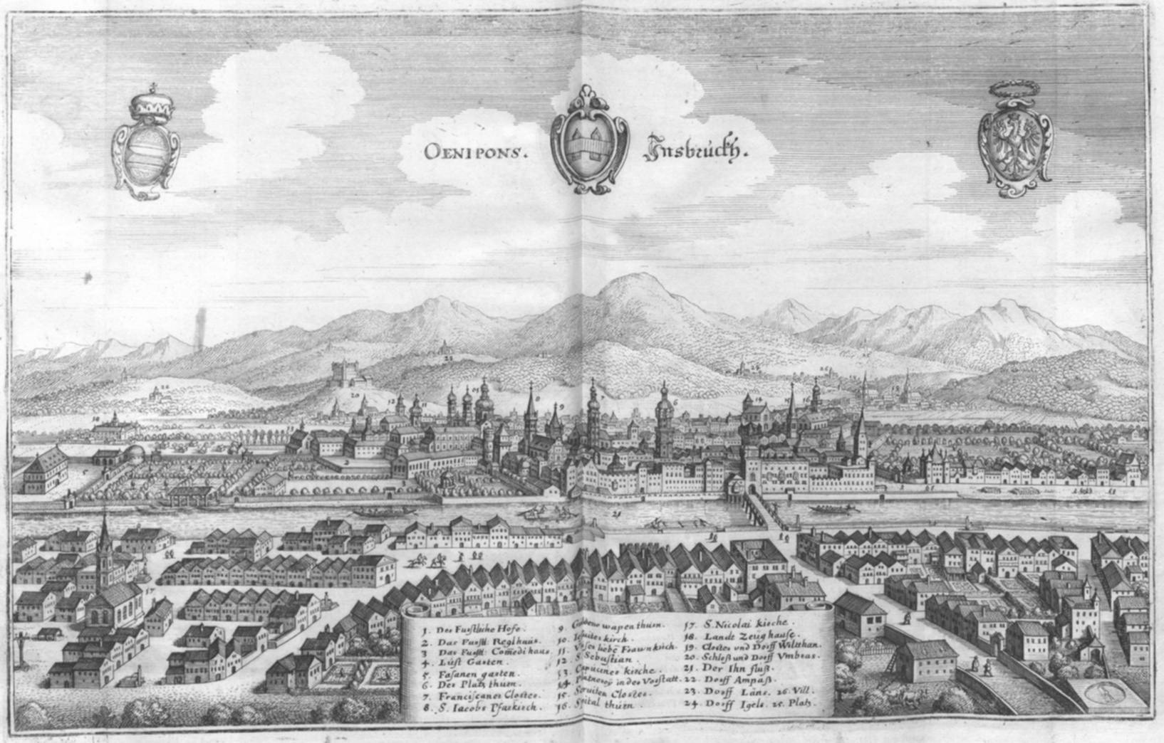
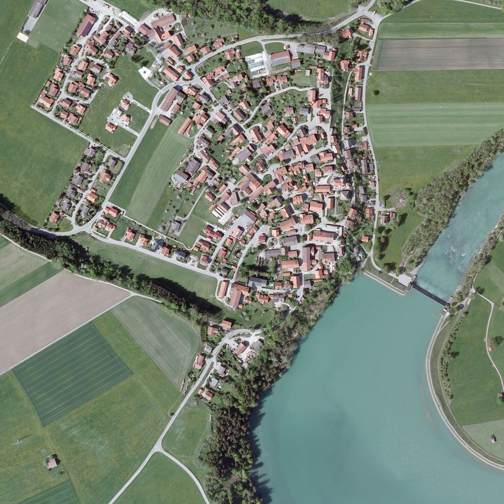
There’s more to Epfach, an unassuming little village along the Lech, than first meets the eye. It’s a very, very old settlement, in fact. Older, even, then most German towns — Munich, for example, was first established in the 12th century. Epfach, apparently originally a Celtic settlement, was ideally situated to serve as a station along the Via Claudia Augusta in the Roman province of Raetia. It’s Roman name was Abodiacum, (or Abodiaco, as it’s found on the Tabula Peutingeriana).
TP
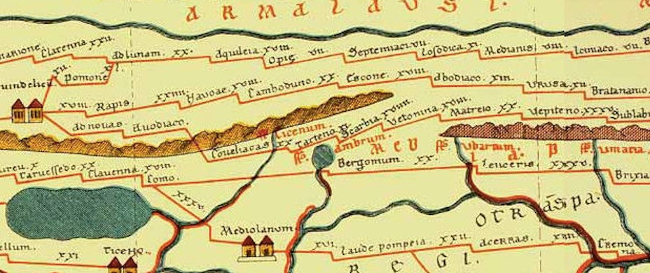
The Tabula Peutingeriana, in fact, has two Abodiacos: they are the same village. It stands at the crossroads of two Roman roads : the Via Claudia Augusta, where it’s just after the  station ‘ad novas’ on the road out of Augusta Vindelicum/Augsburg, and the salt road that partly connected Lake Constance (Brigantium) to Salzburg (Iuvavum).
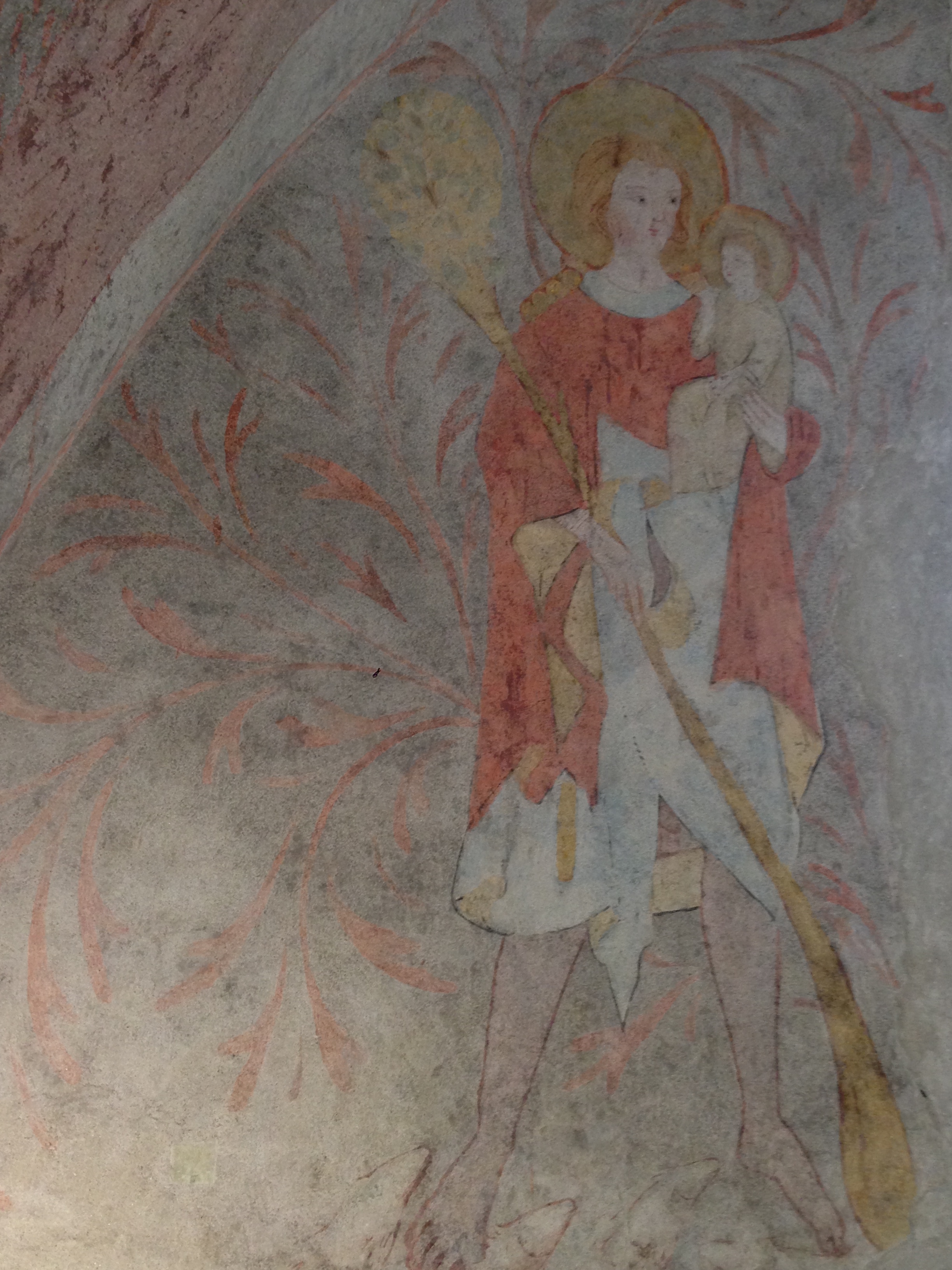
Visitors to Epfach will first see that the north-south road through town is marked as the Via Claudia. Right on this road stands the local museum, which provides information on Epfach’s Roman history, all in a space about as big as my living room. Of particular interest is an exhibit on Epfach’s first internationally renowned local homeboy, Claudius Paternus Clementianus.
IMG_2524
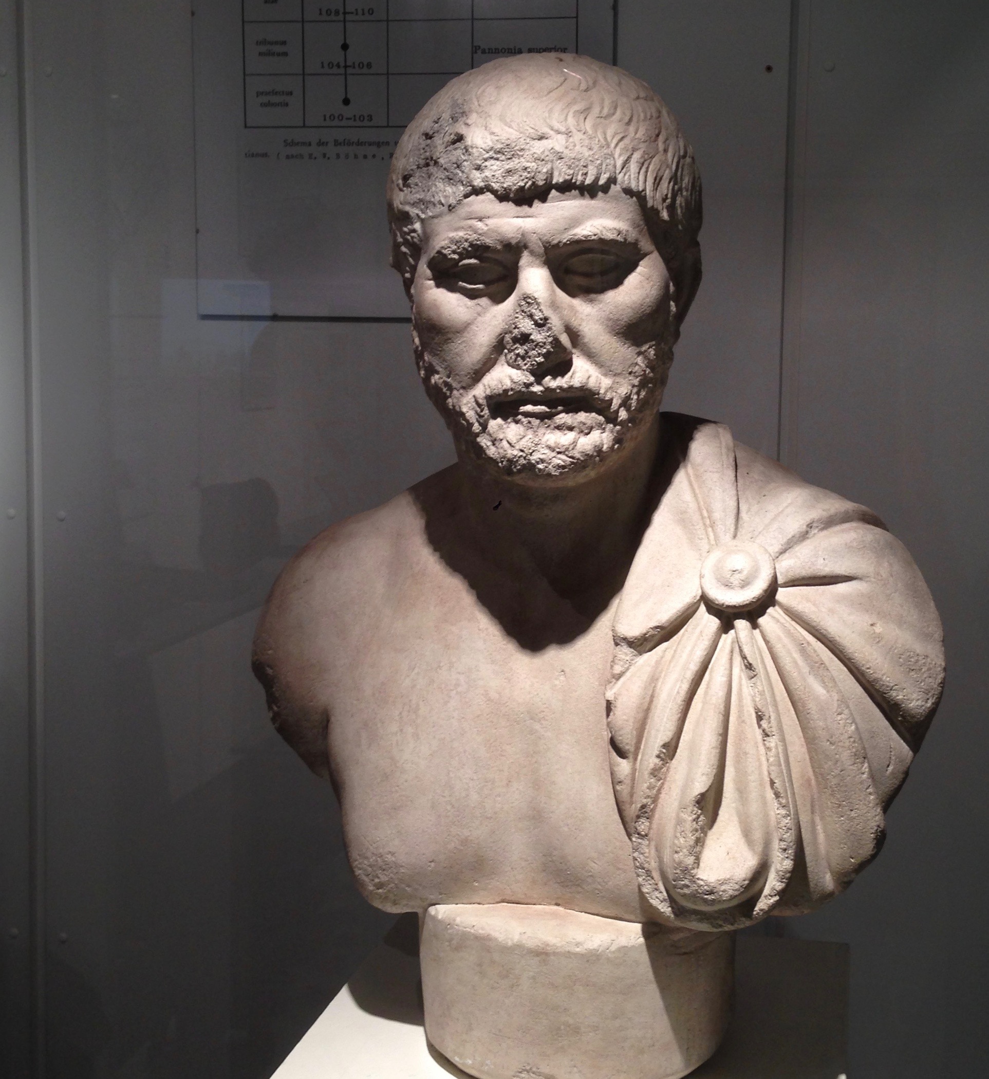
CPC was a Celt with Roman citizenship through his father, which allowed him to serve in the Roman army as an officer. His career took him to Hungary, Romania, Judea (where he served as Procurator there just 80 years after Pontius Pilate held that job, long enough afterward to have probably never heard of him), Sardinia and Northern Africa, before he came home to retire and presumably spend his golden years fishing on the Lech and downing the local wines.

Tripoli, Libya - Roman Mosaic, National Museum, Fishermen

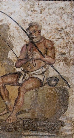
Tripoli, Libya – Roman Mosaic, National Museum, Fishermen

He may have had the good fortune to enjoy his twilight years secure in the belief that the Empire was strong. It was another hundred years before Alemanni tribes began sacking the settlement, followed by the Romans rebuilding it, in turns. The northern frontier (Limes) remained in operation until sometime in the 5th century C.E. Then again, as a Celt, maybe he would have been happy with the eventual outcome.

While Epfach is not on the Via Raetia, there is a connection nevertheless. The Tabula Peutingeriana, a Middle-Ages copy of a late Roman roadmap of the Empire, shows neither the Via Claudia Augusta nor the Via Raetia in their entireties, but rather an amalgam of the two — the route shown follows the VCA leaving Augusta Vindelicum/Augsburg until Epfach/Abodiaco, detours east on the above-mentioned salt road and then resumes its southward way on the newer Via Raetia at Urusa/Raisting (the next stop listed is Coveliacas, near the Staffelsee). This variant may have turned out to have been shorter, the easiest to maintain (the Via Claudia Augusta, in my opinion, goes over much more precarious mountain territory than the Via Raetia), or had better stations, or better connection, or a combination of any of that.

Aside from the museum (open every day, and if it’s not you can ask for the key at the restaurant next door), you can walk to the Lorenzberg, the hill where the Roman military station was located. Epfach seems to have geared its tourism to the Via Claudia cyclists, who can take a break at the restaurant, stop into the museum, walk off lunch with a short visit to the Lorenzberg, and then continue on their way.

Hardy’s Map

While packing for a long train trip to Styria, I pulled a couple of books of the shelf to help pass the time. Thomas Hardy’s “The Return of the Native” was I book I supposedly had read in high school — although I couldn’t for the life of me remember what happened after chapter one, and it’s likely I really didn’t read it at all since none of it seems familiar now, beyond the Reddleman.

But what really surprised me was this map.

egdon-heath-map1It’s not a real place, or rather it’s a composite of places near Dorchester, real or renamed,   and re-ordered for the convenience of the story. Egdon Heath figures so prominently in the book that it’s been treated as a literary character in several analyses. Of course it has a Roman road, partially a modern road and partially remains of a track through the heath.  An ancient barrow (or grave mound) also features as a setting for several meetings.

Notburga of Rattenberg

einstiegsgrafik

First, a bit of background on Notburga (pronounced Note-boor-ga). She was born in Rattenberg, a small town east of Innsbruck, around 1265 to a couple of hatmakers, and proved to be an extraordinarily intelligent and competent woman. She hired herself out as a serving maid to King Heinrich I up on “Rottenburg” Castle, and beyond her duties she looked out for the poor in the area, bringing them leftovers from the castle meals. When Heinrich II took the throne, his wife was not so keen on Notburga’s presence. The official line is that Ottilia didn’t like the poor being fed, but I suspect it had more to do with her feeling that her power was somehow threatened. Notburga was let go from her job, and found a new one on a farm in nearby Eben, on Lake Achensee (which is redundant, but I’ve seen it often written this way for English readers), where her one condition was that she be allowed to stop working at the first peals of the evening church bell.
One miracle attributed to Notburga involves an occurrence during the harvest. A storm was approaching, and the farmer demanded that his laborers stay at work until all the grain was brought in. When the church bell rang, Notburga stopped, and when confronted by her employer, she threw her sickle into the air, where it hung on a sunbeam.
At some point after the death of Ottilie, Heinrich II, suffering from general disarray and a feud with his brother, asked Notburga to return to the castle (of course he did), where she brought everything back into order. Later, close to death, she expressed the wish that her body be put into an unmanned wagon pulled by two oxen, and that where the oxen stop, she should be buried. This being done, the oxen took her across the Inn River, up the mountain and back to Eben, where they finally stopped in front of the village church.
Notburga’s remains quickly became such a popular pilgrimage destination that the church had to rebuild twice in the next 200 years to accommodate the increased visitor count. She has never been canonised, but the Vatican officially made allowance for her to be revered, which makes her a de facto saint.

Now, there are few different things going on here at once. Old legends around the Rofan Mountains and Lake Achensee tell of the “white ladies”, and Notburga von Rattenberg is in a way one of these, although an historical Christian figure as well. Or, put another way, she was given some other-worldly attributes after her death.

The oxen ride predates Notburga by at least 1500 years — in Greek mythology, the Phoenician prince Cadmus was instructed by the Oracle at Delphi to follow a certain cow and build the town of Thebes on the spot where she lay down.

In “Philosophie, Religion und Alterthum” by Georg Friedrich Daumer, Campe Verlag, 1833, in a chapter discussing Count Hubert of Calw (available via google books, translation by the blogauthor):

This last journey appears in many other legends,  for example in those of St. Gundhildis and of Notburga of Rattenberg… the river crossing is important in mythology and appears also in the following Swiss legend: ‘The building tools were carried by a pair of yoked oxen and where the animals stopped would determine the place where the church would be built. They crossed the river and came to a stop at the place where  St. Stephen’s Church was erected’ … This holy ritual is also found in India. When one wishes to build a pagoda, the place will be determined through the sacred cow; where she lies down at night is the place decided upon by the deity.

The “sickle miracle” might be borrowing from the sickle’s pre-Christian symbolisation of fertility and harvest, the crescent moon. It may be a leap in logic to say this but I suspect that Notburga, being an intelligent and resourceful woman, helped not only the poor of Rattenberg but possibly women as well — pregnancy killed a lot of women back then, and anyone with some good midwife skills (including surgery) could go a long way. It would have been very easy for the Church to turn her into the Patron Saint of Agriculture, with that sharp blade in her hand. But she also sounds like an early champion of farmworkers’ rights, with her insistence that work stop with the sound of the bell. I can well imagine a woman told to get back to work and throwing her sickle into the air — and the shock of hearing about it keeping the story alive, in one form or another, for a while. She may have been the talk of the region, standing up to The Man like that, as well as the one that people sought for help when none was to be found elsewhere. Her insistence on sharing food — hers and the court’s — with the local poor in defiance of authority points to a kind of Christian socialism (was she a late-mediaeval version of “community organizer”?)

0dbc48e7258f69a0321c50ea59168d1c_Tirol Notburga Scannen0005

And it may be another leap in logic to connect her reverence with the Germanic deity Frau Perchta (or Hertha), whose responsibilities included ushering the souls of dead children to the otherworld. Hertha in turn is a variation on the Germanic Frau Hölle (or Holda), who is the protectress of children while having none of her own. What I think we have here is a strong and able woman, revered long after her death for great works among the people (the nature of which the Catholic Church at the time could not recognise), being elevated in a way that conveniently took a little of the life out of the old beliefs which were still floating around.

110318_notburga600Bonus trivia: Notburga’s skeletal remains can still be seen in the church at Eben, upright and dressed above the altar.

Images from here and here.

A Chapel in Axams

A free Sunday afternoon and it happens to be Tag des Denkmals in Austria. This is a day for  cultural and historical monuments across the country, and often there is the chance to see something not normally open to the public.
That opportunity is what got me on a bus to Axams, a village on the slopes of the mountains southwest of Innsbruck. Axams is a very, very old village; archaeological finds point to human settlement in the area as far back as 1200 BCE and the current name is of Celtic origin (Ouxumenes, “very high place”). (g) Its situation on a sunny plateau high above the Inn Valley certainly made it prime real estate then (and now — it’s both a commuter town, being a 20-minute drive from Innsbruck, and a popular spot for ski tourists). // Ein freier Sonntagnachmittag und Tag des Denkmals in Österreich. Dies ist ein Tag für die kulturellen und historischen Denkmäler im ganzen Land, und oft gibt es die Möglichkeit, etwas in der Regel nicht für die Öffentlichkeit zugängliches zu sehen.
Diese Gelegenheit brachte mich in einem Bus nach Axams, einem Dorf im Mittelgbeirge südwestlich von Innsbruck. Axams ist ein sehr, sehr altes Dorf; archäologische Funde weisen auf menschliche Besiedlung in der Region soweit zurück, wie 1200 v.Chr; und der aktuelle Name ist keltischen Ursprungs (Ouxumenes, “sehr hohen Platz”).  Seine Lage auf einem Sonnenplateau hoch über dem Inntal machte es zu einem attraktiven Siedlungsgebiet (und heute ist es sowohl eine Trabantenstadt, 20 Minuten Fahrt von Innsbruck, alsauch ein beliebter Ort für Ski-Touristen).

But the cultural site on offer today was from an era a bit later in its history. The Widumkapelle (“dower”, or endowment chapel) was built around 1330, originally stood as a stand-alone structure, and then became part of the larger parish offices. Into the late 1990s it was used as a furnished meeting room; after extensive excavation in 2003, the original frescoes (g) were uncovered and restored. These frescoes, interestingly, reveal that the original structure was not simply a chapel. // Aber die Kultstätte im Angebot war heute aus einer etwas jüngeren Zeit. Die Widumkapelle wurde um 1330 erbaut, ursprünglich freistehendes Objekt, das später Teil des Pfarramts wurde. Bis in die  späten 90er Jahre wurde es als möblierten Besprechungsraum verwendet; nach umfangreichen Ausgrabungen im Jahr 2003 wurden die Fresken freigelegt und restauriert. Diese Fresken zeigen interessanterweise, dass die ursprüngliche Anlage nicht einfach nur eine Kapelle war.

IMG_1619IMG_1627While the eastern wall bears sacred images of Saints Christopher and Dorothy (both early Christian martyrs), // An der östlichen Wand befinden sich Bilder der Heiligen Christophorus und Dorothea (beide frühchristlichen Märtyrer),

IMG_1628…the western wall displays two jousting knights representing the Knights of Freundsberg and Starkenberg. // …die Westwand zeigt zwei Turniereritter, die Ritter von Freundsberg und Starkenberg.

IMG_1624The northern wall, meanwhile, bears the image of a kind of doorman/bouncer, ready to pummel any unwelcome visitors as they enter. There are also several crests of Austrian principalities.  Was this small building erected for official business between clergy and ruling nobility? A kind of ceremonial or memorial hall, as our guide today suggested? Historical research has not yet come up with the answer. // Wohingegen die Nordwand, das Bild von einer Art Pförtner / Türsteher zeigt, bereit, allen unerwünschten Gästen eins über die Rübe zu geben. Es gibt auch mehrere Wappen der österreichischen Fürstentümer. Wurde das kleine Gebäude für offizielle Zwecke zwischen Klerus und herrschendem Adel errichtet? Eine Art von Zeremonienraum oder Gedenkhalle (“Widum”, mit dem Wort “Widmung” verwandt) wie es unsere Führerin annahm? Die historische Forschung die Antwort noch nicht gefunden.


It’s All Related

And here we tie the two previous posts together with a 15th-century ribbon:
Und hier fügen wir die beiden vorherigen Beiträge mit einem Band aus dem 15. Jahrhundert zusammen:

blog_Duerer_Brennerstrasse

Albrecht Dürer, Brenner Road in the Eisack Valley, 1495. Made, as with the Innsbruck paintings, from a journey to Italy. Note the wheel tracks in the road. This was the “Brenner Autobahn” during the Middle Ages and probably long before then as well.

Albrecht Dürer, Brennerstraße im Eisacktal, 1495. Gemacht, wie auch die Innsbruck Gemälde, auf einer Reise nach Italien. Beachten Sie die Spurrillen auf der Straße. Dies war der “Brenner Autobahn” im Mittelalter und wahrscheinlich auch lange davor.

Image found here

Five Views of Old Innsbruck 1496-1750

DürerIBKSouth
The Beau found a postcard in an old book, with this image of a painting by Albrecht Dürer. It shows the inner courtyard of the Hofburg in Innsbruck, or the “Hof der Burg”. I was immediately curious.
Because: you look at this and think, “Yeah, pretty, I guess. Long time ago.” I look at this and think, hang on, where was that crenellated wall? What’s there now? Can I stand in the same place? Will I recognize it when I see it?
Some searching revealed that the painter (and viewer) are looking south, and that another Dürer painting of the same courtyard exists, this time facing north. Neither view even remotely resembles what one sees when one looks into the large courtyard of the Hofburg today.
Mein Freund fand eine Postkarte mit dem Gemälde von Albrecht Dürer in einem alten Buch. Es zeigt den Innenhof der Hofburg in Innsbruck, oder der ” Hof der Burg ” – und das machte mich neugierig.
Denn, als ich das sah dachte ich: ” Ja, das ist ziemlich, vermute ich, lange her” und „Moment mal, wo war das zinnenbewehrten Mauer? Was ist da heute noch vorhanden? Kann ich an der gleichen Stelle heute noch stehen? Kann ich es erkennen, wenn ich es sehe?“
Nachforschungen ergaben, dass Maler (und Betrachter) nach Süden schauen und dass ein anderes Dürergemälde des gleichen Hofs mit Blickrichtung nach Norden existiert.
Keine der beiden Ansichten ähnelt auch nur entfernt dem, was man heute im großen Innenhof der Hofburg sieht.

Hofburg Nord
So, let’s take these two Dürer paintings and hold them up alongside his third Innsbruck painting, View of Innsbruck with Patscherkofel (mountain in the background), or, alternately, Innsbruck from the North. Also, nehmen wir diese beiden Dürer Gemälde und halten sie über sein drittes Innsbrucker Bild, der „Ansicht von Innsbruck mit Patscherkofel“ (Berg im Hintergrund), bzw. „Innsbruck aus dem Norden“.

durer-innsbruck

This watercolor painting, whatever its name, is pretty awesome, mainly because Dürer takes the Inn River and makes it into a lagoon, similar to Venice. In fact I think I see a gondola there on the water, no? Did Dürer forget where he was? Dieses Aquarell, wie auch immer es heißt, ist ziemlich genial, vor allem, weil Dürer den Inn zu einer Lagune macht, ähnlich wie Venedig. Tatsächlich meine ich eine Gondel auf dem Wasser zu erkennen, nicht wahr? Hat Dürer vergessen, wo er war?

But no, it’s Innsbruck. This site (g) maintains that one can recognise the fortress’s tower, under scaffolding (as it would have been in 1496). The mountains, too, are local features. At first I took the snowy peak between the towers to be the Serles, but on second thought he may have meant the pointy Glungezer, with the rounded-off Patscherkofel just to its right. The white wall with the notches may be the same wall  in the first image (seen from the back on the right).
Aber nein, es ist Innsbruck. Diese Website) ermöglicht den Festungsturm unter Gerüst zu erkennen, (wie es im Jahre 1496 gewesen sein ). Die Berge entsprechend ihrer Eigenheiten herausgearbeitet. Zuerst nahm ich and die schneebedeckten Gipfel zwischen den Türmen seien der Serles, aber tatsächlich ist das die dem Glungezer vor gelagerte Sonnenspitze, mit der abgerundeten Patscherkofel zur Rechten. Der weiße Wand mit den Schießscharten könnte die gleichen Wand wie im ersten Bild (von hinten rechts gesehen ) sein.

Statt_Inspruck_(Merian)
Here is a slightly later view (Matthäus Merian, Martin Zeiller: Topographia Provinciarum Austriacarum, 3. Ausgabe, Frankfurt am Main 1679) The Inn is depicted as considerably narrower, almost like a tubing ride at a waterpark, but I have to assume that the city itself has been portrayed more or less accurately. And now the Stadtturm is more prominent with its new “Zwiebelhelm mit Laterne” (onion-helmet with lantern, added in 1560).
Hier ist ein etwas später Ansicht (Matthäus Merian, Martin Zeiller, Topographia Provinciarum Austriacarum , 3 Ausgabe , Frankfurt am Main 1679 ) Der Inn ist deutlich schmaler dargestellt, fast wie ein Schlauchrutsche im Wasserpark, aber ich muss annehmen, dass die Stadt selbst mehr oder weniger genau dargestellt wurde. Zu diesem Zeitpunkt ist der Stadtturm mit seinem 1560 dazugebauten Zwiebelhelm mit Laterne etwas markanter.

IBKSketch
And here we have a copy of a sketch by one F.B. Werner, from 1750. (I photographed it off a friend’s wall, the reflection was unavoidable.) One sees that all the towers have been redone in the 250 years since Dürer painted here. My notched wall is gone, it seems. (Or maybe Dürer had taken artistic liberties?) The Wappenturm is still there, however, identifiable by it’s pyramid-shaped top above columns, just in front of the polar-bear-face facade of the Hofkirche. This tower stood (still stands) on the southeast corner of the Hofburg, with a portal which leads into Hofgasse. When the facade at Rennweg was completely renovated (1767-70), a second tower was built on the northeast corner, and both were made symmetrically round.
Und hier haben wir eine Kopie einer Skizze von einem F.B. Werner, von 1750. (Ich fotografierte sie an der Wand eines Freundes, die Reflexion war unvermeidlich.) Man sieht, dass alle Türme in den 250 Jahren, seit Dürer sie malte, erneuert worden sind. Meine Schießschartenwand (Stadtmauer — ed.) ist weg, es scheint. (Oder vielleicht hatte Dürer sich künstlerische Freiheiten genommen?) Der Wappenturm ist noch immer da, erkennbar durch seine pyramidenförmige Spitze auf Säulen (Eckerker — ed.), gerade vor der Fassade der Hofkirche mit dem Eisbärengesicht. Dieser Turm stand (und steht noch) an der südöstlichen Ecke der Hofburg, mit einem Portal, das in die Hofgasse führt. Bei der kompletten Renovierung der Fassade am Rennweg ( 1767 bis 1770 ) , wurde ein zweiter Turm an der nordöstlichen Ecke gebaut, und beide wurden symmetrisch rund gemacht.

We live in an old, medieval city, but in fact much has changed over time, even through the middle ages. Wir leben in einem alten, mittelalterlichen Stadt , aber in Wirklichkeit viel hat sich im Laufe der Zeit auch durch die Mittelalter verändert.

Seven Views of Maria-Theresien-Strasse

(click on any image to see source in its URL, sorry, no direct links) This was originally titled “Eight View of Maria-Theresien-Strasse” but I found one of the images redundant and therefor it was pulled. Sorry for any confusion.

philographikon.comIn the beginning, street life looked somewhat chaotic. All of these images include the Annasäule (column) so they are all after 1704. However, the first expansion out of the original Altstadt, that is, the Neustadt (which later became Maria-Theresien-Strasse), began in 1281.

photographium.comThe street is still unpaved, but now that it’s cleaned up, it looks a little on the sterile side. It’s probably a Sunday, around the turn of the century.

akpool.de

An undated postcard. The streets are paved, the tram line is in. Dress lengths and the men’s suits suggest sometime after 1916 and before the Roaring Twenties.

yakohl.comThis is from 1939. Still horse carts but now we’ve got jazzy convertibles.

sagen.atThis is also apparently from 1939, although it looks like it may have been taken around Hitler’s first visit in April 1938. Nazi flags galore. Note the Hitler portrait over the door at far left, with the slogan “Ein Volk, ein Reich, ein Führer“. The woman at right, in the light-colored jacket with the bundle in her hand, gazing quietly across the street. What is she thinking?

curbsideclassic.comSame street, 1950s.  What a change. After the war, denazification certificates were referred to slangily as Persilschein, Persil being a brand of whitening laundry soap. Here it looks as if the entire street has been washed in Persil.

Priceline.comToday Maria-Theresien-Strasse is a thriving pedestrian shopping zone,  most recently even cycling through is not permitted at the northern end (the part you see here).

The Annasäule has been there since the early eighteenth century, even if its statues have been replaced over time. Despite its name, the figure at the top is actually the Virgin Mary. St. Anne stands below (facing the mountains), along with Sts. George, Cassian and Vigilian. The pillar was erected in commemoration of the expulsion of warring Bavarians on St. Anne’s Day in 1703hence the name.

Innsbruck, Dürer and “Ern Malley”

IMG_1031

Liebe Leserinnen und Leser, hier findet ihr Information über diese Geschichte.

This is a postcard that was found in an old book, having been used as a bookmark by a previous reader. It’s Albrecht Dürer’s Hof der Burg zu Innsbruck (Innsbruck Castle Courtyard), and in the mild hopes of finding out exactly where this spot is and what it looks like now, I began by googling the words ‘Dürer’ and ‘Innsbruck’, which led me to this image —

durer-innsbruck

Innsbruck mit dem Blick auf den Patscherkofel (View of Innsbruck with Patscherkofel)

— as well as to a strange poem with an amusing story attached. It was part of a “collection” by one late, great unknown poet named Ern Malley – which was actually all a hoax cooked up by two Modernist poets in Australia serving in war duty in the 1940s, meant to trip up the very young editor and founder of a successful modernist poetry magazine. They threw together a parody of late modernist poems, invented a fictional author who died young and a sister who “found” the works, and submitted them to the magazine. The hoax was a success – the young editor received them excitement, sure that he had made a great discovery. Well.

The first poem, by the way, was called “Dürer: Innsbruck, 1495”:

I had often cowled in the slumbrous heavy air,
Closed my inanimate lids to find it real,
As I knew it would be, the colourful spires
And painted roofs, the high snows glimpsed at the back,
All reversed in the quiet reflecting waters –
Not knowing then that Durer perceived it too.
Now I find that once more I have shrunk
To an interloper, robber of dead men’s dream,
I had read in books that art is not easy
But no one warned that the mind repeats
In its ignorance the vision of others. I am still
The black swan of trespass on alien waters.

Das erste Gedicht wurde übrigens “Dürer: Innsbruck, 1495” genannt.
[Paschberg macht einen Versuch, das Gedicht zu übersetzten. Fast zu gut..!]

Oft umfing mich die schläfrig schwere Luft
Meine leblosen Lider schließend, wirklich zu finden
wie um die Erscheinung der farbigen Türme wusste
und dier bemalten Dächer vor dem Hintergrund das hohen Schnees
alles gestürzt in den stillen spiegelnden Wassern
damals nicht wissend, dass auch Dürer das wahrgenommen
Jetzt erkenne ich mich wieder, geschrumpft
zu einem Eindringling, einem Räuber, eines toten Mannes Traum
In Bücher hab ich gelesen, dass Kunst nicht einfach ist,
doch niemand warnte vor dem Wiederholen der Gedanken
in der Unwissenheit der Visionen . Ich bleibe
der schwarze Schwan des Friedensbruchs in fremden Gewässern

The authors claim they pulled words out of reference dictionaries at random and from what came to mind. This first poem, however, had come from an earlier serious attempt which was then edited to make it somehow more “late modernist”, a style the authors did not like at all. I’m guessing “I had read in books that art is not easy” is one of the “improvements”…Die Autoren behaupten, sie hätten die Wörter zufällig aus Wörterbüchern und in freier Assoziation genommen. Das erste Gedicht ist jedenfalls ein früherer ernsthafter Versuch, bearbeitet um es irgendwie Spätmodern klingen zu lassen, ein Stil, der den Autoren überhaupt nicht gefiel. Ich nehme an das „In Bücher hab ich gelesen, dass Kunst nicht einfach ist“ eine der „Verbesserungen“

Over the years, the fictional poet Ern Malley has taken on a kind of minor cult fame in Australia. He’s got his own website, and the story and poems have become the inspiration for other works over the years. Im Lauf der Jahre wurde der fiktive Dichter Ern Malley in Australien zu einer Art Kultobjekt. Er hat nun seine eigene Website und seine Geschichte und seine Gedichte wurden im Laufe der Zeit Inspiration für andere Arbeiten.

1st image from the author; 2nd image found here

Hell Under Glass

While we are discussing concentration camps, here is a clip of Jake and Dinos Chapman discussing their work, “The End Of Fun”, which just finished showing at the Hermitage Museum in St. Petersburg, Russia. The camera zooms in quite a bit on this detailed, cast-of-thousands, miniature dystopian future, showing, well, their view of Hell. It’s not easy to describe, watch the clip. Lengthy but worthy of a look.

h/t to a commenter on a post at Club Orlov.

UPDATE: BONUS LINK. I knew there was another link I wanted to include here, but I had to wait until the fog of this Grippe cleared before I remembered what it was: here an article (with fascinating photos) of a rather unusual officers’ pow camp in Murnau, in southern Bavaria.

OLYMPUS DIGITAL CAMERA
UPDATE 2: Reader Paschberg sends this image of another representation of Hell, found embedded in a stone wall in Naples. Here the (burning) subjects seem to be aware of the glass, and press on it as if trying to escape.