Licus Translation

German to English translation, ATA-certified

Licus Translation

May 5th, 1988

The postcard arrived in his mailbox on the 4th.

This was it. It was now happening. The last few years might have been like a dream, but the months leading up to this moment had been like the day of a storm, when the clouds are gathering and the air pressure has dropped, and you know something’s brewing, and you welcome it but at the same time it makes you nervous. There had been massive preparation involved leading up to this moment. And here it was, the postcard.

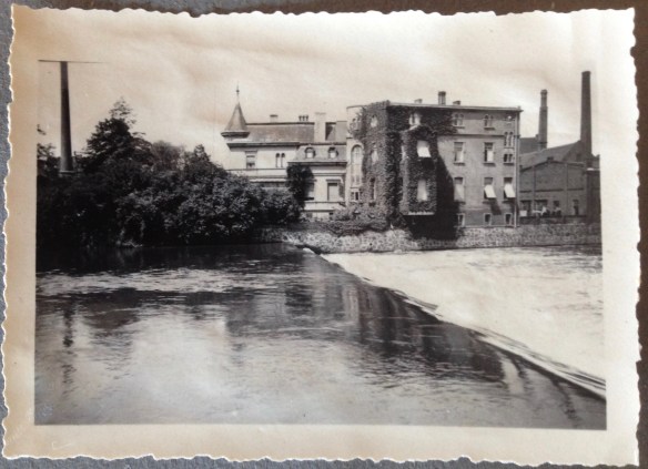
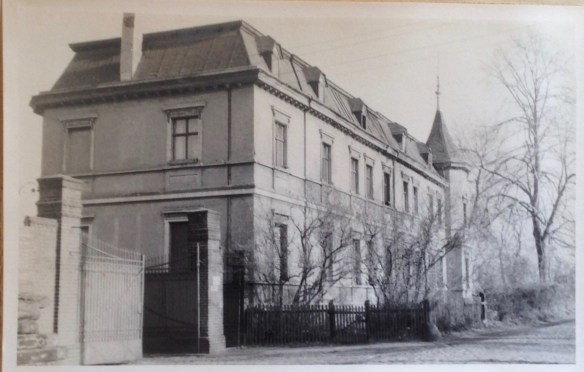
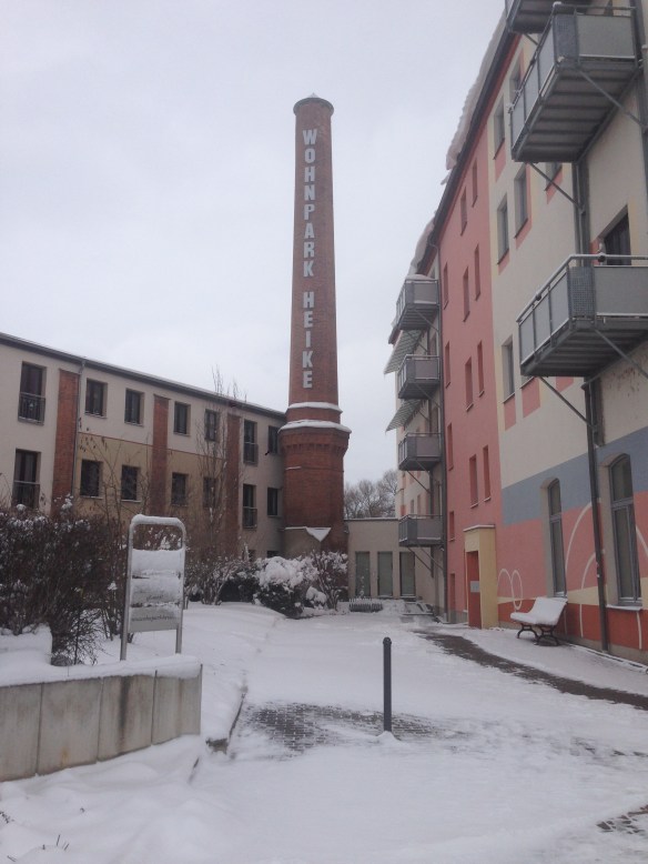
He knew in the back of his mind that, under what one in the West might call “normal circumstances”, it wouldn’t have been a sure thing that he and she would stay together. It wasn’t a sure thing as it was, but they were in love, and there was so much riding on the decision now that there really wasn’t room for second thoughts. The decision had been made and they were sticking to it. They’d met a couple of years before, back when she had come to his hometown to visit a mutual friend, and sparks had flown from the start. He not being allowed to leave the country, they met regularly in Prague. They spoke for hours on the phone, knowing full well that the Stasi was listening. Eventually they decided that the only way they could be together would be to marry, so they got all their paperwork in order, including the application for permission to emigrate for personal reasons. This last point had required some careful thought – he would have done anything to leave the GDR and emigrate to the West, but this could jeopardize a relative’s chances to be accepted to university or be promoted at work. The state tended to hold things like that against your family if you demonstrated your desire to leave*. They determined that there was no immediate danger to anyone’s career. They arranged a modest wedding and reception. He did most of the planning, as it had to take place there in East Germany. Her parents came over, as did several of her friends. His friends were there. His parents refused to come. Afterwards she drove her car back over the border, packed with more of his things. And then the waiting began.

When the postcard came, informing someone that he or she was now permitted to leave the country forever,  you then had to quickly collect the relevant papers at the relevant government authorities in order to receive an official exit visa which was only good for 24 hours.  He’d already sorted his belongings in anticipation of its arrival, assigning everything he couldn’t take with him – record collection, furniture, housewares. When his postcard arrived, he called round and let his friends know, and they convened that evening for one last night of drinking, smoking, and reminiscing together.
It felt permanent, and sad. He wanted nothing more than to get out and experience life in a free country, but it was painful to look at his friends and wonder if he would ever see them again. He was leaving 27 years of his life behind, locked away forever behind an iron curtain.

A few of his closest friends stayed through the night, and crashed at his place in sleeping bags. The next morning, bags packed, he was accompanied to the train station, where they all said their last goodbyes. There were tears. He promised he would write. What a feeling it was, the finality of it, as the train pulled away from the station. He was leaving his country and the only home he’d ever known, and even though he’d hated it and couldn’t wait to get out, it still came with a measure of unease. What would happen to him now? Would he even make it out? The border police were not above playing games with those bearing exit visas, if they were feeling ornery.

There were three older women in the train compartment with him. Two looked past retirement age – retirees had more freedom to travel in the West, since the GDR half-hoped they’d leave permanently and would have to stop drawing on their pensions. The third probably had a temporary travel permit. No one spoke. This train served as a normal regional train with stops along the way, people getting on and off until the last town before the border.

WikimediaCommons

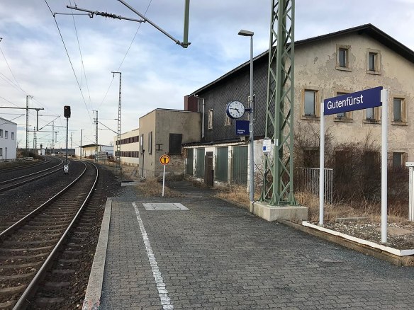
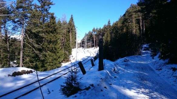
Gutenfürst, the fortified GDR border station. Image from Wikimedia Commons.

There, at the border station, the train was stopped and the customs officials summoned him to alight and join them for questioning in their administrative building. They made him unpack all his baggage and identify everything while the train sat in the station. They searched all his things, examined his customs forms, asked him questions. After an hour, they were satisfied and allowed him to board again, and then the police came through to see everyone’s travel papers. The train moved again. He stood in the aisle outside his compartment, smoking cigarette after cigarette and watching the land roll by. They passed through the death strip, something he had naturally never seen before with his own eyes, and recognized it as the furthermost boundary of his entire world until that moment.  Beyond that point, the other passengers suddenly became cheerful and more talkative. A member of the Bavarian border police appeared – Grüss Gott, where are you traveling to? Ah, Munich? You’re moving to be with your wife? Very nice. He had never heard someone in uniform speak to him in such a friendly manner. The atmosphere inside the compartment turned palpably lighter. He was in the West. He was out.

She was waiting for him on the platform when the train pulled into Munich. It happened to be her thirtieth birthday, and so she’d made reservations at a nice restaurant in town. He still remembers everything about that day. It was a beautiful spring evening, the sun was shining, and he was riding through his wonderful new city in the passenger seat of his new wife’s Citroen. He was indescribably happy, with a feeling that his future – their future – fanned out before him, seemingly without limit. Hinterm Horizont geht’s weiter. They would travel. They would start a family. There was no way to know that within two years they would split up, that the Wall would come down, that his old country would cease to exist, that he’d start a new career  – after it was clear that his East German diploma, from the best of universities, was somehow suspect – and that neither the career change nor the divorce would be his last.


*From Wikipedia’s entry on crossing the inner German border: “The process of applying for an exit permit was deliberately intended to be slow, demeaning and frustrating, with a low chance of success. Applicants were pushed to the margins of society. They were demoted or sacked from their jobs, excluded from universities and subjected to ostracism. If the applicants were parents, they could face the threat of having their children taken into state custody on the grounds that they were unfit to bring up children. The heavily politicised East German law code was used to punish those who continued to apply for emigration despite repeated rejections. Those who repeatedly submitted emigration applications faced charges of “impeding … the state and social activity”. If they sought assistance from contacts in the West, such as relatives or West German state bodies, they were guilty of “illegal contact” or “traitorous information transfer or activities as an agent.” Criticising the political system was a crime of “public disparagement”. Over 10,000 applicants were arrested by the Stasi between the 1970s and 1989 on such charges.

Rilke’s Ammersee flirtation

Wikimedia_Commons

The “Künstlerhaus Gasteiger” in Holzhausen, near Utting. This is not the villa Rilke wanted to rent (that house may have burned down in the 1960s). Image from Wikimedia Commons.

Between 1914 and 1916, Rainer Maria Rilke was involved romantically with the (married) painter Lou Albert-Lasard. In 1915 he found himself somewhat stranded in Munich, waiting to learn whether he would be drafted into the Austrian Army. While there he was consoled by another married Lou, his former lover and life-long good friend Lou Andreas-Salomé (who had a number of other admirers during her lifetime, including Nietzsche and Sigmund Freud). Andreas-Salomé helped him look for a country home to rent on the western shore of the Ammersee. The lake’s western shore and more specifically Holzhausen have long been popular with artists.

Andreas-Salomé: “Yesterday after a bit of an odyssey I rode with Rainer to Holzhausen on the Ammersee so that he could see a small villa owned by Professor Erler. A beautiful, tranquil lakeside park, a charmingly furnished little house seemed to us the clear choice. He’s only uncertain because he would have to commit for the summer months. I think the solitude in nature will do him immense good.”

Ammersee_Kurier

Image from the Ammersee Kurier

Rilke: “…it is likely that next week I will move into a very small house on the Ammersee, with a housekeeper (whom I am still looking for) and my books. So that I won’t have to speak nor hear and, in a way, be faceless. … the city has become quite unbearable to me”.

“The little house has been taken away from me (when I had just decided this morning), since the Erlers now want to rent out their other, larger villa, not the small one down on the lake!”

“The Erlers”, one assumes, were the brothers Fritz and Erich Erler, both artists, or one of them with spouse. I can’t say which one might have been the professor to whom Andreas-Salomé refers.

Gemeinde_Utting

Image from Municipality of Utting website

Quotes from “Mich gelüstet’s nach Idylle” by Karen Eva Noetzel (in German).

St. Ulrich’s Chapel & Healing Spring

IMG_3623

Just outside the village of Eresing, near the Ammersee, there is a small chapel and a fountain house where people would come wash themselves devoutly, especially the eyes. This spring is said to have healing powers, is dedicated to St. Ulrich of Augsburg, the patron saint of the diocese, who once allegedly rested here and caused the spring to flow forth. This is supposed to have occurred immediately after Ulrich’s returning from the Battle of Lechfeld (TL;DR version: FC Holy Roman Empire versus visiting Hungary, the Germans won.) Interestingly, the road near the fountain house and the chapel is also the old Roman road known today as the Via Raetia – so it’s possible that the spring was already known during Bavaria’s Roman period, and that travellers drew water from it. I have heard it suggested – although without evidence proffered – that it may have been a holy spring for the Romans as well. The gentleman in the video posted below (warning: it’s in “Boarisch“) claims that this spring’s water is soft, in contrast to the hard water found everywhere else in the area (and I can attest to that, our tap water is quite hard), and so locals fill up jugs of the stuff to brew their coffee with it.

IMG_3624

The figure of St. Ulrich in the fountain house dates from the 15th century. In the 17th century the Court Margrave of Eresingen, Franz von Füll, subsidized the construction of the fountain house, the red marble basin, and the Ulrich chapel with hermitage.

A story of changing times

Once upon a time, there was a miller who lived in a small town. This miller was quite successful, and had expanded his business into a large commercial bakery. There had always been a mill by the river — in fact, the town’s chronicle listed there having been one first mentioned in written records in 1398. Imagine that: before Christopher Columbus had even been born, there had been a mill operating on this river, which flows from the mountains and into the Elbe, and then on to the North Sea.

IMG_3607
The miller wasn’t really a miller by this point; he was factory owner, a capitalist. He had a spacious, somewhat opulent mansion built on his property, situated on what is actually an island, as the water from the river courses around both sides of it. When he grew old and died, his son carried on with the business. This son was the adventurous type of businessman – several times going bankrupt, but always dusting himself off and getting back to some new scheme. When he grew old, his son took over the business. This new owner married a local girl, a saddle maker’s daughter, and had a daughter of his own. IMG_3609

He was called up to war, but lived through it and returned home to find that parts of the bread factory had been destroyed by bombs, and the country had undergone considerable change. In fact, it wasn’t even the same country as it had been before the war – this was now the “Russian zone”, and shortly afterwards a new country was established, and the government insisted that no single family needed a mansion all to themselves. So the owner moved his family into a few rooms in the house, and other people began to take over other parts of it for themselves.
His daughter grew up and married a veterinarian in the hill country, 3 hours away. They had two sons, who enjoyed visiting their grandparents and playing with the neighbor children in the mansion’s expansive orchards and courtyards, where they would set up a tent under a chestnut tree. You would think that the children would have enjoyed playing by the river, but the river was polluted, and had an unpleasant smell. No one wanted to swim in it, although the boys’ mother recalled doing so as a child. This astonished them, as they couldn’t imagine that it had ever been clean, not knowing it any other way.
The owner’s wife fell ill and died, and the old widower married a somewhat younger spinster, the daughter of acquaintances who was happy to have a husband, even a frail one. When he died, she stayed on but eventually began to hoard items as the house fell into disrepair around her.IMG_3593

One year, the grandsons (now young men) were sent by their parents to clean out some of the junk in the old villa. They found piles of stuff, including old C.A.R.E. packages sent at Christmas by relatives in the West. Their contents – soap, coffee, chocolate – had been unwrapped, dutifully admired, and put back in the boxes for safekeeping, until they were decades past their use dates. The two brothers laughed and shook their heads at this unintended waste, and tried to throw them out, but the old widow kept running out to the trash container and bringing things back inside.
Well, time passed. The Wall fell a few years later, and the old widow passed away. No one in the family had any reason to visit that town anymore, as those relatives were all gone. The family tried to sell the decaying property, hoping that a speculator from the West might pay good money for prime riverfront land, but no one was interested and eventually it was bought cheaply by a developer, who tore down the old factory to make room for low-cost apartments, but saved the chimney and the old villa. Maybe he ran out of money before he could get around to the villa.

IMG_3584
One of the grandsons, now in middle age, was passing through the area with his wife, and decided to swing by and see the old homestead, that expanse of small town property which, as his grandmother used to tell him and his brother, would be theirs someday. It filled him with memories and emotions: happy memories of childhood summers spent there, sadness in seeing the old place in such a state of ruin. There is a new developer who, two years ago, said he wanted to build apartments there and save the old original facade. Maybe he will, someday.

IMG_3596

Seeking Fortunatus

After posting my most recent entry I began to look more seriously for the “Vita S. Martini” by Venantius Fortunatus in translation. It hasn’t brought much to light. I cannot read medieval Latin, but there is an Italian translation available in book form, which might be my only option. There is also a German version available but which costs an arm and a leg (and really, I don’t want to spend that much on a hobby). There are plenty of English-language academic papers about aspects of the text, but I don’t believe that an English translation exists. If any buffs of early medieval literature can prove me wrong, please have at it, as I would love to know!

“If the Baiuvarii on the Lech don’t block your way”*

My husband knows that I have this fascination with local maps and roads and routes from long ago. In a recent acquisition of used books he stumbled across something he knew I’d like — “Die Alpen in Frühzeit und Mittelalter” (The Alps during Antiquity and the Middle Ages) by Ludwig Pauli, C. H. Beck, 1980. I skipped ahead to the chapter on Alpine crossings and Roman Roads, and lo, look what I have learned:
It’s about 565 C.E., the Romans have retreated back to the Italian peninsula, and Rhaetia has gone through a few centuries of bloodbaths. The people who buried their silver coins in the hopes of recollecting them “when things died back down” are long dead and their stashes will remain buried for another 1,600 years or so. There’s no upkeep of infrastructure, but the roads are still there, more or less. Against this backdrop, a 25-year-old named Venantius Fortunatus has set off from Aquilea, on the Adriatic coast, for a long journey to Tours to pay respect at the grave of St. Martin of Tours. He wrote about his travels later**, and so we also know the route he took — over the Plöcken Pass (at the Italian border to Carinthia in Austria), then westward to the Brenner Pass, north to the “Seefelder Sattel” and on to Augsburg and beyond. What this means is that he took the (later named) Via Rhaetia, “our” Roman Road, which passes right through our area here between the Ammersee and the Lech River. Fortunatus passed through here — which means he is the earliest person of later world renown*** to have traveled in our area, all those years ago.

I must admit that I was unfamiliar with the name, but a check with Wikipedia revealed something quite interesting — I was already somewhat familiar with his works, musical versions of which are in the Episcopal Hymnal (it wouldn’t be much of a stretch to say that most classical singers in America, no matter what religion or denomination they grew up in, know hymns from the Episcopal Hymnal, because the Episcopal churches, unlike their R.C. counterparts, pay well for professional choirs.)

One of his greatest hits is Pange lingua gloriosi, Corporis mysterium.


*Venantius Fortunatus, advising a traveler about conditions on the Via.

** “The Life of St. Martin”, which of course I need to hunt down.

*** Hannibal and his elephants crossed further west.

Romans in Bavaria: comparing two online archeology maps for one specific area

Zeitspringer has a post up (in German) about the Roman road which ran between Augsburg and Salzburg, an important salt route referred to today as the “Via Julia”. Evidently there is a bit of uncertainty about the point where the road crossed the Isar River south of Munich. In his post, Zeitspringer mentions the site Vici.org, which I hadn’t known about before. Like the Bavarian Monuments Atlas (also in German), this site superimposes archeological sites—as well as presumed routes of Roman roads—onto satellite maps. I love these kinds of maps, and they have been an enormous help in finding things when you’re on the ground and need landmarks for orientation (with these maps, even a lone tree in a field—something you won’t find on a conventional map—can tell you something).

Well, most of what is known about the routes of these Roman roads north of the Alps comes primarily from 1) ancient (but still after-the-fact) maps, 2) excavated finds and 3) common geographical sense, particularly over the passes where there really wasn’t much choice about where to travel (see Scharnitz, in Tyrol). But as far as where-exactly, to the meter precision, it’s really only 2) that can provide any kind of accuracy, and only then at those points. The lines between those two points often must be assumed (unless they come up out of the ground, making for excellent aerial photography).

Wiel_Raisting_google

Anyway, I was curious as to what Vici.org had to say about my Roman road, the Via Raetia, which runs along part of the western shore of the Ammersee. Knowing that these things can’t be anywhere near 100% accurate, I was still a bit surprised to see where they put the line.

Vici-Raetia-Utting

The aerial photo above is of the area west of Utting, south of Achselschwang. We know this area well because we often take walks here; it’s hilly terrain, unlike the flat fields in the photo above it. The Roman road, according to Vici, is the red line through the picture. However, can you make out that faint quadrilateral shape intersected by the line, with trees at three of its corners? That’s an old Celtic Viereckschanze, a four-sided earthwork that pre-dates the Roman road, and I have difficulty believing that the Romans would have simply built a road through it (although I suppose anything is possible, theoretically).

BDA-Utting-Schanze

Above is a screen grab of the same area (the Viereckschanze is in the center, marked in red). Here, the Via Raetia runs a good 200 meters further west, and, knowing the terrain quite well there, I am more likely to believe this. What’s more, it joins the present road at Achselschwang. That means little on its own, and I am certainly no expert, but Achselschwang first gets a mention in records in the year 760. Its beginnings might go back to an old straight(-ish) track that had been used for hundreds of years, why not? When the Romans retreated from the regions north of the Alps, they left behind quite a few “Romanized” locals whose descendants would have kept using the paths, just as they  pulled out Roman gravestones for early stone churches (like the one in nearby Leutstetten, a place discussed here before). Those roads carried pilgrims to Rome, and traders, and early travelers like Albrecht Dürer (who visited Italy twice), and some parts of the old Via Raetia are still part of the national road network, albeit under lots of asphalt. In other words, they left traces.

The MS Utting

The Ammersee in southern Bavaria has summer passenger boat service provided by two paddle steamers, the Dießen and the Herrsching, the smaller motor-powered MS Augsburg and, until recently, the MS Utting. Because we have connections to Utting, I was always especially pleased to see it in service (which didn’t seem very often, if at all, in the last year). Then in early March we were stunned read that it was being retired, and taken off to a new life as some kind of performing space shell in Munich. Ah well, that’s that, we thought.

Until just a few weeks ago, when it was announced that the new MS Utting was on its way to the docks on the northern shore, and so we stopped by to see the new addition.

IMG_3208

By the time we arrived it had already been welded together (it had arrived in two pieces via the Autobahn during the wee morning hours) and was sitting in the water. Masts, upper deck facilities, windows and the interiors all had yet to be installed.

IMG_3211

Those are some impressive cranes.

The new MS Utting is 50.80 meters long and 9.60 meters wide, and will hold up to 500 passengers. It will be barrier-free (with an elevator to the upper deck for wheelchair users) and have a slide for children. The Free State of Bavaria is investing a cool 5.4 million euros in the new vessel.

 The first test ride is planned for the end of June. If all goes well, the MS Utting will have its maiden voyage in the second half of July. Maybe we’ll be on it!


Weekend Mountain Rail Blogging

img_3149

The Mittenwaldbahn meets the trail at the Seefelder Sattel. Photo shamelessly purloined from Martin Schönherr.

Tyrolean omniscient and Friend of the Blog Paschberg sends a photo of greeting from the Seefelder Sattel, a little pass over the most easily navigable part of the Karwendel Mountains, and known as a point along the alignment of the Via Raetia. What he may not remember is that I myself have a similar photo, previously posted here, from pretty much the same spot, but looking the other way — the thing is, I had indeed been looking for the Seefelder Sattel, but didn’t realize that I had been standing right on it until now.
IMG_1999

In a somewhat related vein: the closed railway line which ran past my recent overnight accommodations in Passau’s Innstadt.
img_2830
It turns out to be part of the former Passau-Hauzenberg Railway, now used primarily by dog walkers. (The Beau, charmingly sarcastic as ever, suggested that it had probably been left behind by the Romans.)

In Via: Raisting

*img_2278

If one is interested, as I am, in the routes of the Roman roads in southern Bavaria, then one has probably heard of Raisting; the north-to-south road from the Brenner Pass to Augsburg (Via Raetia) and the southwest-to-northeast road from Bregenz to Gauting intersected here. Evidence of the latter road can be found further west, but the former has left traces in the land here which can be seen from the air. I wanted to find out what can be seen from the ground, and I wasn’t disappointed.

img_3123

First one travels south of Raisting, to the field of giant satellite dishes belonging to the German Postal Service. Our starting point will be this church.

img_2279

The old pilgrimage church St. Johann is supposedly the oldest church in the area, founded in the time of the first Christian community in Augsburg. This thesis is based on the fact that the old Roman Augsburg-Brenner road lay just 100 meters west of it.
According to legend it was built “on a holy place” by Tassilo III (748-788), the last Agilolfinger Duke. Tassilo, so the story goes, got lost on a hunt in the woods between the Lech and the Ammer rivers. He swore that when he figured out where he was, he’d build a church on the spot. Eventually he reached an open space from which he could make out the lake, and that is where Tassilo built his promised chapel. The altar was placed over a spring. (A church on a “holy place, built in the region’s earliest days of Christianity, with the alter over spring, near the Roman road? That sounds suspiciously like the former site of a roadside pagan temple.)

img_2281

It was especially cold last week; the welcoming committee was surely happy to soak up the warm sunshine today. Our instructions were to follow the road past the church until the second ditch, and then look southeast into the field. And lo…

img_3122

It’s difficult to see in this picture that the ribbon stretching before us is slightly raised, but it is easier to tell its presence by its lack of snow — underneath lies the pebble road bed. We left the marked road and trekked into the field.

img_2285

And met up with a barbed wire fence. Which didn’t stop us, we slid over /under it and followed the track to the end of the field, observed only by a small herd of camera-shy deer. Here the road alignment is even clearer to the eye. There is supposed to be the remains of a peat cutting ditch in the strip of woods straight ahead, but we saw only a small border stone marker poking out of the deeper snow before turning back.

img_2295

The satellite facility is surrounded by farmland and is easily accessible. It was impressive to see them up close. With the Via Raetia, St. Johann church and the satellite dishes, we had 2000 years of human achievement presented before us in one short walk.

img_2296

And here the route of the Via Raetia is still in use, as the main road through Raisting and Diessen, after which it veers slightly westward on its way toward Augsburg. The next place to trace its route is in Achselschwang, which we documented back in May 2014. It has since become a regular walking route for us.