Those Damn Socialist Roman Roads

Tafel_2_SchoengeisingJust poking around the internet for information on the Via Raetia (the Roman Road from northern Italy to Augsburg) and exactly where it would have joined the Via Julia (the Roman Road from Salzburg to Augsburg). I found this, and normally would not repost an image if I could otherwise manage to go there myself and take my own photo. But … can you find the reason I posted this?

Tafel_2_Schoengeising - Version 2
Agenda 21! The UN “plot to destroy private property rights and force upon us all a one-world government of ‘the elites’ through radical environmentalism“. Also, the plot to shut down all American golf courses. If you don’t understand me, be thankful you’ve been spared exposure to that nonsense.

Clearly Agenda 21 has plans to shut down the Autobahn and force us to ride bicycles to work on the Roman Roads. The horror.


Image found here.


Two Roads in Utting

IMG_1301

On a small, wooden sign posted along a dirt road outside of Utting am Ammersee, not far from the Celtic Schanze in Achselschwang:

Nach der Eroberung des südbayerischen Raumes 15 v. Chr. enstand zunächst dessen neue Hauptstadt: Augusta Vindelicorum, das heutige Augsburg. Sie wurde Mitte des ersten Jahrhunderts n. Chr. durch die Via Claudia mit Rom verbunden, die über den Reschenpaß führt und am Lech entlanglief.
Die Trasse über den Brenner, den Zirler Berg, Mittenwald, Partenkirchen, Weilheim wurde erst zu Beginn des dritten Jahrhunderts ausgebaut und führt hier durch (den) Flur.
Da sie direktere Verbindung darstellte, wuchs ihre Bedeutung rasch.
Später wurde sie von den Germanen genutzt, die von Norden einfielen und sich unter anderem im Bereich der Straßen, auch hier in Utting, niederließen. Auch im Mittelalter wirde die Trasse noch für die nach Italien ziehenden kaiserlichen Heere benutzt, die sich in Augsburg sammelten.

It tells of the Roman Roads from Italy to Augsburg, and that second of the two (the Via Raetia) passed by here. After the fall of the empire it was used by the Germanic tribes who came down from the north to settle here, and then by imperial armies traveling to Italy in the Middle Ages.

IMG_1302Da die Straße sehr einfach gebaut war — sie war lediglich ein ungepflasterer Kiesweg — verwischten sich ihre Spuren nach und nach wieder in der Landschaft, so daß heute nur noch wenig zu sehen ist. Die Spuren und der angenommene Verlauf auf Uttinger Flur sehen Sie auf der obenstehenden Karte.

Well, the Romans put a lot of engineering and resources into their roads, but perhaps not so much here, probably because the landscape didn’t require it. Here they’d made a gravel road and left it at that, apparently. The sign is not clear as to whether the road did come through right here, or whether it’s assumed to have come through here.

photo 2The second road is not really much of a road at all, but rather a short paved way that connects two other streets over a stream. This, as the sign reads, is Bert Brecht Way, and it is so named because Brecht once lived, briefly,  around the corner.

Sieben Wochen meines Lebens war ich reich.
Vom Ertrag eines Stückes erwarb ich
Ein Haus in einem großen Garten. Ich hatte es
Mehr Wochen betrachtet, als ich es bewohnte. Zu
verschiedenen Tageszeiten
Und auch des Nachts ging ich erst vorbei, zu sehen
Wie die alten Bäume über den Wiesen stünden in der
Frühdämmerung
Oder der Teich mit den moosigen Karpfen lag, vormittags,
bei Regen
Die Hecken zu sehen in der vollen Sonne des Mittags
Die weißen Rhododendrenbüsche am Abend, nach dem
Vesperläuten.

photoBrecht wrote that for seven weeks of his life he was a rich man. He’d bought a house with a large garden, not far from the banks of the Ammersee. He’d observed the house for far longer than he’d actually lived there, passing by to gaze upon the house, the pond, the trees, the rhododendrons. In late 1932 he moved in, but by the following February he was forced to flee Nazi Germany. The house remained in the family until 1953.

And While We’re In The 15th Century…

…it’s only a short jump ahead to the time of Emperor Ferdinand II and Philippine Welser, both of whom figure in the local story of the Roßsprung (“horse jump”). Paschberg has a post up about the story and the now-urban stone markers which commemorate it, in German along with my English translation.

Und weil wir gerade im 15. Jahrhundert sind…
… Es ist nur ein kurzer Sprung weiter zu der Zeit des Kaisers Ferdinand II. und Philippine Welser, die beide in der lokalen Überlieferung der Roßsprung (“Pferd springen”) vorkommen. Paschberg hat einen Post über die Geschichte und den heutigen Steinmarkierungen im Stadtgebiet, die daran erinnern.

It’s All Related

And here we tie the two previous posts together with a 15th-century ribbon:
Und hier fügen wir die beiden vorherigen Beiträge mit einem Band aus dem 15. Jahrhundert zusammen:

blog_Duerer_Brennerstrasse

Albrecht Dürer, Brenner Road in the Eisack Valley, 1495. Made, as with the Innsbruck paintings, from a journey to Italy. Note the wheel tracks in the road. This was the “Brenner Autobahn” during the Middle Ages and probably long before then as well.

Albrecht Dürer, Brennerstraße im Eisacktal, 1495. Gemacht, wie auch die Innsbruck Gemälde, auf einer Reise nach Italien. Beachten Sie die Spurrillen auf der Straße. Dies war der “Brenner Autobahn” im Mittelalter und wahrscheinlich auch lange davor.

Image found here

Five Views of Old Innsbruck 1496-1750

DürerIBKSouth
The Beau found a postcard in an old book, with this image of a painting by Albrecht Dürer. It shows the inner courtyard of the Hofburg in Innsbruck, or the “Hof der Burg”. I was immediately curious.
Because: you look at this and think, “Yeah, pretty, I guess. Long time ago.” I look at this and think, hang on, where was that crenellated wall? What’s there now? Can I stand in the same place? Will I recognize it when I see it?
Some searching revealed that the painter (and viewer) are looking south, and that another Dürer painting of the same courtyard exists, this time facing north. Neither view even remotely resembles what one sees when one looks into the large courtyard of the Hofburg today.
Mein Freund fand eine Postkarte mit dem Gemälde von Albrecht Dürer in einem alten Buch. Es zeigt den Innenhof der Hofburg in Innsbruck, oder der ” Hof der Burg ” – und das machte mich neugierig.
Denn, als ich das sah dachte ich: ” Ja, das ist ziemlich, vermute ich, lange her” und „Moment mal, wo war das zinnenbewehrten Mauer? Was ist da heute noch vorhanden? Kann ich an der gleichen Stelle heute noch stehen? Kann ich es erkennen, wenn ich es sehe?“
Nachforschungen ergaben, dass Maler (und Betrachter) nach Süden schauen und dass ein anderes Dürergemälde des gleichen Hofs mit Blickrichtung nach Norden existiert.
Keine der beiden Ansichten ähnelt auch nur entfernt dem, was man heute im großen Innenhof der Hofburg sieht.

Hofburg Nord
So, let’s take these two Dürer paintings and hold them up alongside his third Innsbruck painting, View of Innsbruck with Patscherkofel (mountain in the background), or, alternately, Innsbruck from the North. Also, nehmen wir diese beiden Dürer Gemälde und halten sie über sein drittes Innsbrucker Bild, der „Ansicht von Innsbruck mit Patscherkofel“ (Berg im Hintergrund), bzw. „Innsbruck aus dem Norden“.

durer-innsbruck

This watercolor painting, whatever its name, is pretty awesome, mainly because Dürer takes the Inn River and makes it into a lagoon, similar to Venice. In fact I think I see a gondola there on the water, no? Did Dürer forget where he was? Dieses Aquarell, wie auch immer es heißt, ist ziemlich genial, vor allem, weil Dürer den Inn zu einer Lagune macht, ähnlich wie Venedig. Tatsächlich meine ich eine Gondel auf dem Wasser zu erkennen, nicht wahr? Hat Dürer vergessen, wo er war?

But no, it’s Innsbruck. This site (g) maintains that one can recognise the fortress’s tower, under scaffolding (as it would have been in 1496). The mountains, too, are local features. At first I took the snowy peak between the towers to be the Serles, but on second thought he may have meant the pointy Glungezer, with the rounded-off Patscherkofel just to its right. The white wall with the notches may be the same wall  in the first image (seen from the back on the right).
Aber nein, es ist Innsbruck. Diese Website) ermöglicht den Festungsturm unter Gerüst zu erkennen, (wie es im Jahre 1496 gewesen sein ). Die Berge entsprechend ihrer Eigenheiten herausgearbeitet. Zuerst nahm ich and die schneebedeckten Gipfel zwischen den Türmen seien der Serles, aber tatsächlich ist das die dem Glungezer vor gelagerte Sonnenspitze, mit der abgerundeten Patscherkofel zur Rechten. Der weiße Wand mit den Schießscharten könnte die gleichen Wand wie im ersten Bild (von hinten rechts gesehen ) sein.

Statt_Inspruck_(Merian)
Here is a slightly later view (Matthäus Merian, Martin Zeiller: Topographia Provinciarum Austriacarum, 3. Ausgabe, Frankfurt am Main 1679) The Inn is depicted as considerably narrower, almost like a tubing ride at a waterpark, but I have to assume that the city itself has been portrayed more or less accurately. And now the Stadtturm is more prominent with its new “Zwiebelhelm mit Laterne” (onion-helmet with lantern, added in 1560).
Hier ist ein etwas später Ansicht (Matthäus Merian, Martin Zeiller, Topographia Provinciarum Austriacarum , 3 Ausgabe , Frankfurt am Main 1679 ) Der Inn ist deutlich schmaler dargestellt, fast wie ein Schlauchrutsche im Wasserpark, aber ich muss annehmen, dass die Stadt selbst mehr oder weniger genau dargestellt wurde. Zu diesem Zeitpunkt ist der Stadtturm mit seinem 1560 dazugebauten Zwiebelhelm mit Laterne etwas markanter.

IBKSketch
And here we have a copy of a sketch by one F.B. Werner, from 1750. (I photographed it off a friend’s wall, the reflection was unavoidable.) One sees that all the towers have been redone in the 250 years since Dürer painted here. My notched wall is gone, it seems. (Or maybe Dürer had taken artistic liberties?) The Wappenturm is still there, however, identifiable by it’s pyramid-shaped top above columns, just in front of the polar-bear-face facade of the Hofkirche. This tower stood (still stands) on the southeast corner of the Hofburg, with a portal which leads into Hofgasse. When the facade at Rennweg was completely renovated (1767-70), a second tower was built on the northeast corner, and both were made symmetrically round.
Und hier haben wir eine Kopie einer Skizze von einem F.B. Werner, von 1750. (Ich fotografierte sie an der Wand eines Freundes, die Reflexion war unvermeidlich.) Man sieht, dass alle Türme in den 250 Jahren, seit Dürer sie malte, erneuert worden sind. Meine Schießschartenwand (Stadtmauer — ed.) ist weg, es scheint. (Oder vielleicht hatte Dürer sich künstlerische Freiheiten genommen?) Der Wappenturm ist noch immer da, erkennbar durch seine pyramidenförmige Spitze auf Säulen (Eckerker — ed.), gerade vor der Fassade der Hofkirche mit dem Eisbärengesicht. Dieser Turm stand (und steht noch) an der südöstlichen Ecke der Hofburg, mit einem Portal, das in die Hofgasse führt. Bei der kompletten Renovierung der Fassade am Rennweg ( 1767 bis 1770 ) , wurde ein zweiter Turm an der nordöstlichen Ecke gebaut, und beide wurden symmetrisch rund gemacht.

We live in an old, medieval city, but in fact much has changed over time, even through the middle ages. Wir leben in einem alten, mittelalterlichen Stadt , aber in Wirklichkeit viel hat sich im Laufe der Zeit auch durch die Mittelalter verändert.

“gen de Kloas’n” / Klais*

IMG_1186

Teachers told us
The Romans built this place
They built a wall and a temple on the edge of the
Empire garrison town
They lived and they died
They prayed to their gods
But the stone gods did not make a sound
And their empire crumbled
Till all that was left
Were the stones the workmen found

— Sting, “All This Time”

The train from Innsbruck to Munich over Mittenwald stops in Klais, an unassuming alpine village of small hotels (for the tourists who come to ski in the winter and hike in the summer) and locals who probably work in Mittenwald or Garmisch-Partenkirchen. Last week I unboarded there to take a look at some  local attractions, one in particular.

IMG_1190First, along the small path called Römerweg (more on that in a bit), one comes across the Kirchfeld (church field), in which a boulder rests. This is the site of the old original Scharnitz Abbey (g), founded in 763 and whose monks moved to another area in 772. Excavations in the late 20th century found a church foundation, traces of living quarters, and a small graveyard. Just a minute further along the path, however, one comes to this:

IMG_1199

A path cut right out of the rock. This is what remains locally of the old Roman “Via Raetia”, which ran over the Alps via the Brenner Pass, Innsbruck, and then on to the Roman provincial capital Augusta Vindelicorum, now known as Augsburg.

IMG_1205
Above, a closer look at one of the grooves which helped determine, by the distance between them, that this road was used by Roman wagons and not wagons from the middle ages, when parts of this route were still very much in use.  (In researching this I stumbled upon a old tale which claimed that the US standard railroad gauge descends directly from the distance of the grooves left by “Roman chariots”. This story is false, for several reasons, but one of them being that the Roman army didn’t use chariots, which were so light that they wouldn’t have been leaving grooves anyway. The grooves come from plain old horse-drawn carts laden with goods, for army use or for trade.)

IMG_1200Römerweg ends here at this unpaved road, which leads to the main road back to Mittenwald. The Via Raetia probably does not lie beneath it, but rather somewhere hidden under pasture. Or maybe it does. One could cycle a bit of the general area of the road, although there is no fixed bike route as there is with parts of the Via Julia. The “Via Raetica Bike Path” is something else altogether, along the Danube near the Roman frontier. This online compendium of the Via Raetia would be useful in planning a route. Perhaps, with some deeper research and field work, I could publish my own someday…

*Ah yes, the title to this post.  A sign at the abbey site mentions, in the original documents pertaining to the dedication of the abbey, that the faithful of Mittenwald came to the church gen de Kloas’n [Geleisen], or “along the wheel tracks”. Although it has also been put forward that the village of Klais got it’s name from the Kloster, or even from the possibility of a clausura (military camp), the connection to the Geleisen seems to me the best answer.

AND: why you can’t walk/cycle a Roman road in it’s entirety. Note the lines indicating the tracks. Image from here (g).
www.kaluwi.de:Esch_Ech.html

Seven Views of Maria-Theresien-Strasse

(click on any image to see source in its URL, sorry, no direct links) This was originally titled “Eight View of Maria-Theresien-Strasse” but I found one of the images redundant and therefor it was pulled. Sorry for any confusion.

philographikon.comIn the beginning, street life looked somewhat chaotic. All of these images include the Annasäule (column) so they are all after 1704. However, the first expansion out of the original Altstadt, that is, the Neustadt (which later became Maria-Theresien-Strasse), began in 1281.

photographium.comThe street is still unpaved, but now that it’s cleaned up, it looks a little on the sterile side. It’s probably a Sunday, around the turn of the century.

akpool.de

An undated postcard. The streets are paved, the tram line is in. Dress lengths and the men’s suits suggest sometime after 1916 and before the Roaring Twenties.

yakohl.comThis is from 1939. Still horse carts but now we’ve got jazzy convertibles.

sagen.atThis is also apparently from 1939, although it looks like it may have been taken around Hitler’s first visit in April 1938. Nazi flags galore. Note the Hitler portrait over the door at far left, with the slogan “Ein Volk, ein Reich, ein Führer“. The woman at right, in the light-colored jacket with the bundle in her hand, gazing quietly across the street. What is she thinking?

curbsideclassic.comSame street, 1950s.  What a change. After the war, denazification certificates were referred to slangily as Persilschein, Persil being a brand of whitening laundry soap. Here it looks as if the entire street has been washed in Persil.

Priceline.comToday Maria-Theresien-Strasse is a thriving pedestrian shopping zone,  most recently even cycling through is not permitted at the northern end (the part you see here).

The Annasäule has been there since the early eighteenth century, even if its statues have been replaced over time. Despite its name, the figure at the top is actually the Virgin Mary. St. Anne stands below (facing the mountains), along with Sts. George, Cassian and Vigilian. The pillar was erected in commemoration of the expulsion of warring Bavarians on St. Anne’s Day in 1703hence the name.

Remembering the Pogrom 1938

Deutschsprachige Leser kann mehr hier lesen.

In light of reports like here and here, one might start to think that Europe is going under any day. Reading beyond the headlines, one learns

[t]he trend in Europe does not signal the return of fascist demons from the 1930s, except in Greece, where the neo-Nazi party Golden Dawn has promoted openly racist beliefs, and perhaps in Hungary, where the far-right Jobbik party backs a brand of ethnic nationalism suffused with anti-Semitism.

But the soaring fortunes of groups like the Danish People’s Party, which some popularity polls now rank ahead of the Social Democrats, point to a fundamental political shift toward nativist forces fed by a curious mix of right-wing identity politics and left-wing anxieties about the future of the welfare state.

Yes, the far-right groups are worrisome. No, we are not being taken over or sliding back into the 1930s.

That said, it is still supremely important to remember what happened, and today marks the 75th anniversary of the November pogroms in Germany, known as Kristallnacht. Efforts have been made in the last decades to stop using this latter name and call it what it was, a pogrom, and most formal reference to it uses Novemberpogrome. The old name is still around, though.
Innsbruck has a group of citizens dedicated to keeping the memory of the horrors in the Anschluss years from fading into obscurity. They have toiled for years publishing about many aspects of those years — the schools, the psychiatric system, the ethnic cleansing, the local resistance, and a lot more I can’t even think of right now — if you are looking for literature, this author has been especially prolific (I have read some of his books, and am impressed enough to recommend anything written by him.)
The commemorations this year include a concert featuring the work Concerto funebre by the late Innsbruck composer Bert Breit, dedicated to the Innsbruck victims of Kristallnacht; walking tours of the Altstadt with emphasis on its former Jewish residents; research projects for high school students at the City Archives; commemorative speeches at the entrance to the Jewish cemetery, followed by a silent march to the Pogromnacht memorial menorah near the State Govermnent Building (Landhaus), where a Kaddish will be recited.

I assume that other cities across Austria and Germany will be having similar events tonight.

Yesterday evening I attended a small reading and slide-show presentation of letters to one Erna Krieser, a young woman who left Innsbruck in the late 1930s to take a job with a rich family in Tuscany, from her immediate family. Her mother and twin sister write in ever increasing urgency about their situation — being forced to sell the family business, being told they must leave Innsbruck, eventually settling in the Jewish ghetto in Vienna, all the while hoping to find a way out and being too afraid to make any rash decisions — a reunion in South Tyrol becomes out of the question as the family learns they would not be able to return home. This is difficult for many younger listeners to understand, but without proper travel and residency papers, virtually nothing was possible, especially for a middle-aged couple and their daughter. On the other hand, if they had known what was in store for them (the parents perished in Auschwitz, Erna’s sister Käthe in the Lodz ghetto), would they have risked it? (A good novel on the kafkaesque labyrinth of bureaucracy one faced is “Transit”, by Anna Seghers). Their last letters, right up to the outbreak of the war, and the closing of all the borders, were filled with hoping against hope that someone would come through for them, and with enormous gratitude that their daughter Erna had got out (she was able to emigrate to Palestine.)

The readings were interspersed with selections from an old photo album, many “last photos” of Jewish Innsbruck families in their homes, on holiday, on the way out of Europe. The evening was titled Abschiedsbilder, farewell pictures, and presented by local author and filmmaker Niko Hofinger.

Bergisel Jump (virtually) Revisited

Edited English-language intro: as the course for which I wrote this post is being offered once again, I have begun to remove references to it out of concern that someone will find this post via keywords and then just cut and paste. I would like for that not to happen.

2011 schrieb ich über einen Besuch bei den archäologischen Grabungen  an der Hinterseite des Bergisel. Ich habe diesen Beitrag nun hervorgeholt, um ihn bei meinem Archäologiekurs zu verwenden – um einen Fall über die Bewahrung von Funden zu beschreiben und zu zeigen, ob die Anstrengungen von Erfolg gekrönt waren oder nicht. Die Übung, diesen Beitrag nun in einem anderen Lichte zu schreiben, brachte mich dazu meinen bisherigen Ansichten zum Fundort und den Arbeitsschritten zu überdenken. Der Kulthügel am Bergisel ist eigentlich sowohl eine Rettungsgrabung alsauch ein Vermächtnis. Im Geiste der Teilhabe veröffentliche ich daher diese neue und verbesserte Version des damaligen Beitrags.

KoneSchanze

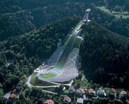
(Photo from  kone.com )

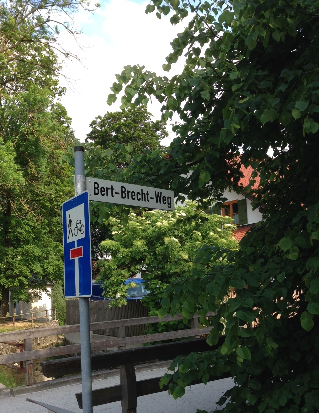
Bergisel is known today as the site of one of the “Four Hills” ski jumps (and a very nice one at that).  You may have seen the ski jumping competitions held here on television. The area is also used for concerts, New Year’s Eve fireworks displays, World Cup soccer match broadcasts on large screens, the annual “Air&Style” Freestyle Snowboard Festival, and is the location of the new Tirol Panorama Museum. There is also a pretty trail along the Sill Gorge, on the back side of the hill. It has, therefor, somewhat heavy human traffic at certain times during the year.
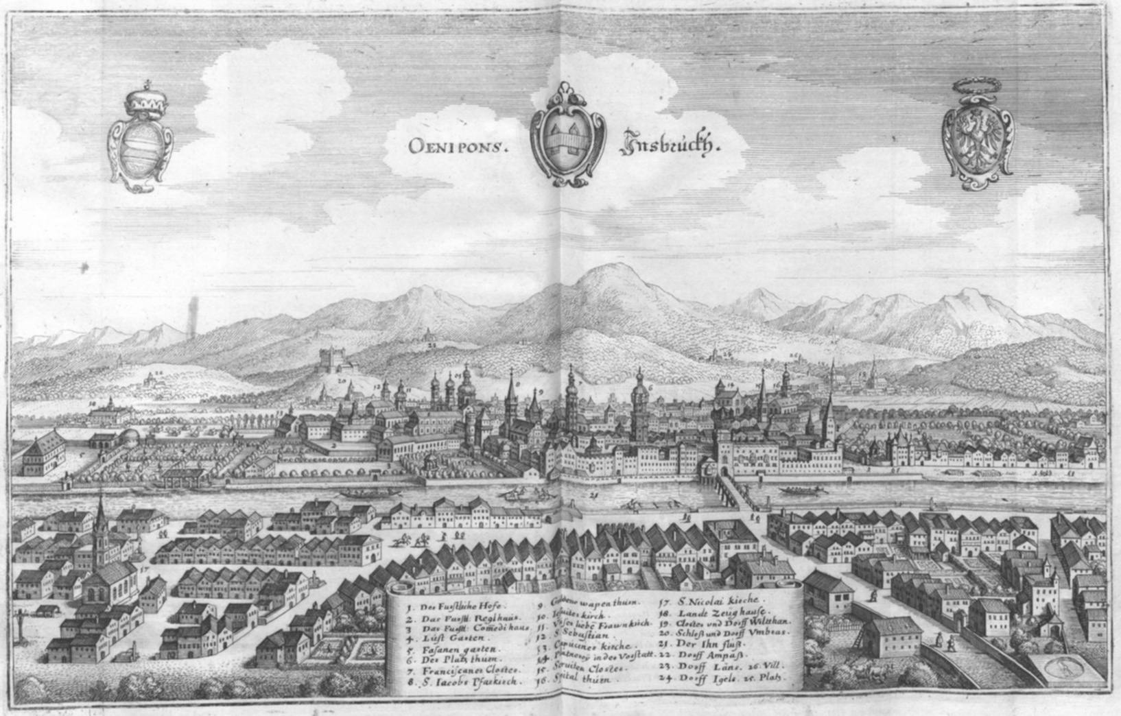
 Bergisel was also known to be a significant archaeological site since the 1840s, when a small military museum was built on a lower slope —the partial collection of a large treasure find is housed in the Tirol State Museum Ferdinandeum, the other part having been “carried off by the wagonful and sold by weight to bellmakers”.

Der Bergisel ist heutzutage bekannt als eine (besonders schöne) Station der Vierschanzentournee. Vielen wird der Bergisel von Fernsehübertragungen der Schisprungveranstaltungen bekannt sein. Das Gelände wird auch für Konzerte, Neujahrsfeuerwerke, Fußballübertragungen auf Großleinwand und dem jährlichen Air&Style Snowboard Festival genutzt. Zudem ist es der Standort des neuen Tirol Panoramas. Es gibt auch einen reizenden Steig durch die Sillschlucht, an der Rückseite des Bergisel. Der Platz ist somit im Jahreslauf zeitweise von Besuchern stark frequentiert.

Der Bergisel ist als herausragendes archäologisches Fundgebiet seit den 1840ér Jahren bekannt, da man damals ein kleines Militärmuseum am unteren Hangteil errichtete. Ein Teil der damaligen funde sind im Tiroler Landesmuseum ausgestellt, während eine anderer Teile als „Wagenladung weggeschafft und  nach Gewicht an Glockengießer verkauft wurde“.

Schanze BingAerialsketch

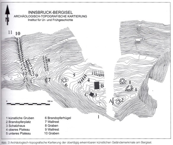
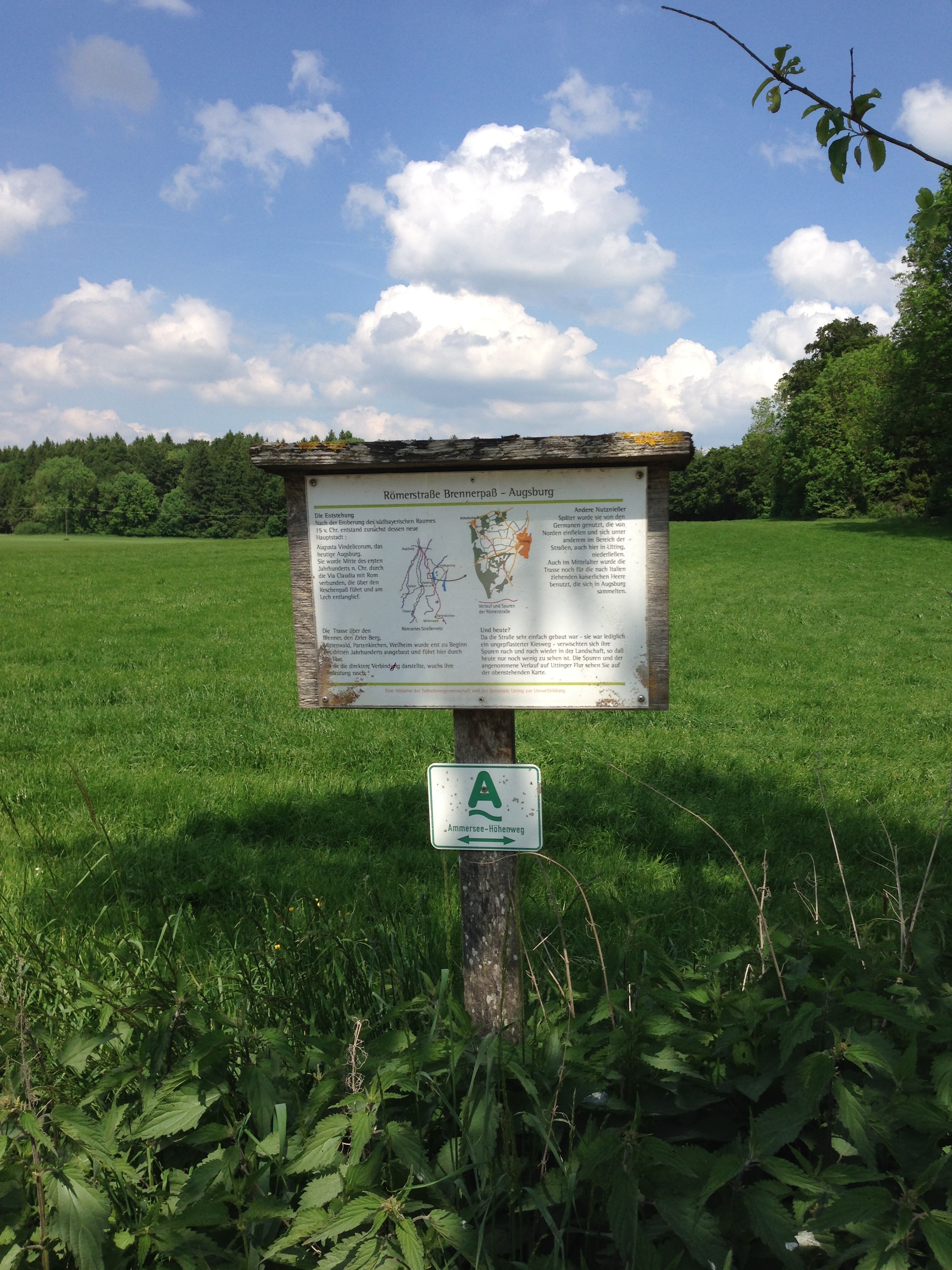
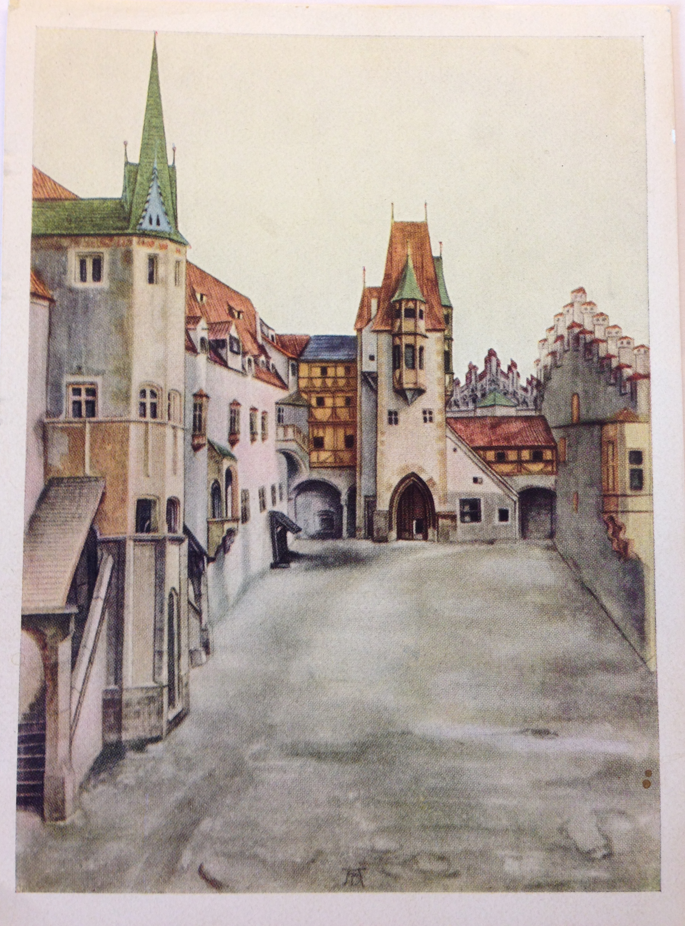
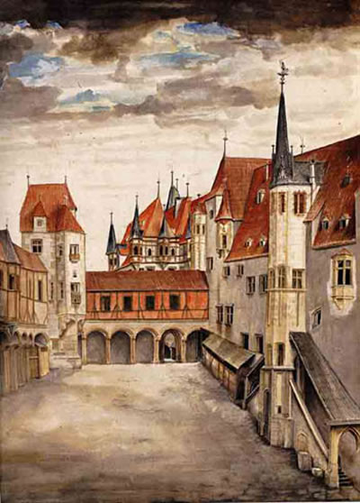
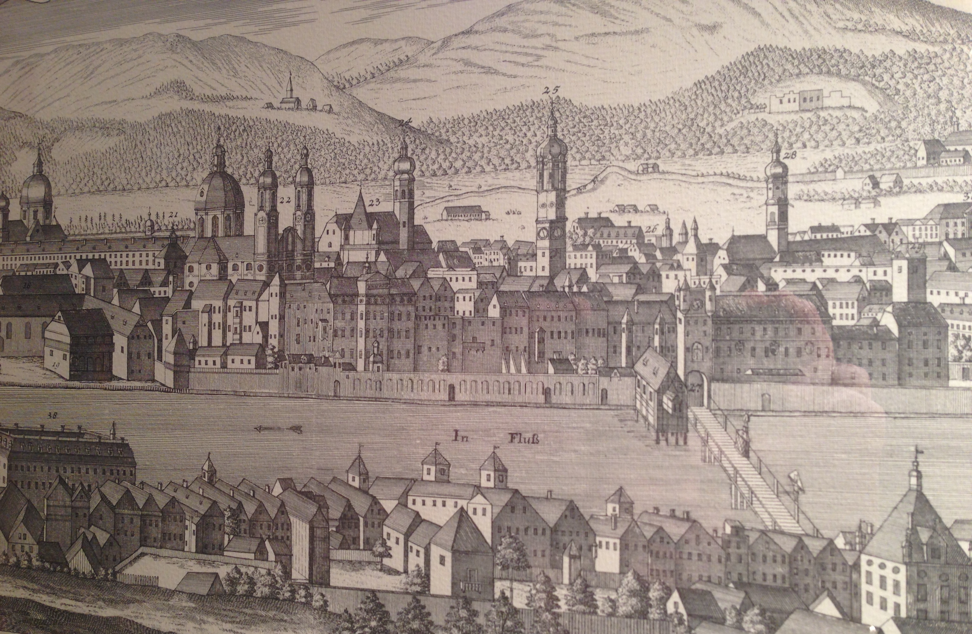
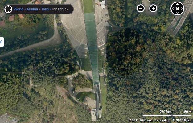
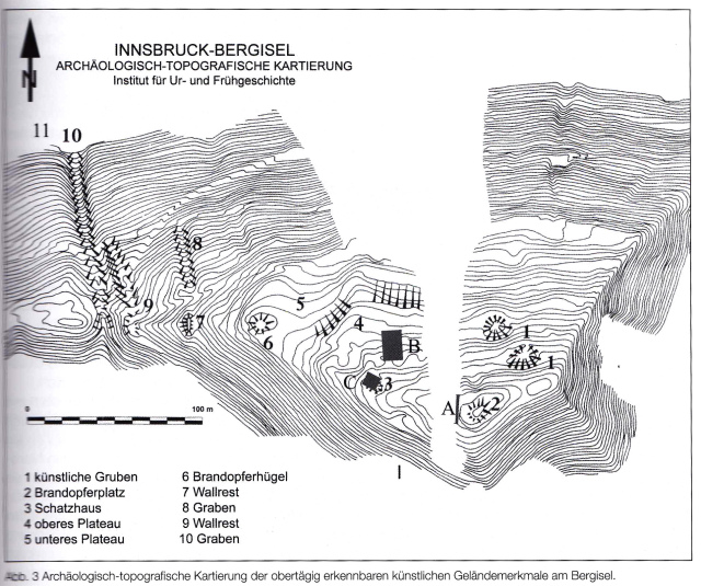
Top image is a screenshot from Bing Maps. Bottom image is from “Ur- and Frühgeschichte von Innsbruck” (“Prehistoric and Protohistoric Archaeology of Innsbruck”) catalog accompanying the 2007 exhibit at the Tiroler Landesmuseum Ferdinandeum, Innsbruck. In German.

When the old jump was built for the 1964 Winter Olympic Games, a large swath of earth had been removed, and a great deal of archaeological evidence unfortunately went with it. This jump was demolished in 2001 to make room for a better, modern one planned by the well-known architect Zaha Hadid, and in between local archaeologists from the University of Innsbruck were able to come in for a limited time and do excavations.
These excavations have uncovered a site for burnt offerings near the highest point of the hill, just a few meters east of the ski jump tower. Animal bones were found which had been burnt at a temperature of over 600°C.  These artifacts have been dates to ranging from 650 BCE to 15 BCE, when the Romans arrived, and would have been taken to the Ferdinandeum.

Als die alte Schisprungschanze  für die olympischen Spiele 1964 gebaute wurde, wurde eine mächtige Erdschicht und zugleich eine große Menge archäologischer Beweisstücke entfernt. Diese Schanze wurde 2001 abgetragen und durch einen besserer und modernere von der bekannte Architektin Zaha Hadid geplante ersetzt. Ein begrenzte Zeit konnten Archäologen der UNI Innsbruck Ausgrabungen durchführen.

Bei diesen Ausgrabungen wurden verbrannte Opfergaben nahe der Spitze des Berges, wenige Meter östliche des Schanzenturms entdeckt. Bei 600°C verbrannte Tierknochen wurden gefunden. Diese Fundstücke wurden Zeitraum zwischen 600 und 15 v.Chr., vor Ankunft der Römer, datiert und ins Ferdinandeum gebracht.

The features, that is, the larger artifacts, were then back-filled with earth and left alone.  There was absolutely NO information found (in 2012) at the site itself, which is on the outside of the fenced-in ski jump area, so one can’t just take the incline to visit it. There are barely trails — animal paths really — up the very steep grades on the back end of the hill. There are no signs forbidding access but it is difficult to get up there. ( I only made it up  —and down — by grabbing onto tree roots and watching very carefully where I stepped. Dead leaves, pine needles and pine cones added a certain hair-raising slipperiness to the adventure. )

Die Bodenmerkmale, also die größeren Fundstücke, wurden dann wieder mit Erde verfüllt und sich selbst überlassen. Es wurde absolut kein Hinweis auf den Fundort außerhalb des umzäunten Geländes der Sprungschanze hinterlassen, sodass man nicht die Möglichkeit hat, den Ort mit der Standseilbahn zu besuchen. Es gibt kaum Pfade den steilen abhängen der Hinterseite des Berges hinauf; die vorhandenen sind tatsächlich Trittspuren von Tieren. Es gibt keine Schilder, die den Zutritt verwehren, aber es ist auch nicht leicht dorthin zu kommen. (Ich selbst kam nur rauf –und runter – in dem ich mich an Baumwurzeln hochhantelte und genau achtete wohin ich trat. Alte Blätter, Nadeln und Tschurtschen (Föhrenzapfen) erweitern das Abenteuer um haarsträubenden Rutschigkeit)

OLYMPUS DIGITAL CAMERA

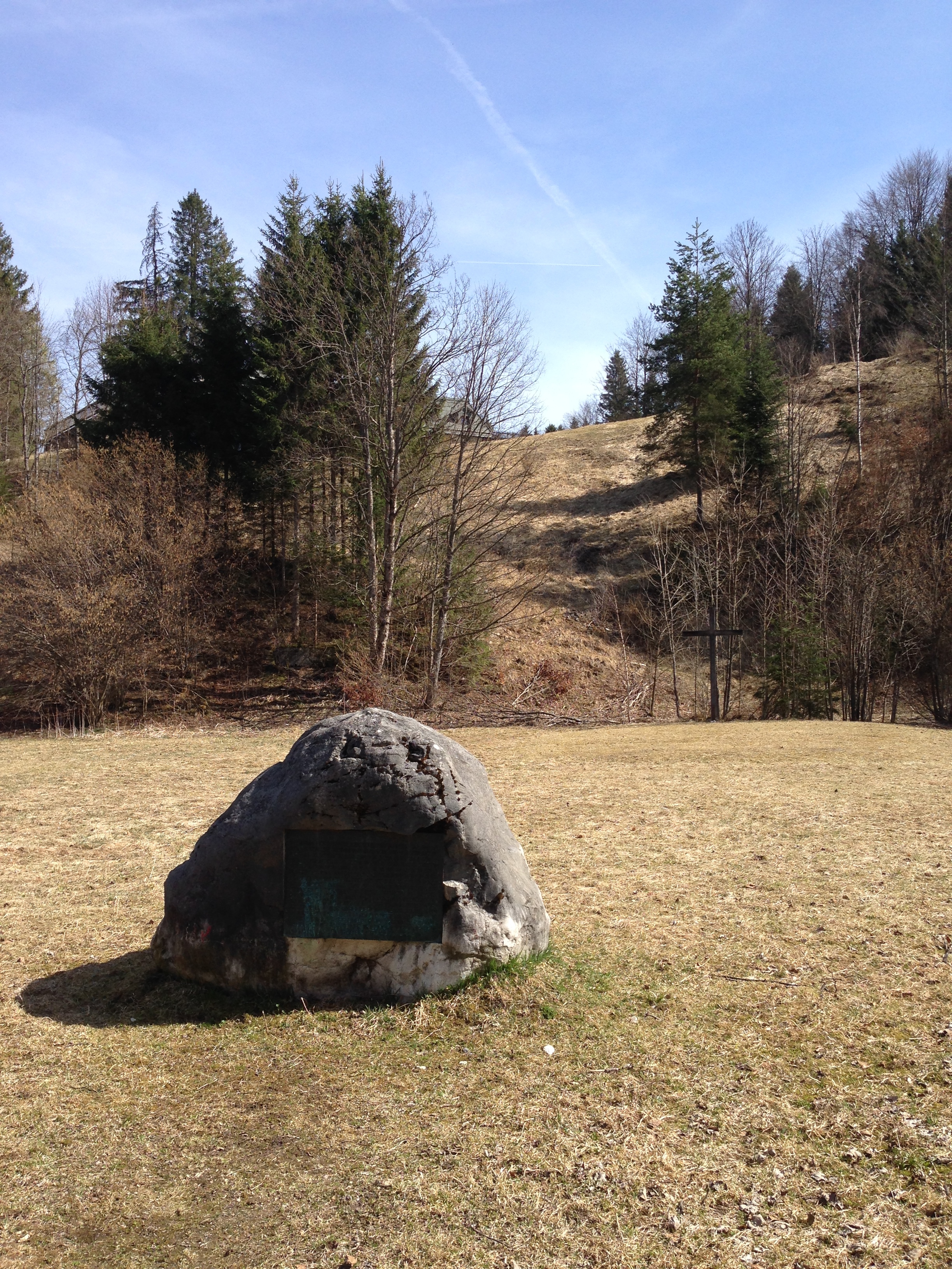
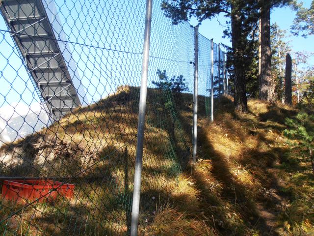
Photograph by the author.

The altar mound as seen today, on the highest point of the hill. The fence around the sport area runs right through the mound, which seems a little unfortunate. I do not know the impact of the fence on the re-buried site but hope that it is minimal.
My take on this site is that despite the great loss of artifacts from earlier landscaping and construction,  archaeologists have done their best to secure it and keep it removed from human disturbance as best they can.  They had been extremely pressed for time before construction on the new tower began. Today nearly all visitors experience the Bergisel at the lower end, where the Panorama Museum is located, or take the incline ride to the cafe  inside the ski jump tower (or walk up on the concrete steps) and have no interest in wandering over to the unidentified excavation site. This makes the conservation efforts  a success. A prognosis is more difficult, as I do not know what plans the property owners have for the area. As long as it remains as it is, the site is secure.[submitted summer 2013]

Der Kulthügel, wie man ihn heute sieht, liegt am höchsten Punkt des Berges. Der Zaun der Sportarena läuft direkt durch den Hügel, was etwas unglücklich erscheint. Ich weiß nicht, welche Auswirkungen das Zaunfundament auf die darunter vergrabene Fundstätte hat, hoffe aber, dass diese gering bleiben. Meinen Meinung über diesen Fundort ist, dass die Archäologen trotz der großen Verluste an Fundstücken durch frühere Geländeveränderungen und Bauarbeiten ihr Bestes getan haben, um das verbleibenden zu sicheren und vor menschlichem Zugriff zu bewahren. Sie handelten während des Baues der Sprungschanze unter großem Zeitdruck .

Heute erleben die Besucher den Bergisel vor allem am unteren Ende, wo das Panorama-Museum steht, oder fahren mit der Standseilbahn zum Cafe im Schanzenturm (oder gehen über die Stufen der Tribünen), haben jedoch kein Interesse über die unbekannte Ausgrabungsstätte zu wandern. Die sicherungsmaßnahmen der Archäologen sind somit erfolgreich. Eine Prognose ist hingegen schwierig, da ich die Pläne der Grundstückseigentümer nicht kenne. Solange es so bleibt ist der Fundort sicher.

Additional source link: http://www.uibk.ac.at/urgeschichte/projekte_forschung/archiv/archivprojekte-tomedi/03_02.html (in German)
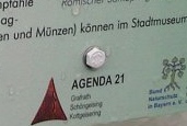
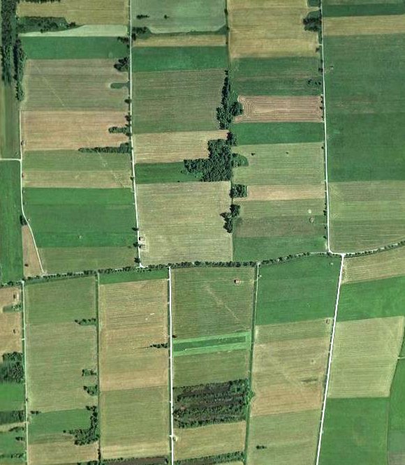
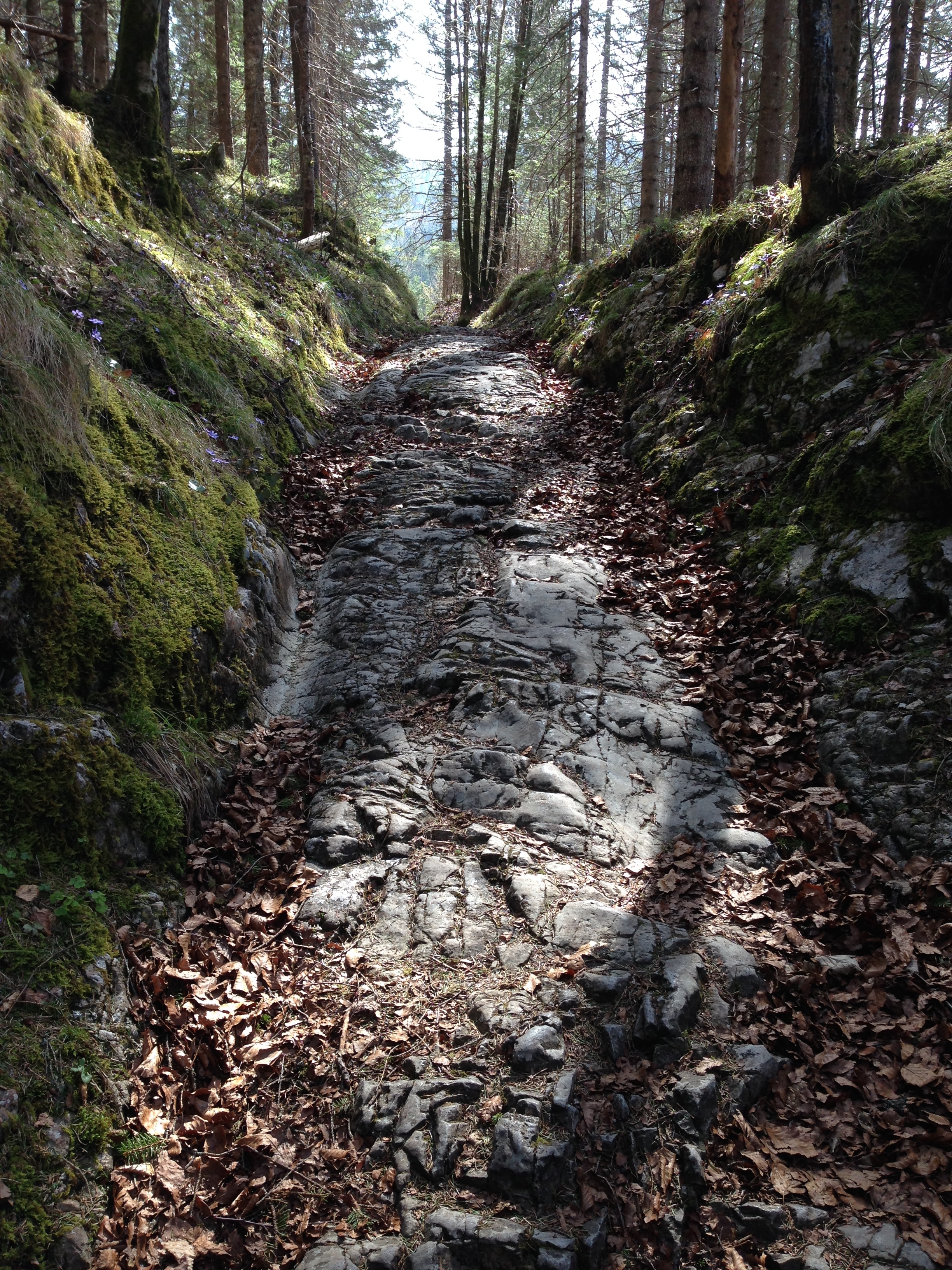
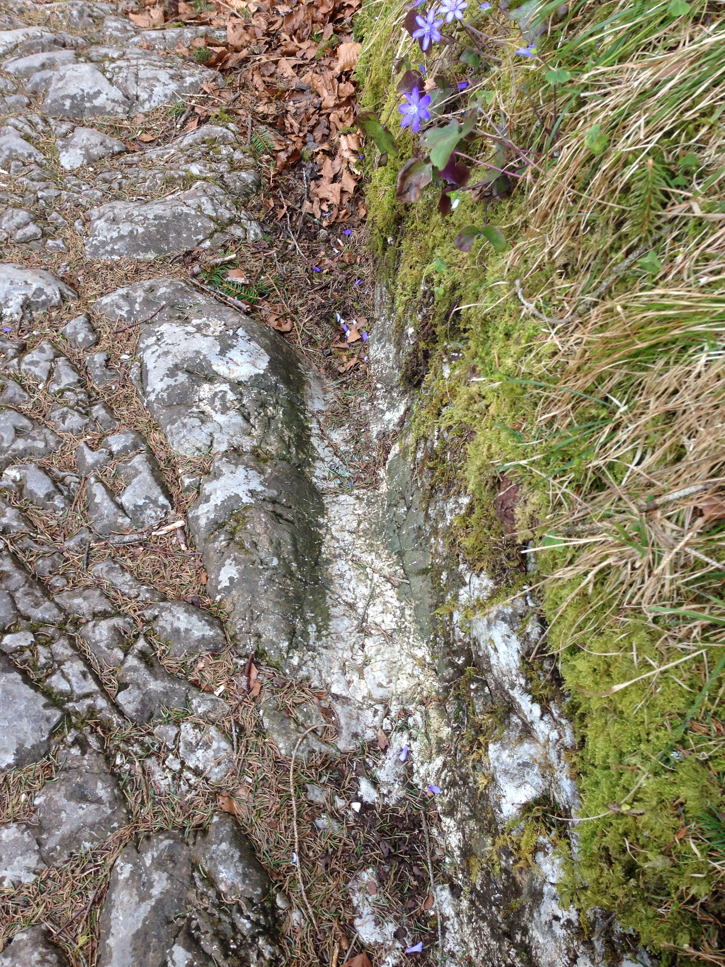
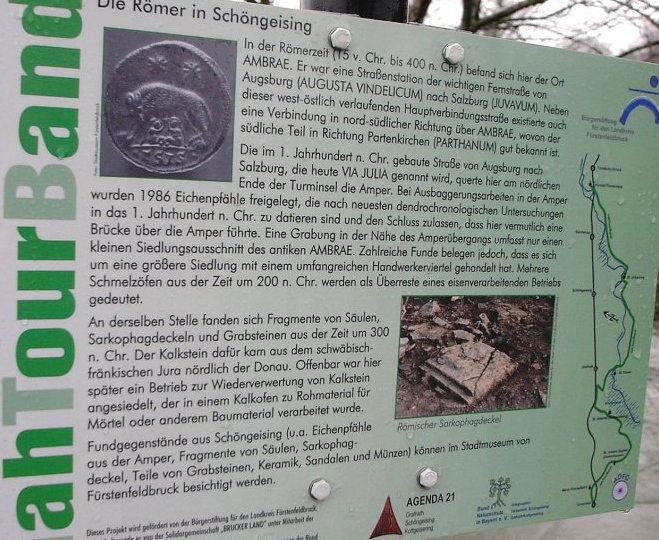