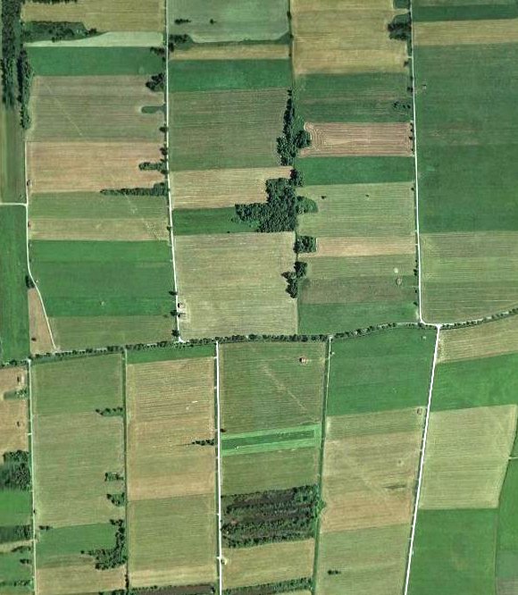
It’s the faint line running diagonally through the fields, between the villages of Wielenbach and Raisting.
Image from this informative collection of Via Raetia images from Mittenwald to the Ammersee. (In German, but the photos are nice.)

It’s the faint line running diagonally through the fields, between the villages of Wielenbach and Raisting.
Image from this informative collection of Via Raetia images from Mittenwald to the Ammersee. (In German, but the photos are nice.)

Obviously the nowdays parcels are no remnants of roman fields
LikeLike
Much of the Via Raetia (and the Via Julia) in Bayern runs southeast-northwest as it approaches Augsburg. I suppose the fields may have been laid out in a similar way…
LikeLike
That’s delightful! Amazing what shows up with satellite photos.
LikeLike