The Odd (and Beautiful) Nikolauskirche in Hall // Die seltsame (und schöne) Nikolauskirche in Hall

Dear Reader, I did this little trip to Hall in Tirol more for me than for you, as I knew I needed to get out of the house. Three straight months of rehearsals for three different productions, plus teaching private lessons, left very little time for blog-related excursions (and I was off to Germany any time I had two consecutive days free). Now that I have a little more time, I’ve got to make myself get back outside.
I have been to the St. Nikolaus Parish Church before, once just to look inside, once to sing a mass. But Paschberg recently brought to my attention the existence of its Waldauf Chapel, which we’ll get to in a bit…
Liebe Leser, ich habe diesen kleinen Ausflug nach Hall in Tirol mehr für mich als für sie gemacht, da ich merkte, ich brauche was um rauszukommen.
Drei harte Monate des Probens für drei verschiedene Produktionen sowie das Halten von Privatunterricht, ließ sehr wenig Zeit für blogbezogene Ausflüge übrig (und ich war jedes Mal, an dem ich zwei aufeinanderfolgenden Tagen frei hatte, in Deutschland). Jetzt, wo ich wieder ein wenig mehr Zeit, habe ich mir diese auch genommen um ins Freie zu kommen.
Ich bin schon früher in der Pfarrkirche St. Nikolaus gewesen, einmal einen Blick ins Innere zu werfen, einmal um eine Messe singen. Aber Paschberg hat mich vor kurzem auf die Existenz seiner Waldauf Kapelle aufmerksam gemacht, die wir uns nun ansehen werden…

NikHallKnick

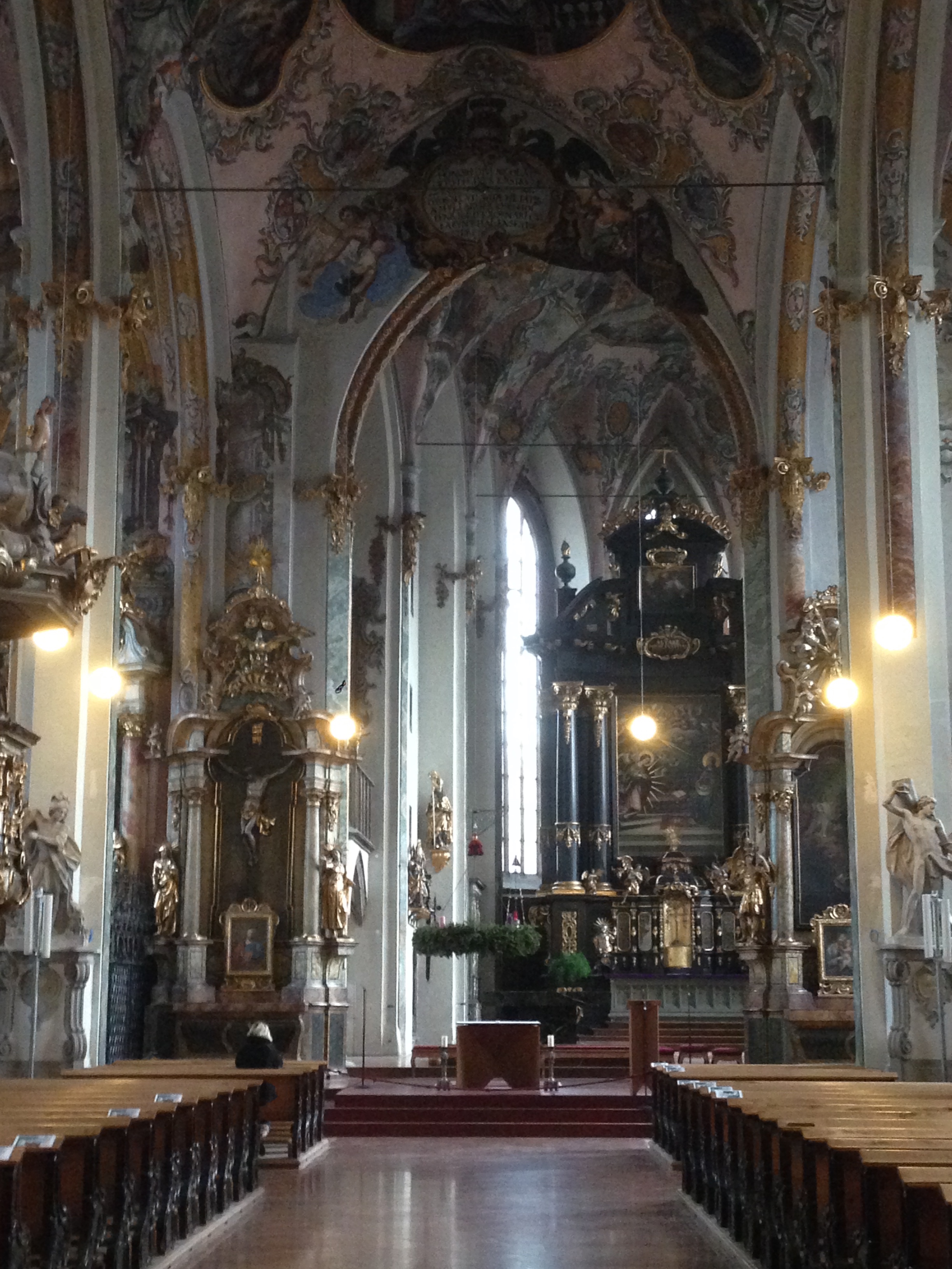
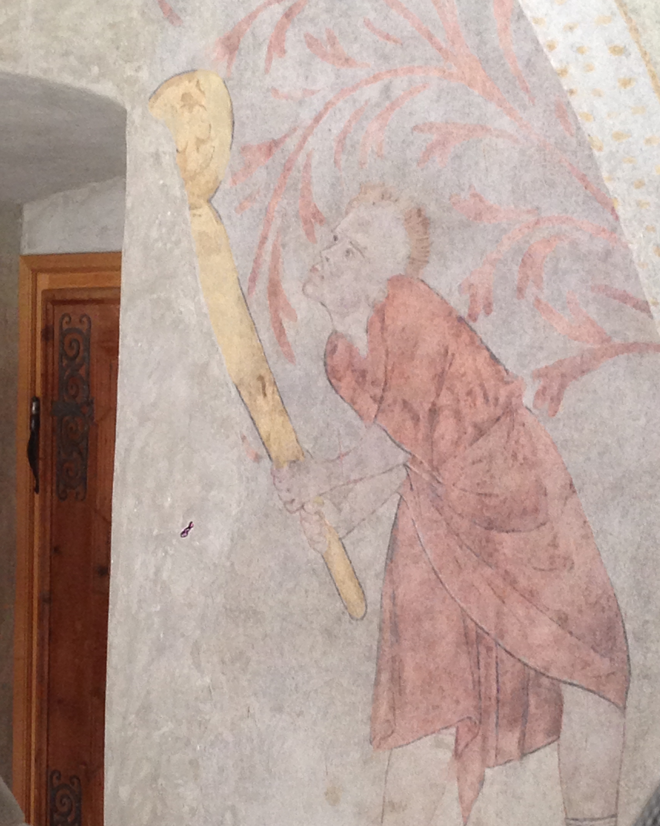
From the entrance the visitor can see that the chancel is not aligned with the rest of the building. The chancel is actually part of the earlier incarnation of the building, which by the early 15th century was too small for the growing local population. A wider, longer nave was built but could not be extended out directly in line with the chancel, and so the church has this odd “kink” in its interior.
Vom Eingang kann der Besucher sehen, dass der Chor nicht mit dem Rest des Gebäudes ausgerichtet ist. Der Chor ist eigentlich ein älterer Teil des Gebäudes, das Anfang des 15. Jahrhunderts für die wachsende Bevölkerung zu klein wurde. Ein breiteres, längeres Langhaus wurde gebaut, aber nicht in direkter Übereinstimmung mit der Flucht des Altarraums, so dass die Kirche diesen seltsame “Knick” in ihrem Inneren bekam.

IMG_1751

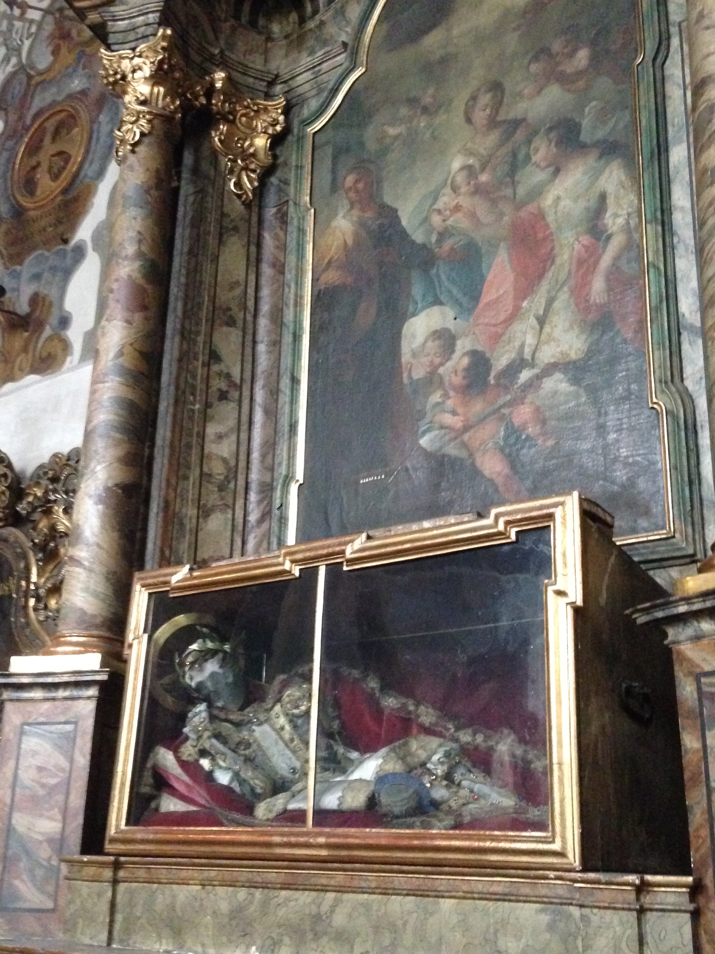
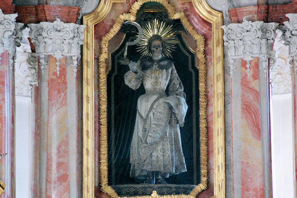
On the north wall, an apparently complete skeleton, dressed in Baroque finery, over an alter to St. Catherine (Katharinenaltar), but I don’t who this would be behind the glass. S/he is flanked by alleged relics of Ss. Constantine and Agapitus, ensconced in their own wall niches.
An der Nordwand, findet man ein scheinbar vollständiges Skelett, im Barockornat gekleidet, auf einem Altar der Hl. Katharina (Katharinenaltar), aber ich weiß nicht, wir hinter dem Glas ist. Er / sie wird von angeblichen Reliquien der Hln. Konstantin und Agapitus flankiert, in eigene Wandnischen eingesetzt.

IMG_1745

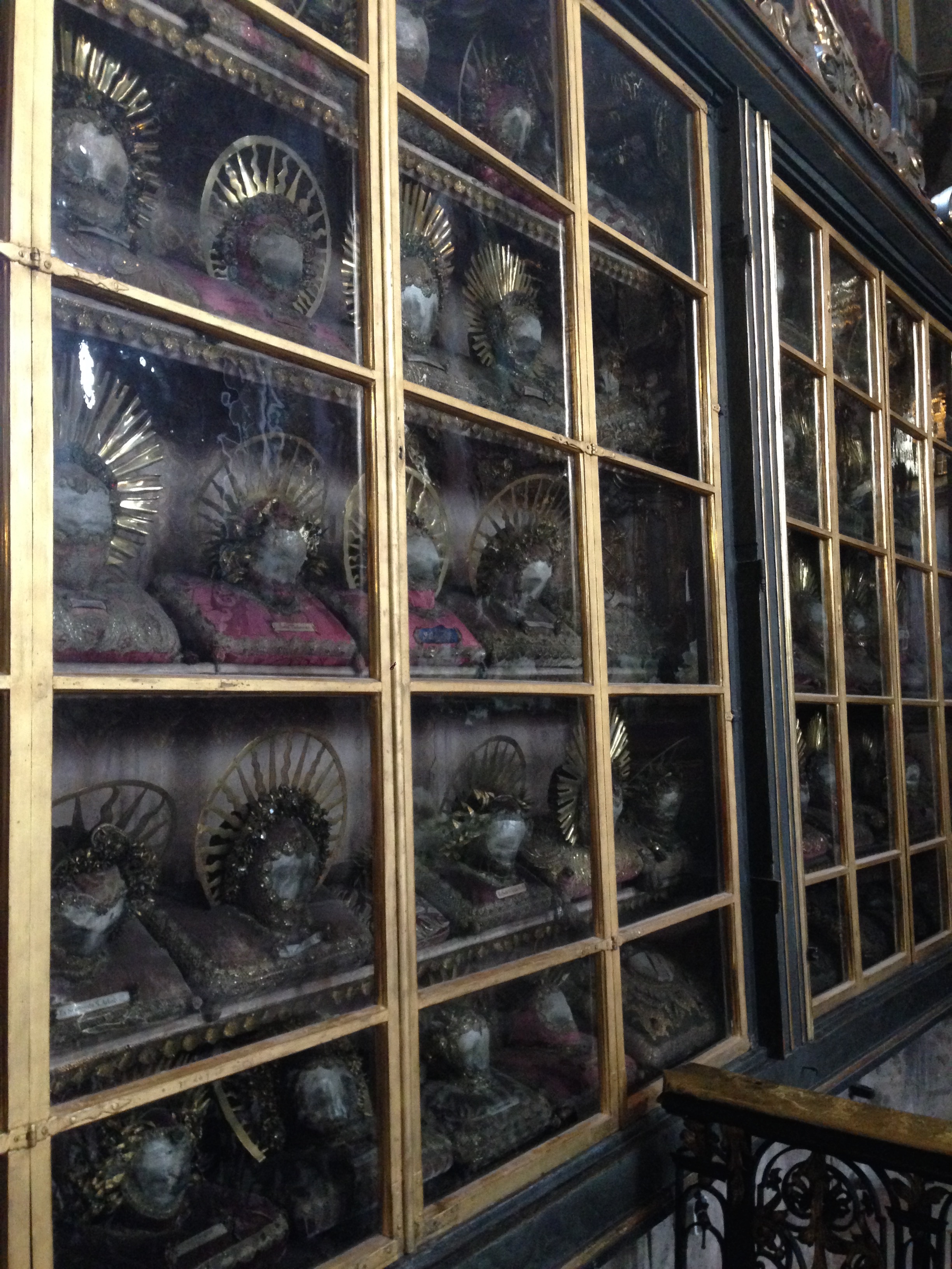
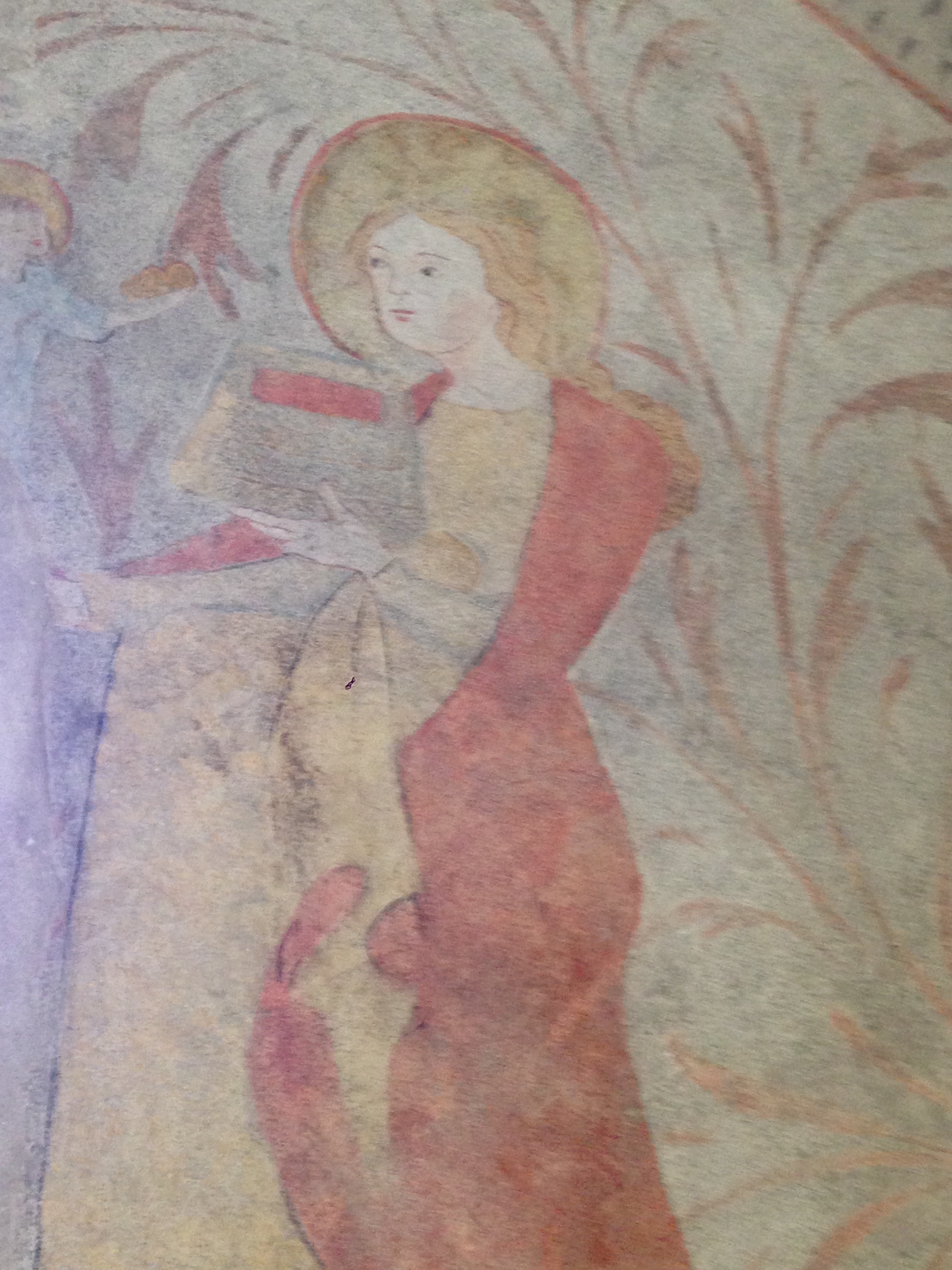
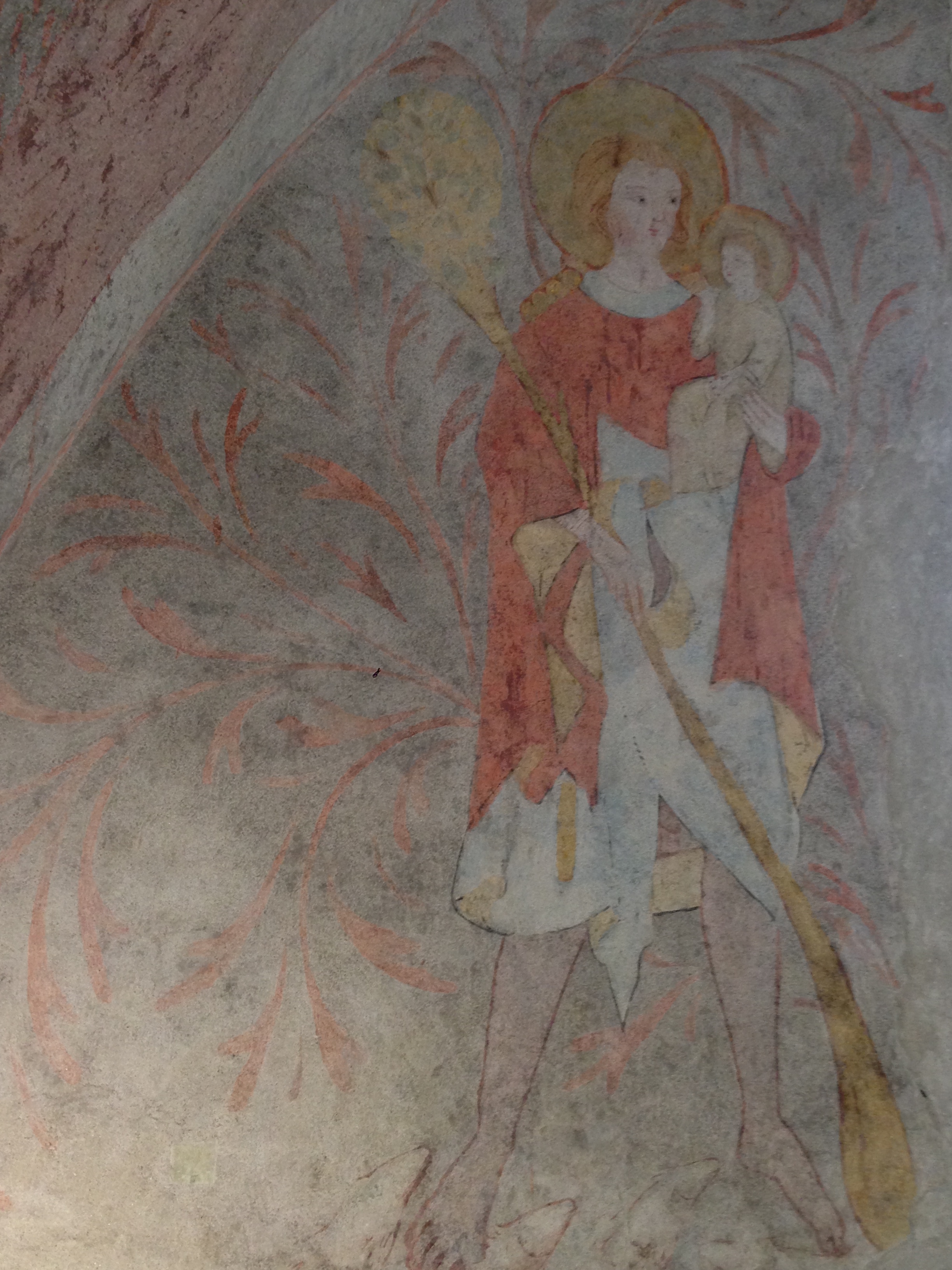
Further along in the north transept one enters the Waldaufkapelle, named after one Florian von Waldauf, the 15th-century knight who had the chapel built and who donated his massive collection of holy relics, picked up here and there during his extensive travels.
Im weiteren Verlauf in des nördlichen Querschiffs betritt man die Waldaufkapelle, nach einem Herrn Florian von Waldauf benannt, Ritter aus dem 15. Jahrhundert, der die Kapelle gebaut hatte und der seine riesige Sammlung von heiligen Reliquien gespendet hatte, die er hie und da während seiner zahlreichen Reisen erstand.

IMG_1742

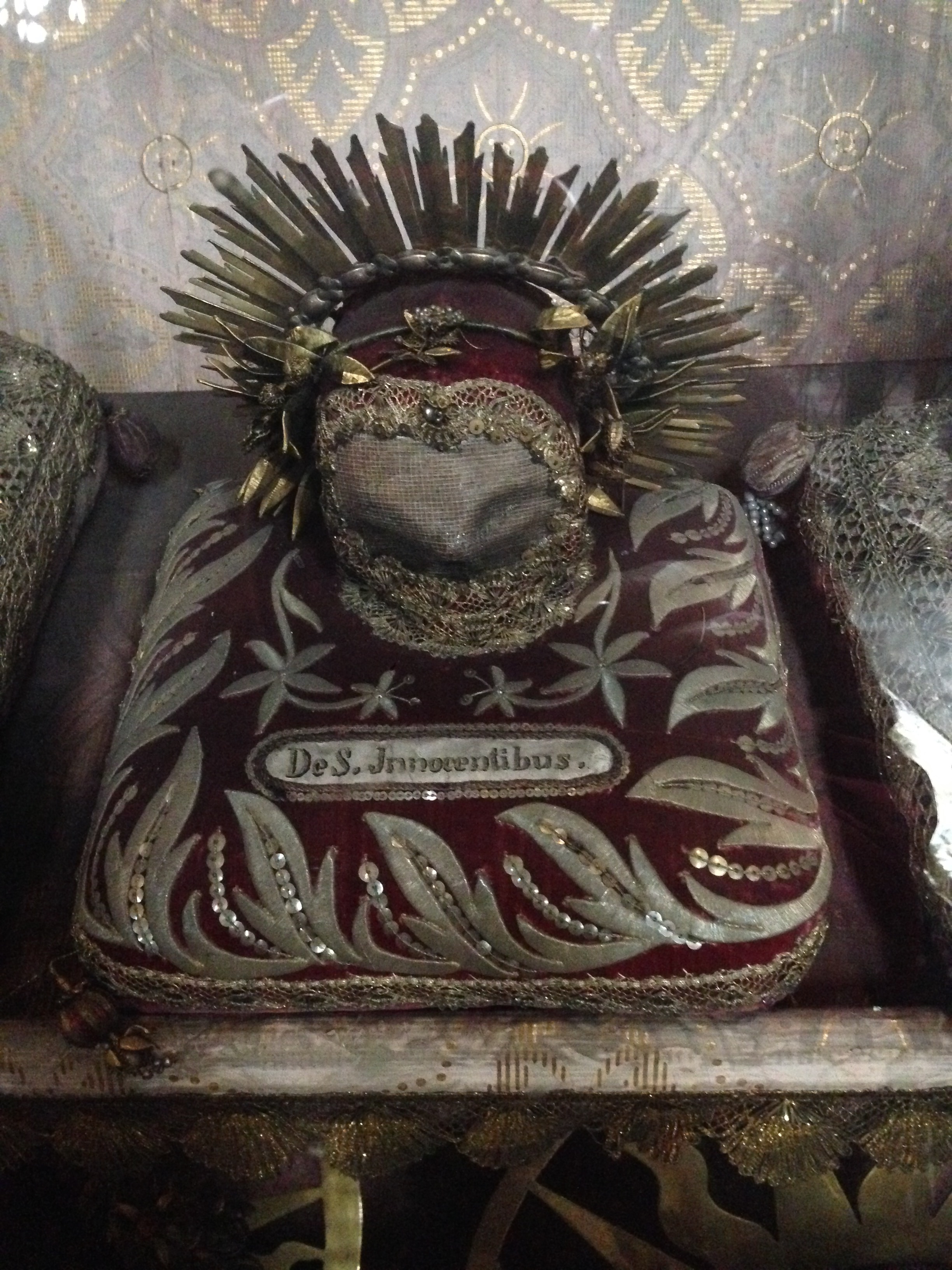
Among the dozens of adult skulls (and some long bones) sits a very small child’s skull with the word  S Innocentibus* embroidered on its pillow. Who all these saints really were, I don’t know. The Niklauskirche is being renovated but its doors are open to visitors.
Unter den Dutzenden von Erwachsenenschädeln (und einigen langen Knochen) sitzt ein sehr kleiner Kinderschädel mit dem Wort S Innocentibus * auf sein Kissen gestickt. Wer all diese Heiligen wirklich waren, weiß ich nicht. Die Niklauskirche wird renoviert, aber ihre Pforten für Besucher geöffnet sind.

* Reader Joe informs me that this name signifies one of the Holy Innocents, the children killed by Herod shortly after the birth of Jesus. The church’s official guide booklet states that the relics come predominantly from the Roman catacombs.// Reader Joe teilt mir mit, dass dieser Name für eines der unschuldigen Kinder steht, die Herodes kurz nach der Geburt Jesu töten ließ. Im offiziellen Faltblatt der Kirche steht, dass die Reliquien vorwiegend aus den römischen Katakomben kommen.

Forgotten Bavaria: St. Johannes auf der Bergerin

IMG_1713(What’s left of a few signs which may have once indicated the original site./ Was von den Resten übrig blieb, die einmal den ursprünglichen Standort angedeutet haben könnten.)

Many centuries ago, west of the Ammersee in southern Bavaria, the main road from Diessen to Entraching crossed the road from Utting to Dettenschwang about right here in this forest. It was more meadow then, with a hermitage and a cemetery near the church.
Vor vielen Jahrhunderten kreuzte sich westlich des Ammersees in Südbayern die Hauptstraße von Dießen nach Entraching und die Straße von Utting nach Dettenschwang ungefähr hier, in diesem Wald. Damals war es eher eine Wiese, mit einer Kapelle und einem Friedhof daneben.

According to this article in the Augsburg newpaper, a local priest named Karl Emerich is credited for rediscovering the site of the church in 1916, a good hundred years after it had burned down in a fire and been forgotten. Father Emerich posited the theory that the place had been held sacred in pre-Christian times. “It is well known that the German Pagans liked their sacred sites in forests and groves.” The early Christian missionaries “preferred to convert pagan holy sites to Christian ones, and as there was a splendid spring nearby, which may have had religious significance,” they would have found it convenient to build a church here where the local people were used to coming, wrote Emerich.
Nach diesem Artikel aus der Augsburger Allgemeine Zeitung ist die Wiederentdeckung des Standorts der Kirche im Jahre 1916, gut hundert Jahre, nachdem sie abbrannte und vergessen wurde, einem örtlichen Priester namens Karl Emerich zu verdanken. Pater Emerich vertrat die Theorie, dass der Ort bereits in vorchristlicher Zeit heilig war.”Die heidnischen Deutschen hatten bekanntlich ihre Heiligtümer gerne in Wäldern und Hainen”. Die christlichen Missionare hätten mit Vorliebe “heidnische Heiligtümer in christliche umgewandelt, und da sich eine prächtige Quelle vorfand, die vielleicht schon im heidnischen Kultus Bedeutung hatte, so lag für die Missionäre wohl nichts näher, als diesen Platz zu einer christlichen Kultusstätte und zwar zu einem Tauforte einzurichten, denn hier strömten die Umwohner ohnehin aus alter Gewohnheit zusammen zu ihren heidnischen Opfern (…)” – so Emerich.

IMG_1715

Just down the main road is the rebuilt Johannesbrunnen with some information about the church and its spring. In 1718 the water was declared to hold healing powers. In the mid-eighteenth century it was reported that poachers kept breaking the the church windows and stealing the lead, in order to make bullets from it, and in 1759 Bavarian Elector Maximilian III Joseph arrived with his entourage and stayed around to hunt wild boar. By the end of the century the hermitage was down to just one hermit, and in 1802 the structures were destroyed in a fire.
Gerade am Ende der Hauptstraße steht der wieder errichtete Johannesbrunnen mit einigen Informationstafeln über die Kirche und ihre Quelle. Im Jahre 1718 wurde diese als Heilquelle anerkannt. In der Mitte des achtzehnten Jahrhunderts wurde berichtet, dass Wilderer die Kirchenfenster zerbrachen um die Bleifassungen zu Gewehrkugeln zu verarbeiten. Im Jahre 1759 weilte der bayerische Kurfürsten Maximilian III. Joseph mit seinem Gefolge dort, um Wildschweine zu jagen. Am Ende des Jahrhunderts war die Kapelle bis auf einen verbliebenen Einsiedler heruntergewirtschaftet, und im Jahr 1802 wurde das Gebäude bei einem Brand zerstört.

Now only the fountain remains, and a pretty forest of beech and spruce trees behind it. The site where the church once stood is now occupied by oak trees, which took root there there after the fire.
Heute zeugt nur mehr der Brunnen davon – und ein hübscher Wald aus Buchen und Fichten dahinter. Der Ort, an dem die Kirche stand stehen heute noch Eichen, die nach dem Brand dort aufkamen.

Notburga of Rattenberg

einstiegsgrafik

First, a bit of background on Notburga (pronounced Note-boor-ga). She was born in Rattenberg, a small town east of Innsbruck, around 1265 to a couple of hatmakers, and proved to be an extraordinarily intelligent and competent woman. She hired herself out as a serving maid to King Heinrich I up on “Rottenburg” Castle, and beyond her duties she looked out for the poor in the area, bringing them leftovers from the castle meals. When Heinrich II took the throne, his wife was not so keen on Notburga’s presence. The official line is that Ottilia didn’t like the poor being fed, but I suspect it had more to do with her feeling that her power was somehow threatened. Notburga was let go from her job, and found a new one on a farm in nearby Eben, on Lake Achensee (which is redundant, but I’ve seen it often written this way for English readers), where her one condition was that she be allowed to stop working at the first peals of the evening church bell.
One miracle attributed to Notburga involves an occurrence during the harvest. A storm was approaching, and the farmer demanded that his laborers stay at work until all the grain was brought in. When the church bell rang, Notburga stopped, and when confronted by her employer, she threw her sickle into the air, where it hung on a sunbeam.
At some point after the death of Ottilie, Heinrich II, suffering from general disarray and a feud with his brother, asked Notburga to return to the castle (of course he did), where she brought everything back into order. Later, close to death, she expressed the wish that her body be put into an unmanned wagon pulled by two oxen, and that where the oxen stop, she should be buried. This being done, the oxen took her across the Inn River, up the mountain and back to Eben, where they finally stopped in front of the village church.
Notburga’s remains quickly became such a popular pilgrimage destination that the church had to rebuild twice in the next 200 years to accommodate the increased visitor count. She has never been canonised, but the Vatican officially made allowance for her to be revered, which makes her a de facto saint.

Now, there are few different things going on here at once. Old legends around the Rofan Mountains and Lake Achensee tell of the “white ladies”, and Notburga von Rattenberg is in a way one of these, although an historical Christian figure as well. Or, put another way, she was given some other-worldly attributes after her death.

The oxen ride predates Notburga by at least 1500 years — in Greek mythology, the Phoenician prince Cadmus was instructed by the Oracle at Delphi to follow a certain cow and build the town of Thebes on the spot where she lay down.

In “Philosophie, Religion und Alterthum” by Georg Friedrich Daumer, Campe Verlag, 1833, in a chapter discussing Count Hubert of Calw (available via google books, translation by the blogauthor):

This last journey appears in many other legends,  for example in those of St. Gundhildis and of Notburga of Rattenberg… the river crossing is important in mythology and appears also in the following Swiss legend: ‘The building tools were carried by a pair of yoked oxen and where the animals stopped would determine the place where the church would be built. They crossed the river and came to a stop at the place where  St. Stephen’s Church was erected’ … This holy ritual is also found in India. When one wishes to build a pagoda, the place will be determined through the sacred cow; where she lies down at night is the place decided upon by the deity.

The “sickle miracle” might be borrowing from the sickle’s pre-Christian symbolisation of fertility and harvest, the crescent moon. It may be a leap in logic to say this but I suspect that Notburga, being an intelligent and resourceful woman, helped not only the poor of Rattenberg but possibly women as well — pregnancy killed a lot of women back then, and anyone with some good midwife skills (including surgery) could go a long way. It would have been very easy for the Church to turn her into the Patron Saint of Agriculture, with that sharp blade in her hand. But she also sounds like an early champion of farmworkers’ rights, with her insistence that work stop with the sound of the bell. I can well imagine a woman told to get back to work and throwing her sickle into the air — and the shock of hearing about it keeping the story alive, in one form or another, for a while. She may have been the talk of the region, standing up to The Man like that, as well as the one that people sought for help when none was to be found elsewhere. Her insistence on sharing food — hers and the court’s — with the local poor in defiance of authority points to a kind of Christian socialism (was she a late-mediaeval version of “community organizer”?)

0dbc48e7258f69a0321c50ea59168d1c_Tirol Notburga Scannen0005

And it may be another leap in logic to connect her reverence with the Germanic deity Frau Perchta (or Hertha), whose responsibilities included ushering the souls of dead children to the otherworld. Hertha in turn is a variation on the Germanic Frau Hölle (or Holda), who is the protectress of children while having none of her own. What I think we have here is a strong and able woman, revered long after her death for great works among the people (the nature of which the Catholic Church at the time could not recognise), being elevated in a way that conveniently took a little of the life out of the old beliefs which were still floating around.

110318_notburga600Bonus trivia: Notburga’s skeletal remains can still be seen in the church at Eben, upright and dressed above the altar.

Images from here and here.

A Chapel in Axams

A free Sunday afternoon and it happens to be Tag des Denkmals in Austria. This is a day for  cultural and historical monuments across the country, and often there is the chance to see something not normally open to the public.
That opportunity is what got me on a bus to Axams, a village on the slopes of the mountains southwest of Innsbruck. Axams is a very, very old village; archaeological finds point to human settlement in the area as far back as 1200 BCE and the current name is of Celtic origin (Ouxumenes, “very high place”). (g) Its situation on a sunny plateau high above the Inn Valley certainly made it prime real estate then (and now — it’s both a commuter town, being a 20-minute drive from Innsbruck, and a popular spot for ski tourists). // Ein freier Sonntagnachmittag und Tag des Denkmals in Österreich. Dies ist ein Tag für die kulturellen und historischen Denkmäler im ganzen Land, und oft gibt es die Möglichkeit, etwas in der Regel nicht für die Öffentlichkeit zugängliches zu sehen.
Diese Gelegenheit brachte mich in einem Bus nach Axams, einem Dorf im Mittelgbeirge südwestlich von Innsbruck. Axams ist ein sehr, sehr altes Dorf; archäologische Funde weisen auf menschliche Besiedlung in der Region soweit zurück, wie 1200 v.Chr; und der aktuelle Name ist keltischen Ursprungs (Ouxumenes, “sehr hohen Platz”).  Seine Lage auf einem Sonnenplateau hoch über dem Inntal machte es zu einem attraktiven Siedlungsgebiet (und heute ist es sowohl eine Trabantenstadt, 20 Minuten Fahrt von Innsbruck, alsauch ein beliebter Ort für Ski-Touristen).

But the cultural site on offer today was from an era a bit later in its history. The Widumkapelle (“dower”, or endowment chapel) was built around 1330, originally stood as a stand-alone structure, and then became part of the larger parish offices. Into the late 1990s it was used as a furnished meeting room; after extensive excavation in 2003, the original frescoes (g) were uncovered and restored. These frescoes, interestingly, reveal that the original structure was not simply a chapel. // Aber die Kultstätte im Angebot war heute aus einer etwas jüngeren Zeit. Die Widumkapelle wurde um 1330 erbaut, ursprünglich freistehendes Objekt, das später Teil des Pfarramts wurde. Bis in die  späten 90er Jahre wurde es als möblierten Besprechungsraum verwendet; nach umfangreichen Ausgrabungen im Jahr 2003 wurden die Fresken freigelegt und restauriert. Diese Fresken zeigen interessanterweise, dass die ursprüngliche Anlage nicht einfach nur eine Kapelle war.

IMG_1619IMG_1627While the eastern wall bears sacred images of Saints Christopher and Dorothy (both early Christian martyrs), // An der östlichen Wand befinden sich Bilder der Heiligen Christophorus und Dorothea (beide frühchristlichen Märtyrer),

IMG_1628…the western wall displays two jousting knights representing the Knights of Freundsberg and Starkenberg. // …die Westwand zeigt zwei Turniereritter, die Ritter von Freundsberg und Starkenberg.

IMG_1624The northern wall, meanwhile, bears the image of a kind of doorman/bouncer, ready to pummel any unwelcome visitors as they enter. There are also several crests of Austrian principalities.  Was this small building erected for official business between clergy and ruling nobility? A kind of ceremonial or memorial hall, as our guide today suggested? Historical research has not yet come up with the answer. // Wohingegen die Nordwand, das Bild von einer Art Pförtner / Türsteher zeigt, bereit, allen unerwünschten Gästen eins über die Rübe zu geben. Es gibt auch mehrere Wappen der österreichischen Fürstentümer. Wurde das kleine Gebäude für offizielle Zwecke zwischen Klerus und herrschendem Adel errichtet? Eine Art von Zeremonienraum oder Gedenkhalle (“Widum”, mit dem Wort “Widmung” verwandt) wie es unsere Führerin annahm? Die historische Forschung die Antwort noch nicht gefunden.


Licus

IMG_1609A beautiful late-summer Saturday afternoon walking along the Lech River, south of Landsberg. The river was full of swans, dozens of them, and as we walked  an enormous flock of honking wild geese came in over the trees and landed in the water. The Lech gets its name from the Celts who lived here and who were known to the Romans as Licates. Over the years it’s been referred to as Licus, Licca, Lecha, and finally Lech. According the the German Wikipedia, the Welsh word llech (stone slab) and the Breton word lec’h (gravestone) point to a Celtic origin, as the river is unusually gravelly.

Spaziergang an einem schönen Spätsommersamstagnachmittag den Lech entlang, südlich von Landsberg. Der Fluss war voll von Schwänen, Dutzende von ihnen, und während wir da gingen kam laut schreiend eine enorme Schar Wildgänse über die Bäume geflogen und landete im Wasser. Der Lech hat seinen Namen von den Kelten, die hier lebten. Diese waren bei den Römern als Licates bekannt. Im Laufe der Jahre ist er als Licus, Licca, Lecha und schließlich Lech bezeichnet worden. Nach der die deutsche Wikipedia, weisen die walisische Wörter Llech (Steinplatte) und die bretonische Wort lec’h (Grabstein) auf einen keltischen Ursprungs, zumal der Fluss ungewöhnlich viel Geschiebe führt.

Reading the Tabula Peutingeriana

The Tabula Peutingeriana is a 13th century copy of a Roman road map from around the 4th or 5th century CE, judging by the place names on it. It is named for Konrad Peutinger, a man of letters from 16th-century Augsburg, who had bequeathed it to his great-nephew Markus Welser (the Welser clan was a famous banker family in Augsburg, and had an Innsbruck representative in Philippine.) It is a very unusual map in that the road lengths are consistent (“längentreu”) but not the areas between them. In this way it resembles a subway map, where all the rail lines extend in directions beneficial to the space of the map but not true to actual geography. The lands on the Tabula extend from the British Isles to the Ganges Valley in India. // Die Tabula Peutingeriana ist eine im 13. Jhdt. N. Chr. angefertigte Kopie einer römischen Straßenkarte des 4 oder 5 Jhdt. N. Chr, wenn man von den verwendeten Ortsnamen ausgeht. Sie wurde nach Konrad Peutinger, einem Gelehrten des 16. Jahrhunderts in Augsburg, der es seinem Großneffen Markus Welser vermacht hatte, benannt (die Welser-Clan war eine berühmter Bankier-Familie in Augsburg, und hatte in Innsbruck einen Vertreter in Philippine). Es ist eine sehr ungewöhnliche Karte, da die Straßenlängen konsistent sind (“längentreu”), nicht aber die Gebiete zwischen ihnen. Auf diese Weise gleicht sie einer U-Bahn-Karte, in der alle Eisenbahnlinien so gerichtet sind, dass sie ins Papierformat der Karte gut passen, aber nicht tatsächliche Geographie abbilden. Die Länder auf der Tabula erstrecken sich von den Britischen Inseln bis zum Ganges-Tal in Indien.
I recently obtained a copy of Via Claudia Exkursionsführer (Via Claudia Excursion Guide) by Hermann J. Volkmann. It’s a rather academic booklet, put out by scholars of geography didactics, but not difficult to follow. To my delight, it shows with modern maps the presumed route of the Via Claudia from Augsburg to Füssen, almost to the meter, including information on where it is still accessible and where one has to detour. Volkmann says some interesting things about the famously straight Roman roads and their representation on the Tabula Peutingeriana. On the map below you will see that they are drawn as straight lines with kinks. According to Volkmann, these kinks represent stages or segments on the journey, and each joint was probably recognisable by landmarks (grave mounds, viereckschanzen, rivers, lakes) or guesthouses, found at regular intervals along the road and offering bed and board, stalls and supply depots. // Ich habe vor kurzem eine Kopie des Via Claudia Exkursionsführer (Via Claudia Wanderführer) von Hermann J. Volkmann erhalten. Es ist eine eher akademische Broschüre, die von Wissenschaftlern der Geographie erstellt wurde (Lehrstuhl für Didaktik der Geographie an d. Univ. Augsburg), aber nicht schwer zu folgen. Erfreulicherweise zeigt es mit modernen Karten die mutmaßliche Route der Via Claudia von Augsburg nach Füssen, fast auf den Meter, einschließlich Informationen darüber, wo sie noch zugänglich ist und wo man einen Umweg machen muss. Volkmann sagt einige interessante Dinge über die berühmte geraden Römerstraßen und deren Darstellung auf der Tabula Peutingeriana. Auf der Karte sieht man, dass sie als gerade Linien mit Knickstellen gezeichnet werden. Nach Volkmann, stellen Knicke Stufen oder Segmente auf der Reise dar, und jedes Gelenk war wohl erkennbar ein Wahrzeichen (Grabhügel, Viereckschanzen, Flüsse, Seen) oder Pensionen, in regelmäßigen Abständen entlang der Straße, die Unterkunft,Verpflegung, Ställe und Depots bieten.

TPSchnitt

Only two travel segments of the Via Claudia can be found on the Tabula Peutingeriana; from Augusta vindelicum (two towers near the top left corner, above) to Da novalis, and from there to Abodiacum. After that there seems to be a detour somewhere* over to the Via Raetia**, which was built later and runs through Innsbruck and the Brenner Pass. Volkmann posits that the Via Raetia was the more important route at the time, so it would have made sense to include it and not the older, longer route.
Here are the stops between Augusta vindelicum (Augsburg, Bavaria) and Tridentum (Trento, Italy). I have included the names on the Tabula Peutingeriana, a known Roman name (if different), and the modern name for that place. // Nur zwei Reise Segmente der Via Claudia konnten auf der Tabula Peutingeriana gefunden werden; von Augusta Vindelicum (zwei Türme in der Nähe der oberen linken Ecke, oben) nach Da Novalis, und von dort zu Abodiacum. Danach scheint es eine Umleitung irgendwo über der Via Raetia zu geben **, die später gebaut wurde und die durch Innsbruck und über den Brenner * verläuft. Volkmann geht davon aus, dass die Via Raetia zu der Zeit eine wichtigere Route an der Zeit war, so dass es sinnvoll war auf die Darstellung der alten Route zu verzichten. Hier sind die Rastplätze zwischen Augusta Vindelicum (Augsburg, Bayern) und Tridentum (Trento, Italien) zu sehen. Ich habe die Namen auf der Tabula Peutingeriana, bekannten römischen Namen (falls abweichend), und modernen Namen für diesen Ort gegenübergestellt.

Augusta vindelicum — Augsburg
Da novalis — possibly Obermeiting
Avodiaco — Abodiacum— Epfach
Coveliacas — “Köchel”, at Murnauer Moos***.
Tartena — Parthanum  — Partenkirchen
Scarbia  —  Klais, where Scharnitz Abbey once stood. (The story of the name Klais is connected to the Via Raetia.)
“Vetonina” —  Veldidena — Innsbruck – Wilten
Matreio —  Matreium —  Matrei am Brenner
Vipiteno  —  Vipiteno (Sterzing)
Sublavione  — Chiusa (Klaussen)
Pentedrusi  — Pons Drusi — Bolzano (Bozen)
Tredente —  Tridentum  — Trento (Trient)

*An east-west Roman road from Salzburg to Kempten connected Epfach, on the Via Claudia, with Raisting, south of the Ammersee and on the Via Raetia.  Possibly one simply detoured there. // Eine Ost-West-Römerstraße von Salzburg nach Kempten verband Epfach, an der Via Claudia, mit Raisting, südlich des Ammersees und an der Via Raetia gelegen. Möglicherweise wurde sie hier einfach umgeleitet.

** The name Via Raetia is a later invention, the Roman name for this road is forgotten, if indeed it had ever had a name. // Der Name Via Raetia ist eine spätere Erfindung, der römische Name für diese Straße ist vergessen, wenn es denn jemals einen Namen hatte.

***Other researchers point to the Echelsbacher Bridge near Bad Bayersoien, but this doesn’t make sense to me. // Anderer Forscher weisen auf die Echelsbacher brücke bei Bad Bayersoien hin; mir leuchtet das aber nicht ein.

Der Hofstetter Frauenwald

IMG_1534

A few months ago I quickly photographed a field of grave mounds along the main road from Hofstetten to Pürgen. / Vor ein paar Monaten habe ich schnell ein Feld von Grabhügeln entlang der Hauptstraße von Hofstetten nach Pürgen fotografiert.

IMG_1533

The Wikipedia entry for the nearby community of Pürgen mentions a Totenstadt; that there once were said to be 200 grave mounds, and that by 1908 that number was down to 63. / Der Wikipedia-Eintrag für die nahegelegene Gemeinde Pürgen erwähnt eine Totenstadt; dass es einmal um die 200 Grabhügel gewesen sind, und dass  um 1908 diese Zahl auf 63 gesunken war.

totenstadt

IMG_1580

Today I took a tour of a large patch of woods, called the Hofstetter Frauenwald, across the road from that field. I don’t know why it’s called a “Ladies’ Forest” but postulate that the land had once belonged to a convent. I suspected that there may be many more grave mounds inside the forest. / Heute habe ich eine Tour durch einen großen des Waldes gemacht, dem so genannten Hofstetter Frauenwald, gerade jenseits der Hauptstraße dieses Felds. Ich weiß nicht, warum es eine “Frauenwald” genannt wird, aber nehme an, dass das Land einst zu einem Kloster gehörte. Ich vermutete, dass viele weitere Grabhügel im Wald sind.

IMG_1583And indeed, from the path alone I counted 28 of them. A visit in the winter, when one can leave the trails (too much thorny underbrush growing there right now) will surely lead to more. With the ten visible in the field across the main road, that’s 38 at least. / Und tatsächlich –  vom Weg aus zählte ich bereits 28 von ihnen. Ein Besuch im Winter, wenn man die Wege verlassen kann, wird sicherlich zu mehr führen (zu viel dornigen Gestrüpp dort wächst dort im Augenblick). Mit den zehn sichtbaren Grabhügeln im Feld gegenüber die Hauptstraße sind es dann mindestens 38.

IMG_1574

A dozen photographs of x-thousand-year-old grave mounds eroding in the woods might bring to mind Monty Python’s tree slide show, especially since they all look more or less alike… / Ein Dutzend Fotos von x-tausend Jahre alten Grabhügeln in den Wäldern Erodieren erinnert an Monty Pythons Baum Dia-Show, vor allem da sie alle mehr oder weniger gleich aussehen …

…and so I’ll spare you from any more! Suffice to say that I am very pleased to have found the Bronze Age necropolis in the woods just outside our village. There are no signs at the site and very little information online, but once you know where to look, they are all around you… / Und so erspare ich ihnen mehr davon! Es genügt zu sagen, dass es mich sehr freut, die Bronzezeit-Nekropole in den Wäldern vor den Toren unseres Dorfes gefunden zu haben. Es gibt keine Hinweise auf dem Gelände und sehr wenig Informationen online, aber wenn Sie wissen, wo sie suchen müssen, steht man schon mittendrin.

Cambodunum – Kempten

IMG_1556

An artist’s rendition of the stone layers of an inside wall in the kleine Therme.


Kempten, in the Allgäu region, is one of Germany’s oldest cities. Earliest mention appears to be by the ancient Greek geographer Strabo, who called it Kambodunon and wrote that it was a town of the Celtic Estiones. When the Romans  invaded in 15 BCE, they built a classical Roman city on the plateau overlooking the current modern town. Cambodunum‘s buildings were initially made of wood, and after a fire destroyed the town in 69 CE, it was rebuilt in stone, and it is these remains which the visitor sees at the Cambodunum Archaeology Park (g).


IMG_1546

IMG_1552

Above, the remains of the Temple District (top). The population of Cambodunum consisted not only of Romans but of assimilated (“romanized”) locals and immigrants, and each group had their own set of gods to worship. In Cambodunum, the temples of local gods and Roman gods existed side by side. The low stone walls define the excavated walls and foundations, as for example the Forum in what is now a large lawn.

IMG_1557

The kleine Therme (“small bathhouse” — I was unable to figure out it there was a large one as well, possibly reburied for conservation purposes or lost to centuries of urban construction) is on display inside a protective building. It was built for the town’s chief magistrate, his staff and guests, and featured hot and cold baths, a steam room, and latrines. When Rome abandoned its transmontane colonies and eventually went down itself with the invading hordes, it unfortunately took its knowledge of its infrastructure maintenance with it. In a 2007 interview for Salon, historian Katherine Ashenburg explains why the following centuries of life in Europe were filthy ones.

IMG_1563

Random piles of building stones within the park. Not everything can by reconstructed.

Here And There In America: The Pine Forge

This post brings us to another kind of railroad: the Underground Railroad, neither a railroad nor underground, the unofficial “tracks” of which were laid in the early nineteenth century.

Dieser Beitrag bringt uns zu einer anderen Art von Eisenbahn: Der „Underground Railroad“, weder eine Eisenbahn noch U-Bahn, sondern geheime „Geleise“ (für die Flucht der Sklaven aus den Südstaaten) die im frühen neunzehnten Jahrhundert gelegt wurden.

Several routes passed through the Quaker and German farmlands of southeastern Pennsylvania. Thomas Rutter, an ironmaster who built the first ironworks in Pennsylvania in 1716, was a former Quaker and active opponent of slavery, and although he died in 1730 his heirs must have felt the same way, for the Rutter mansion is said to have been a safehouse for sheltering fugitive slaves on their way to Canada in the 19th century. Pennsylvania’s Quaker reputation for tolerance is not 100% deserved; nearby Boyertown is known to have been a Klan area in the 20th century, so my mother tells me.)


Mehrere Routen führten durch das Anbaugebiet von Quäkern und Deutschen des südöstlichen Pennsylvania. Thomas Rutter, ein Eisenfabrikant, der die ersten Eisenhütte in Pennsylvania im Jahre 1716 errichtete, war ein ehemaliger Quaker und aktiver Gegner der Sklaverei, und obwohl er im Jahr 1730 starb, waren seine Nachfolger der gleichen Meinung, da man sagte, dass das Herrenhaus der Familie Rutter im 19. Jahrhundert eine Unterkunft für flüchtige Sklaven auf ihrem Weg nach Kanada war. Der tolerante Ruf von Pennsylvanias Quäkern ist aber nicht 100% verdient; das nahe Boyertown ist dafür bekannt, im 20.Jhdt. ein (Ku-Klux-) Klan-Bezirk gewesen zu sein, wie mir meinen Mutter sagte.

IMG_1465The Pine Forge Institute (now Pine Forge Academy) was founded on the grounds in 1945 and is in continued use to this day as an African American boarding school, owned and run by the Seventh-day Adventist Church. The church has expressed interest in turning the Rutter mansion into a museum; at the moment it’s still closed up.

Das Pine Forge Institut (heute Pine Forge Akademie) wurde auf dem Gelände des Herrenhauses im Jahr 1945 gegründet und ist seither als afroamerikanisches Internat in Verwendung, im Besitz und unter Verwaltung der Siebenten-Tags-Adventisten. Die Kirche hat ihr Interesse daran erklärt, das Rutter Herrenhaus in ein Museum umzubauen; im Moment ist es aber immer noch nicht öffentlich zugänglich.

One of my Pennsylvania German ancestors, one Samuel Schaeffer, worked at the Pine Forge ironworks.

Einer meiner Pennsylvania-deutschen Vorfahren, ein Samuel Schaeffer, arbeitete in der Pine Forge Eisenhütte.

Interestingly, Pine Forge was once a stop on the old Colebrookdale Railroad, which serviced several iron forges and plating works (Thomas Rutter also built the Colebrook Dale Furnace). A re-opening of the line is planned for the autumn of 2014 as a tourist ride called the Secret Valley Line. My parents rode it a few years ago when the community was trying to raise funds for the restoration. I look forward to riding it myself on my next visit.

Interessanterweise war Pine Forge einmal ein Halt auf der alten Colebrookdale Eisenbahn, die mehrere Eisenwerke versorgte (Thomas Rutter baute auch die Colebrookdale Hochöfen). Eine Wiedereröffnung der Linie ist für Herbst 2014 als Touristenbahn, genannt Secret Valley Line, geplant. Meine Eltern fuhren sie vor ein paar Jahren, als die Gemeinde versuchte, Mittel für die Wiederherstellung zu lukrieren. Ich freue mich auf eine Fahrt bei meinem nächsten Besuch.

Here And There In America: Strasburg PA

IMG_BfI’m not actually a train buff in the traditional sense of the term. Then again, when I write that, it brings to mind Nick Hornby, in the Bob Dylan chapter in his book “31 Songs”

I’m not a big Dylan fan. I’ve got Blonde On Blonde and Highway 61 Revisited, obviously.
And Bringing It All Back Home and Blood On the Tracks… And I’m interested enough to have bought The Bootleg Series Volumes 1-3, and that live album we now know wasn’t recorded at the Royal Albert Hall…There are…around twenty separate Bob Dylan CDs on my shelf; in fact I own more recordings by Dylan than by any other artist. Some people – my mother, say, who may not own twenty CDs in total – would say that I am a Dylan fanatic, but I know Dylan fanatics, and they would not recognize me as one of them.

A recent trip to central Pennsylvania allowed me a chance to swing down to Strasburg, where there is a very popular Railroad Museum and the Strasburg Railroad, a stretch of track where historic engines and cars offer rides through the Pennsylvania Dutch countryside. It was a beautiful day and I was right there in the area, so why not?

Ich bin kein Eisenbahnfan im herkömmlichen Sinn. Während ich das schreibe fällt mir das Bob Dylan Kapitel in Nick Hornby´s Buch „31 Songs“ ein:


Ich bin kein großer Fan Dylan. Augenscheinlich habe ich „Blonde On Blonde“ und „Highway 61 Revisited“. Und „Bringing It All Back Home“ und „Blut Auf den Geleisen“ … Und ich bin interessiert genug, um die Alben zu haben wie, Raubkopien der Serie 3.1, und dieses Live-Album, das wie wir jetzt wissen, nicht in der Royal Albert Hall aufgezeichnet wurde … Es gibt … um zwanzig eigene Bob Dylan CDs in meinem Regal; tatsächlich besitze ich mehr Aufnahmen von Dylan als von jedem anderen Künstler. Einige Leute, z.B. meine Mutter, die insgesamt kaum mehr als zwanzig CDs besitzen dürften – würde sagen, dass ich ein Dylan-Fanatiker bin, aber ich kenne Dylan-Fanatiker, und sie würden mich nicht als einen von den ihren erkennen.


Eine kürzliche Reise ins Zentrum Pennsylvanias eröffneten die Chance eines Abstechers nach Straßburg, wo es eine sehr bekanntes Eisenbahnmuseum und die Strasburg Railroad gibt, eine Bahnstrecke, auf der historische Lokomotiven und Wagen Fahrten durch die holländische Landschaft Pennsylvanias. Es war ein schöner Tag und da ich genau dort in der Gegend war, warum nicht die Gelegenheit ergreifen?

IMG_1449
IMG_buchThis was the Open Air car, between rides. There was also the options of Coach (3rd class), First Class and the President’s Car, the last two with plush decor and air conditioning. I soon had found a new friend in B., a 6-year-old with a season pass, who was in the process of learning everything he could about this particular engine. His mother said they’ve been on this ride more times than she could count. Finding a new victim, he quickly took to me as his Favorite Aunt For This Ride, which also worked out for me as even the train fanatics with big cameras had friends or wives with them.
Das war der offene Wagen, zwischen zwei Fahrten. Es gab auch die Optionen Waggon (3. Klasse), 1. Klasse und Salonwagen, letzter zwei mit Plüsch-Dekor und Klimaanlage. Ich hatte bald einen neuen Freund in B. gefunden, einem 6-jährigen mit einer Saisonkarte, der gerade dabei war alles Erreichbare über eine bestimmte Lokomotive in Erfahrung zu bringen. Seine Mutter sagte, sie hätten diese Fahrt bereits unzählige Male gemacht. Nachdem er nun ein neue Opfer gefunden hatte, nahm er mich schnell als seine „Lieblings-Tante für diese Fahrt“, was mir auch gepasst hat, nachdem auch die Zug-Fanatiker mit großen Kameras von Freunden oder Ehefrauen begleitet wurden.

IMG_1446
IMG_ausweicheWe rode through the fields and farmlands of Amish Country, through acres of corn and (above) tobacco.
There were several small highlights for the passengers, including a passing loop for the next scheduled ride. B. could barely contain himself, waiting for the next steam locomotive to pass.
Wir fuhren durch die Felder und Ackerland von Amish Country, hektarweise Mais und (oben) Tabak.
Es gab mehrere kleine Highlights für die Passagiere, darunter Zugkreuzung mit dem nächsten fahrplanmäßigen Zug. B. konnte die Vorbeifahrt der nächsteb Dampflokomotive kaum erwarten.

IMG_1447
The rail yard near the station was populated with engines and cars of all shapes and sizes. These bear a strong resemblance to the old Lionel train set we kids used to set up in the living room.
Der Rangierbahnhof in der Nähe der Station ist mit Lokomotive und Wagen in allen Formen und Größen bevölkert. Diese haben eine starke Ähnlichkeit mit dem alten Lionel Zug, den wir als Kinder gerne im Wohnzimmer fahren ließen. (die US Firma Lionel war ein ähnlich altehrwürdiger Modellbahnproduzent, wie z.B. Märklin oder Trix.)

IMG_1451A Good Humor Man, in full retro garb and an old authentic truck near the museum entrance. Of course I bought an ice cream bar from him.
Ein Good Humor Man (ein Berühmtheit aus dem 60-er und 70-er Jahre) ähnlich zu einem Langnese Eisverkäufer), in voller Retro-Uniform vor einem alten authentischen LKW in der Nähe des Museumseingang. Natürlich kaufte ich mir einen Eisriegel von ihm.

IMG_1456
IMG_1460Nearby, the Red Caboose Motel in Ronks, PA. Instead of rooms, guests stay in individual, restored, air conditioned caboose cars. In their restaurant (in the dining car, natürlich), diners can watch the passing Strasburg Railroad trains from the windows.
In der Nähe befindet sich in Ronks, PA das Red Caboose Motel. Anstatt in Zimmern, wohnen die Gäste in individuellen restaurierten Güterzugbegleitwagen mit Klimaanlage. In ihrem Restaurant (im Speisewagen, natürlich), können die Gäste die Vorbeifahrenden Züge der Strasburg-Bahn beobachten.