Mountain Blogging: Schönberg

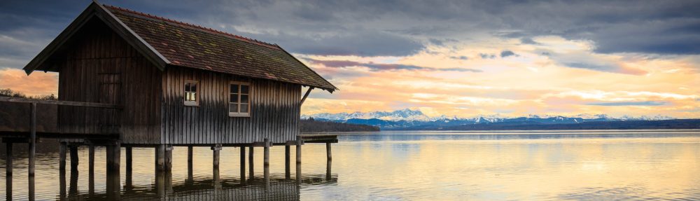
Confession — when I began blogging about 4.5 years ago, I quite honestly thought I might be out of material in 6 months’ time. In fact, the opposite has happened — the ‘to do’ list just keeps getting longer. Recent discoveries (for me) have included a lot of points south of here, in the Wipp and Stubai Valleys. Above, the length of the Stubaital, ending at the Stubai Glacier (yet another thing I need to see, especially before it melts for good.)

Today I went to Schönberg on a couple of leads, and learned more there than I had expected to. In all honesty, I didn’t know a thing about this small town, as it’s not on the rail line and doesn’t seem to have any tourist industry — perhaps it’s really an insider thing. Anyway, I had read that there is a segment of the old Roman Road (Via Raetia) on display in Schönberg, and here it is.

Note the grooves left in the stones by centuries of wagon wheels.

The Via Raetia ran from Italy over the Brenner Pass to Augsburg. The primary Roman road, known as the Via Claudia Augusta, went west over the Reschen Pass (near Graun, home of the sunken village belltower), along the Inn and then over the Fern Pass.
In any event, although the road did indeed pass right through these parts, it was not right here in this exact spot — these stones were dug up and laid out here — next to a large Autobahn rest stop, of all places. And that has a certain logic, the old next to the new.

Two things about Schönberg called to mind George Washington. The first was that Goethe was here, and fortunately the small town of Schönberg has a quote to prove it. (“Goethe visited here” is the German parallel to “Washington slept here.”) On his travels to Italy in 1786 (“The Italian Journey”), the great writer penned, Up on the Brenner I saw the first larch trees, at Schönberg the first Swiss pine. This little chapel is on a spot called Goetheruhe (Goethe’s Rest) and there is indeed a Swiss pine tree on the site. The road that runs by it is called Römerstrasse, and is very likely the old road. This route through Raetia had its own alternative “bypass” route, which branched off near here and followed the upper plateau on the eastern side of the valley (and there is a “Römerstrasse” up there today too.)

The second reason that Washington comes to mind is Schönberg’s relationship to Andreas Hofer, who had friends here and used a local hotel as headquarters during the fighting — which makes it a bit like the 1809 Tirolean Valley Forge.

Schönberg, like much of the higher plateau lands above the rivers, has offered up archaeological evidence pointing to pre-historic settlement. Armed with GPS coordinates from the internet and a google map print-out (yeah, I need a smartphone), I went to search for this area which has been designated as a protected historic monument — and only found this flat-topped hill on private, apparently inaccessible ground, so I can’t say. Then again, the high ground is absolutely lousy with archaeological finds all up and down the valley, so we might as well assume that every hill and dale were inhabited since the end of the last ice age.

To see the Via Raetia road segment without a car: ST Bus from Innsbruck Train Station to Schönberg Ortsmitte. Follow “Römerstrasse” signs to the Autobahn underpass. It’s at the far end of the rest stop, which includes a McDonalds with the best views I have ever seen.

Cozens in Brixen*

I had already been toying with the idea of a series of alpine paintings accompanied by photos of the mountains which inspired them, when Paschberg sent me the link to this watercolor by the 18th century British artist John Robert Cozens, with the somewhat clunky but informative title The Valley of the Eisak Near Brixen in the Tyrol, 1783/84. It currently belongs to the Art Institute of Chicago.

Looking around online for more information, I found a “2.0” version; In the Tyrol, the Valley of the Eisack, near Brixen, 1791 The painting, like the name, is similar but not identical — the view looks to be from further down on the floodplain, closer to the winding river. This version belongs to the National Gallery of Canada.

Near Brixen, June 7 appears to be the original sketch for both paintings. The Yale Center for British Art, Paul Mellon Collection owns it…

…as well as this sketch with the same name. Since they are both dated June 7, one can assume the two scenes are not far away from each other. Perhaps all Cozens did was turn around, and sketch the view in the opposite direction.

There are tentative plans for a trip into that area next month. I can’t spend days hunting down this particular place but I’m going to keep my eyes open for it. The river may have changed since Cozen’s trip (dredged, straightened) but the mountains will still be there.

*Brixen is a town in the German-speaking, northernmost region of Italy. The Italian name, which may be all you find in an American atlas, is Bressanone.

The Albrecht-Dürer-View, in Mösern

Do you remember the local theory that Pieter Breugel sketched out his “Hunters In The Snow” while sitting on the shady banks below Schloss Ambras, at Innsbruck? This is Albrecht Dürer’s Self-portrait at 26, which is hanging in the Museo del Prado in Madrid.

Dürer traveled from Nuremberg to Italy in 1494, and like Breugel he was impressed by the alpine landscape and made sketches which he would use in later works. The village of Mösern, near Seefeld in Tirol, claims that the landscape visible from the window is clearly of the Inn Valley as viewed from Mösern, and has named this particular vista the “Albrecht-Dürer-View”.

I’d say this is a pretty good match, especially for a painting made from a sketch, itself made years before on a journey.

Above photo by Veronika Freh found here. Image of Dürer’s self-portrait from Wikipedia.

Weekend Mountain Blogging: Stubaital

Pagans In Tirol: This cave, when rediscovered in 1976, held pottery from the La Tene era, the pottery being more specifically from 500-300 BC. This cave is presumed to have been a holy spring (Quellheiligtum) for the local residents. Whether they also kept their local brew at a desirable temperature here, no one can say…

The Stephansbrücke was a very big deal when it was erected in 1843, and Archduke Stefan Franz Viktor himself came to the ceremony to lay the foundation stone, at the tender age of 26. The bridge was part of continuous improvements on the Brenner Road, which stretches from Innsbruck over the Brenner Pass into Italy. The history of this highway is long — the Romans made the Via Raetia, and that road (and its later incarnations) remained the most direct way to all points south for a long time. Occasionally one might see an old Austrian or Bavarian film from the 50s or early 60s, where a journey to Italy by car leads over these very roads, some not yet even paved. Then the Brenner Autobahn came and changed everything.

I did not cross the Stephansbrücke, but I did cross this. The woods and valleys looks just as they should in early spring — crocuses are blooming, and other wildflowers along the forest trails. The songbirds are back, and I saw plenty of butterflies and bumble bees — which brought relief, since one hears so much lately of these critters becoming scarce.

This long hike began in the Stubai Valley (via tram) and continued north, toward the Northern Range and the Patscherkofel, following the Ruetz and then the Sill River (mostly a creek, especially this far upstream) The Bergisel ski jump tower, like a beacon, signals that home is finally near.

Weekend Mountain Blogging: How The Irschenberg Got Its Name


(Above: the pilgrimage church in Wilparting, alleged home of the bones of Marin and Anian, although the monastery at Rott am Inn maintains that they have the real relics. Image found here.)

Well, Wikipedia will tell you that it comes from the Latin Ursus with the old German Perg, to mean “Bear Mountain” (there is a written reference to “Ursenperig” from 1315).

However, both Wikipedia and the book Unbekanntes Bayern (Unknown Bavaria), volume 4, refer to the legend of the Irish monks Marin and Anian who had settled there in the 7th century, bringing Christianity to the local inhabitants. Marin was martyred by marauding Vandals, and Anian, the story goes, died simultaneously of natural causes. They are referred to as Scotch-Irish, or Iroschotten. “Iroschotten” > “Irschen”.

Just something to think about next time you drive over the Irschenberg on the A8.

Added bonus trivia: the 2001 film Die Scheinheiligen takes place in Irschenberg, the plot revolving around construction plans for a fast-food reststop for the nearby Autobahn. (There is in fact a McDonald’s there now. The modern version of marauding Vandals.) The word scheinheilig refers to someone who is sanctimonious, hypocritical, holier-than-thou-but-faking-it.

Forgotten Innsbruck: A Photo Book

Recently an old, tattered copy of a photo book on Innsbruck by one Adolf Sickert (Innsbruck: Ein Farbbildwerk, published by Meinhold Verlagsgesellschaft, Dresden 1943) fell into my hands, and some of the photographs I found interesting enough to scan and post here. For example this view of the Serles over the snow-covered rooftops of the old town, with its swastika-draped facades.

This town square still looks pretty much the same — the fountain is still there, and the grass, and even that nice big tree. The old ladies are gone, replaced by young homeless men and their dogs. The name of the square, too — at the time it was Adolf-Hitler-Platz, but it went (back?) to Theaterplatz after all that business ended.

The old Hungerburgbahn — would this be one of the original cars? — had open windows from which one could lean out. This track is no longer used since the new line was built, but the bridge is still there.

The arch, where Maria-Theresien-Strasse meets Maximilienstrasse. The gun shop is now a bakery/lunch counter. The “oldtimer” trams, like the one shown here, are pulled out and run every so often.

Pagans In Bavaria: Leutstetten

The church of St. Alto, in Leutstetten, north of Lake Starnberg. This church has a curiosity in its sanctuary.

This 1643 oil on wood painting features three unusual saints: Ainpet, Gberpet and Firpet. These are local, alpine-regional deities, so to speak. They’re not on the official register of Roman Catholic saints, and it has been postulated that they are pre-Christian, reformed into good Catholics simply by putting new stories on them and calling them the Three Virgins. Other paintings of them are found in scattered churches, and one is (was?) in the church of St. Vigilius, in Obsaurs, Tyrol. I have not been there and can only refer to it. This painting here was not always at St. Alto — it originally hung in the chapel in the village of Einbettl (Ainpet, Einbettl) which was torn down in the 19th century.

Here the chapel at Petersbrunnen, or St. Peter’s fountain; however, the name may well stem from “Betenbrunnen”. In any case the water was long considered to have healing properties, and in the 16th century Duke Wilhelm IV had the chapel built, alongside facilities for cure-seekers (to keep the riffraff separate from the paying guests). The baths are gone, the chapel is still there. In his book “Romerstraßen und Kultplätze” (Roman Roads and Ritual Sites), Martin Bernstein sees an irony in the fact that the chapel, built over a possible heathen holy site, has to be renovated frequently due to problems with moisture. The revenge of the Beten, perhaps.

The Villa Rustica (country villa and farm), built in 150 AD, excavated in 2002. The glass structure covers the part of the house which had heated floors (Hypocaustum) and a bath. Nearby Gauting (then Bratananium) was where the Roman road crossed the river Würm (Starnberger See was once the Würmsee. It began its name change in the 1800s and made it official in 1962.) Evidence of crops and livestock raising were found. Romans were good at adapting to what grew here already (spelt, emmer-wheat) and introduced wheat and rye. From other Roman farm excavations it is certain there were also animal stalls, silos, barns, and lodging for the farm workers. A millstone was found near this site, indicating a flour mill.
The method used to heat the floors allowed smoke to escape from behind the walls, thereby also heating the rooms to a comfortable temperature. To realize that, even over a thousand years later, kings were living in cold drafty castles, drives home the meaning of the term Dark Ages.

Finds from the nearby spring, most likely offerings, all copies for display here: two house keys, pottery, a slate writing tablet. The large stone is a copy of a Roman gravestone which is believed to belong to the owner of this villa. It is written that he came from Braga (northern Portugal), had a long military career, and that his loving wife erected this stone for him. The original stone was discovered to have been built into the side altar in the above-mentioned St. Alto church (where it remains today), presumably hauled off from one of two Roman urn graves nearby. Whether the stone, the graves and the villa all deal with the same 2 people is speculative, but highly probable. This spring, incidentally, provided the means of determining the date that the farm was in use — the farmer had had a wooden, box-shaped well built on it, which was nicely preserved upon discovery. The wood fragments of the well itself — plus other pieces which had been used to fill it when the farm was abandoned — were then dendochronologically dated.
The Villa Rustica is not directly accessible by car, but one can walk there along the bike path — from the above-mentioned village of Einbettl. And with that, the circle is complete.

Pagans In Bavaria: Viereckschanzen in Holzhausen

Along with the Sunderburg and the pre-Christian grave mounds hidden here and there, the area immediately north of the Ammersee also contains two fairly well-preserved Celtic Viereckschanzen, rectangular earthen enclosures, called Holzhausen 1 and 2. Their function is disputed among archaeologists as to whether they held sacred groves or were built for more practical purposes as forerunners to medieval city walls. They were certainly large enough for whole clans to live in them, being roughly 100 meters long and 75 meters wide, which would make for an unusually wide football field.

Holzhausen 1 has an entrance gate, or at least a higher break in the wall where a gate would have been built. A nearby sign suggests how one would have looked.

A path now leads along the top of the wall, bringing the visitor all the way around and back to the gate.

Inside the wall is meadow, and, interestingly, a small copse of young trees about right in the middle. Much older trees had stood here but had been cut down. We didn’t count the rings in their stumps but there were many. Possibly someone is maintaining their own sacred grove.

At Holzhausen 2, the forest has taken over. The ground inside the wall has filled in over time so that the earthwork is now more of a plateau. Here is the edge, from above on the wall.

Here again, just about in the middle of the Schanze, an unusual circle of plant life. I’m going to assume that fires were made here in the recent past, and the wood ash left the earth especially fertile for this plant. I’m not very romantic about the past — I tend to think people had way too much to do trying to stay alive and healthy and keep what they had, than to put all this work into a little sacred circle. But hey, that’s me. It’s clearly someone’s sacred circle now, and it’s nice to know that these someones are caring for this speck of land.

By each Schanze is a small sign explaining the site, and nothing more. Better that way — it’s not easy to find, not easy to reach (we took our mountain bikes), and less liable to be wrecked. Holzhausen is just south of Fürstenfeldbruck, near Schöngeising, 40 kilometers west of Munich.

Forgotten Bavaria: Sunderburg

High above the Amper River lies a mountain spur known as the Schlossberg (Castle Hill) or the Sunderburg, where evidence has been found of settlements from different eras. Excavations have shown that people lived here as early as the early Bronze Age (app. 1700-1600 BC). and there have been finds belonging to the Urnfield Culture (app. 1200-800 BC, and there are indeed grave mounds nearby.) In the Hallstadt Culture years the settlement was apparently abandoned. I have no knowledge as to whether the Romans used the hill for any strategic purpose, although it is rather close to the Via Julia, the roman salt road which ran from Salzburg to the Donau at Günzburg.

In the 11th century a fortress was allegedly erected on the hill by Count Friedrich of Diessen-Andechs, and Middle Age archaeological finds confirm this. The name Sunderburg was first mentioned in records in 1447. The House of Wittelsbach built a hunting lodge there in the 16th century.
On the steep slope to the river one finds mixed forest an, below that, rare flora in the wetland meadows downriver.

There is no information on hand about the earthwalls an the plateau, they could have been constructed in any of the periods where people used the hill.
An old local tale about the Sunderburg tells of it going under with all its inhabitants and treasures. A peasant, finding glass shards on the ground, took one home to find it had turned to gold. When he returned for more shards, they had all vanished. Another story tells of two pails of gold deep in the castle well, guarded by spirits which cannot be banished, which sinks further into the mountain every year. Similar stories of ancient gold in ancient fortresses can be found in Tirol, and probably wherever old, pre-christian settlements are known to have been. The locals may have known nothing of those prehistoric people, but the myths and legends often contain something of them.