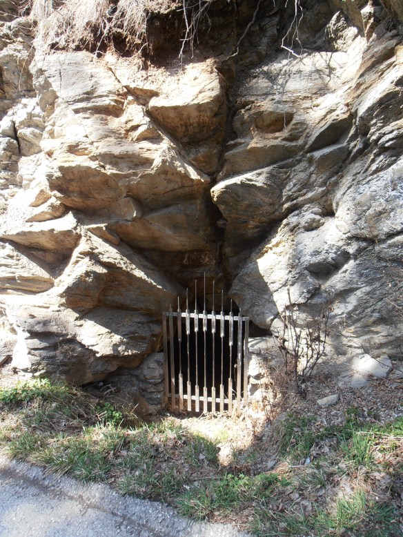
Pagans In Tirol: This cave, when rediscovered in 1976, held pottery from the La Tene era, the pottery being more specifically from 500-300 BC. This cave is presumed to have been a holy spring (Quellheiligtum) for the local residents. Whether they also kept their local brew at a desirable temperature here, no one can say…
The Stephansbrücke was a very big deal when it was erected in 1843, and Archduke Stefan Franz Viktor himself came to the ceremony to lay the foundation stone, at the tender age of 26. The bridge was part of continuous improvements on the Brenner Road, which stretches from Innsbruck over the Brenner Pass into Italy. The history of this highway is long — the Romans made the Via Raetia, and that road (and its later incarnations) remained the most direct way to all points south for a long time. Occasionally one might see an old Austrian or Bavarian film from the 50s or early 60s, where a journey to Italy by car leads over these very roads, some not yet even paved. Then the Brenner Autobahn came and changed everything.
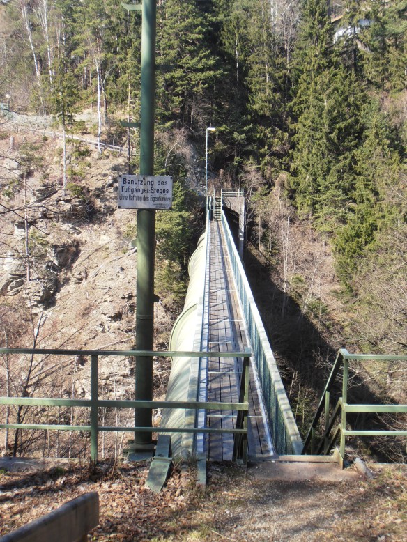
I did not cross the Stephansbrücke, but I did cross this. The woods and valleys looks just as they should in early spring — crocuses are blooming, and other wildflowers along the forest trails. The songbirds are back, and I saw plenty of butterflies and bumble bees — which brought relief, since one hears so much lately of these critters becoming scarce.
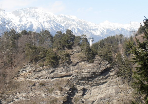
This long hike began in the Stubai Valley (via tram) and continued north, toward the Northern Range and the Patscherkofel, following the Ruetz and then the Sill River (mostly a creek, especially this far upstream) The Bergisel ski jump tower, like a beacon, signals that home is finally near.


Sending good thoughts to your bumble bees.
LikeLike
Ah, they have made a new door for the cave. The former was made of wrought iron.
So you have made the whole hike – from Telfes to Innsbruck – approximately 15km?
The viaduct ist part of the sill-powerstation.
And this http://tiris.tirol.gv.at/scripts/esrimap.dll?Name=Anich&MyAufl=1024&MapIDX=1&Left=229273&Bottom=230026&Right=230904&Top=230983&KS=-5&thv=25&Cmd=ZoomIn&AppPar=0&Mst=7212&ka=1&HiGr=6&Aktual.x=14&Aktual.y=20&Par3=0&Par4=0 ist the map of the brenner road some years before Stephansbrücke was built (with another projekt of a new road without this bridge).
In fact, I think, already the Brenner Railway changed everything in 1867, hence there was no longer the need for addtional horse or bullocks trailers, the decline of wagooners and various inns started rapidly …. and they now strike back motorized 😦 on the highway.
LikeLike
Hecate, thank you. Actually in my wanderings, I have come across many apiaries just off the trails. I presume there are enough woodland wildflowers etc upon which to feast.
Paschberg, years ago I walked from Fulpmes to Ibk. This time, I made some wrong turns and had to backtrack from dead ends and private ground. In the end, it may have been more than 15 k after skirting around the Sillschlucht (I’d forgotten the map). Did the inns really begin to disappear after the railway? I would have thought that the train line helped people travel to and from the villages and gave business to the inns…
LikeLike
Of course the inns right in the villages prospered after building the railway due to tourism. But roadside inns suffered. There are severeal buildings near the old brenner road (like the Brünnlerhof between Matrei and Steinach, Gasthof Schuppen also was closed for some times) that had been trailer-stations and inns and surely suffered from less freight traffic on the road. There also have been several farms with possibility to stay overnight, this also changed…..
Inns near rail stations of course switched to tourism. But those between the villages could only persist as pleasure trip destinations near town (like the Reisachhof* http://tiris.tirol.gv.at/scripts/esrimap.dll?name=dfk&MyAufl=1024&Left=78618&Bottom=232568&Right=82733&Top=234981&Mst=18195&MapIDX=1&GemNr=101&Chk4=1&Cmd=ZoomIn&click.x=0&ZoomBox=317,31,459,126, which survived till the 1960 ´ies, afterwards really killed by the Motorway).
Several almost run down inns caught a new short heyday in the 1950´ies due to motorization, this came to an end by the motorway.
*Well known for the “Maibutter”, whipped cream with cinnamon served from May (when the cows milk became fatter again)
LikeLike
The bees that are suffering are commercial bees that are trucked about from place to place. They’ve begun to focus on the specific pesticides that are used on crops, Germany has found Bayer’s poisons to be key. One of my posts on bees
Oddly, wild bees and hobbyists’ bee hives don’t seem to get the Colony Collapse Disorder. So grow your veggies and encourage wild bees to visit!
LikeLike
Ellroon, there was recently a post at DKos about this too — a “Kossack” had been told that Bayer’s was fine, even by his/her “super eco-friendly” local tree experts. (Bayer’s had put out its own studies,of course.)
Paschberg, the Cafe Münzerturm, in Hall, would fit under this category, no? And: those Tiris maps are slow to load, but they are awesome.
LikeLike