
Hier ruht
Marie Zöhrlaut
aus Milwaukee, Amerika
*20. Nov. 1831 †20.Apr. 1893
(Just in case you need to find out what happened to your great-great-great Aunt Marie, who left the country and was never heard from again…)
Hier ruht
Marie Zöhrlaut
aus Milwaukee, Amerika
*20. Nov. 1831 †20.Apr. 1893
(Just in case you need to find out what happened to your great-great-great Aunt Marie, who left the country and was never heard from again…)
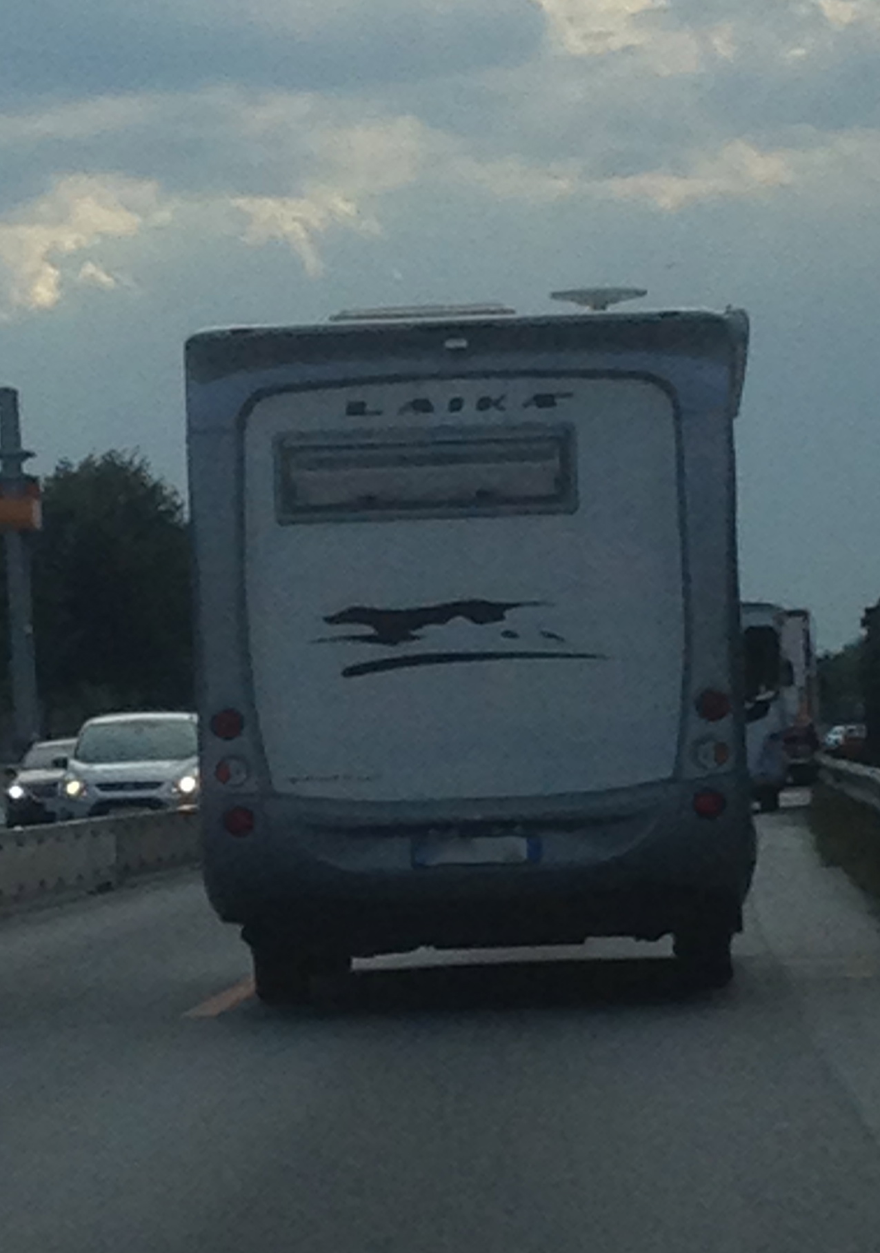
Because nothing says “Not making it home alive” like naming your new camper model “Laika”.
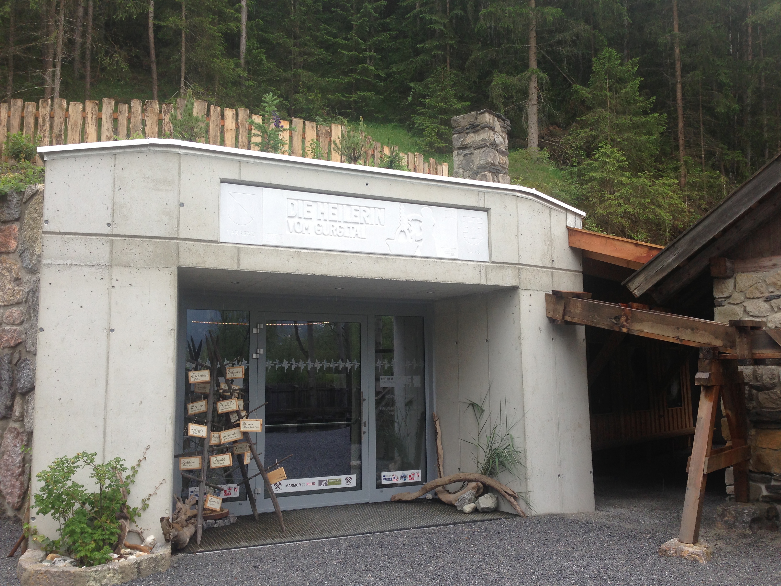
I persuaded a good friend to drive me to the village of Tarrenz (in the Gurgltal, north of Imst) to visit the brand-new museum built to house a fascinating archaeological discovery there — die Heilerin von Gurgltal, which more of less translates as the “Medicine Woman” from the Gurgl Valley. Alternately she’s referenced as being from the Strader Wald, or from the forest in nearby Strad. The story in a nutshell:
Tarrenz lies along the Via Claudia Augusta, one of the old Roman roads over the Alps. Hobby archaeologists are attracted to this area because of the artifacts that can be found along old roads. Some such treasure-hunters were combing the woods with a metal detector, and came across the first signs of something very interesting and ultimately very mysterious.
Eine Freundin fuhr mit mir neulich nach Tarrenz (im Gurgltal, bei Imst), um das nagelneue Museum der Heilerin vom Gurgltal zu besuchen. (Alternativ ist sie die Heilerin vom Strader Wald gennant.) Tarrenz liegt entlang der historische Via Claudia Augusta, ein Ziel für Hobbyarchäologen, wegen der Menge von Artifakten, die man neben alten Strasse finden kann. Ein paar solche Schatzsucher waren vor einige Jahren mit einem Metalldetektor im Strader Wald; dort stießen sie auf einen interessanten und mysteriösen Fund:
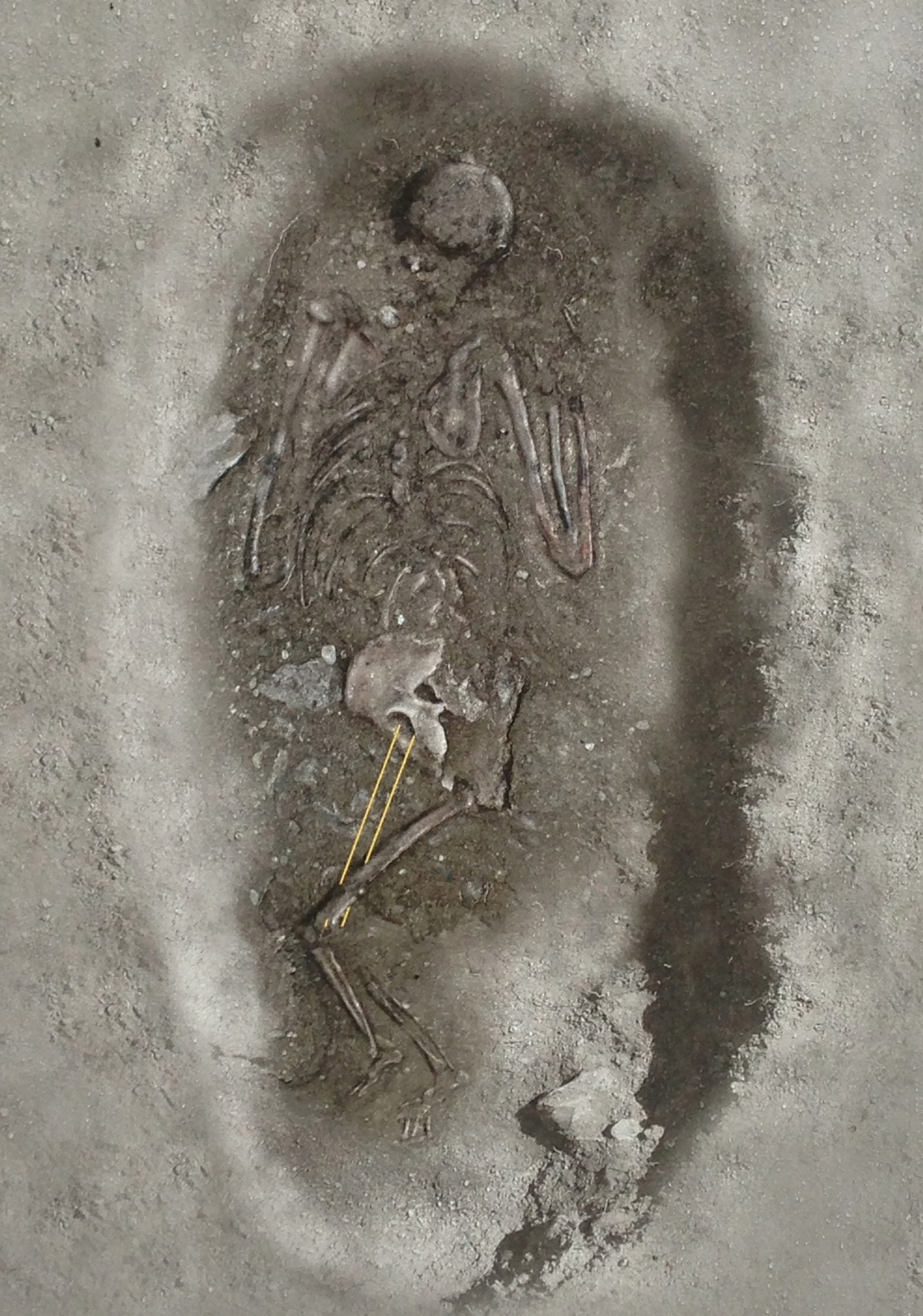
It was the grave of a woman, found lying face-down, along with a bounty of small and valuable objects — metal instruments such as scissors and keys, coins, pearls and crystals, a thimble, and — the headline-grabber —a set of metal cups used for cupping therapy. Dating places her having lived during the time of the 30 Years War, in the first half of the 17th century.
Das Grab einer Frau, in Bauchlage beerdigt, zusammen mit einer Menge kleine wertvolle Gegenstände — ihre Habseligkeiten. Eine Schere, eiserne Schlüssel, Münzen, Perlen, Kristallen, ein Fingerhut, und — meist interessant — ein Set Schröpfköpfe aus Metall. Hier der archäologische Befund. Die Frau lebte während der Zeit des Dreißigjahrigen Krieges.
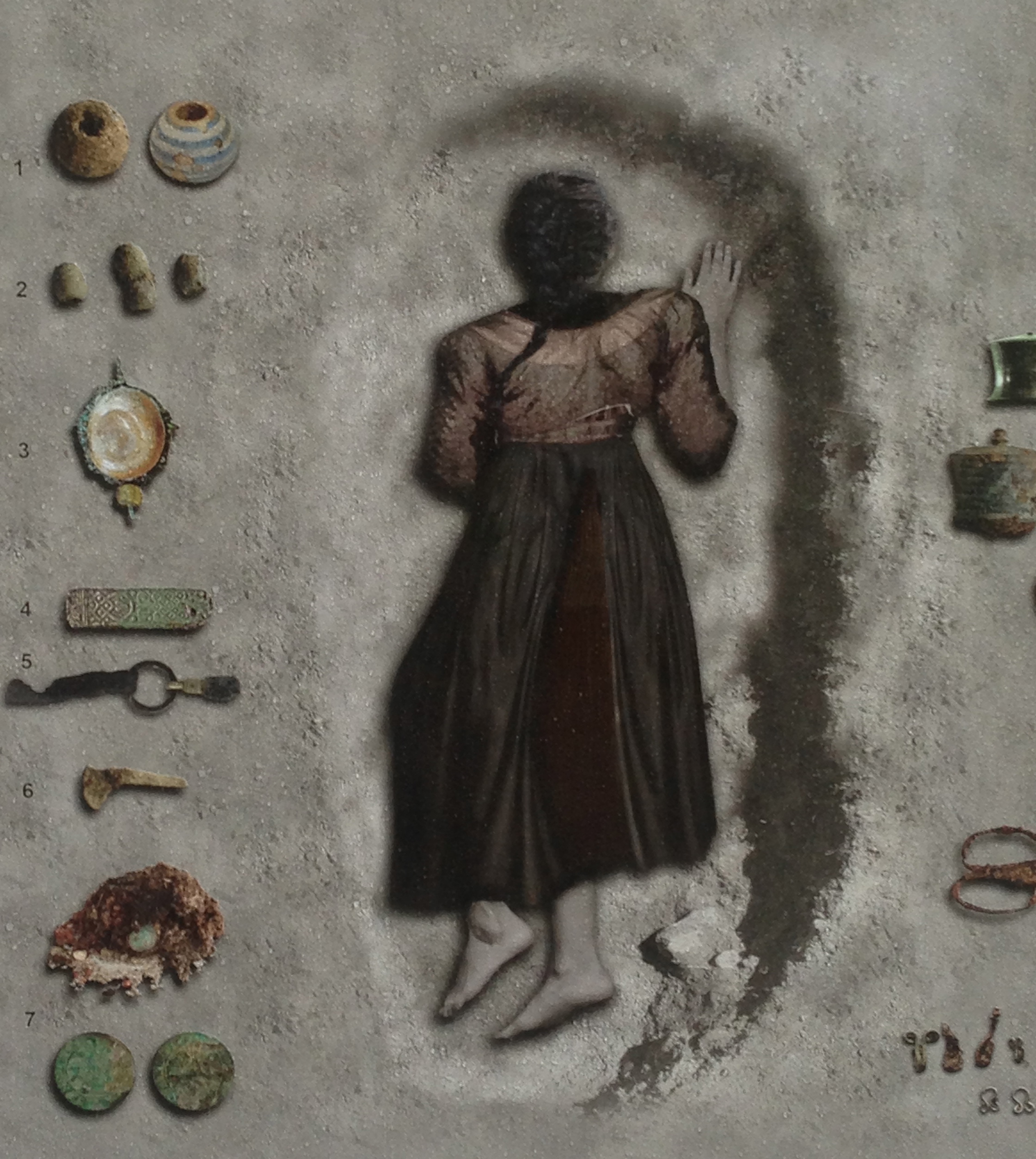
The circumstances don’t fit together in the usual way. She was buried quite far from the cemetery. A foreigner? A suicide? Possible Jenische*? She had, much like Ötzi did, her whole “professional kit” with her. Added to her grave as a kind of honor? Or thrown into it in a hasty burial? Then there’s the “face down” business, which normally is found to have been the custom for criminals. But she clearly hadn’t been executed as a witch, not with all those valuables in the grave with her, even though witch trials were very much in at the time.
Die Sachen passen nicht zusammen wie erwartet. Die Frau wurde ziehmlich weit weg vom nächsten Friedhof begraben. Eine Fremde? Ein Selbstmord? War sie Jenisch? Wie Ötzi, sie hatte ihre professionelle Werkzeuge dabei — wurden sie mit ihr mitbegraben, als ein Ehrenzeichen? Oder schnell hineingeworfen in Eile? Aber sie wurde gegraben mit Gesicht nach unten, wie man Kriminelle bestattete. Offensichtlich wurde sie nicht hingerichtet, sonst hätte man keine Grabbeigaben gefunden, obwohl die Hexenprozesse damals ganz in Mode war.
The museum tries to bring you in with carefully portioned experiences. First you hear of the arts of healing as practiced in these parts, and how knowledge was handed down through generations. Then you learn about some actual cases from Tirol which involved persecutions due to superstition and fear. The antisemitic source — and consequences — of Anderl of Rinn is an example used.
Das Museum führt den Besucher vorsichtig in kleinen Etappen ein, vermutlich für die sehr junge Besucher. Man lernt von Heilkunde und wie das Wissen von Generation zu Generation übergeben wurde. Dann wird man gelehrt über wahre Öpfer von Aberglaube und Angst in Tirol, zum Beispiel die antisemitische Ursprung — und Folgen — der “Anderl von Rinn” Geschichte.
You are then ushered into to larger room to watch a short film combining the facts of the find (given by the head of the archaeology department at the University of Innsbruck, Professor Harald Stadler) with a dramatized version of what might have happened, using locals as actors. Their version involves a heathen midwife, banned from the community and the church (same thing back then) but nevertheless needed and called whenever someone got sick. A stillbirth is enough to have the villagers accuse her of witchcraft, and then tempers get hot, someone (guess who) gets killed, and a hasty, fearful burial is carried out in the forest. Entirely plausible — although often the truth is a lot more boring (she died of illness, her outsider travelling companion(s) buried her as best they could, and moved on?)
After the film ends, you finally get to see the skeleton and the artifacts, laid out under glass with plenty of information about their provenance and uses. The tour guides — a husband-and-wife team — are very much involved in the project and were able to answer questions in depth.
Man kommt dann in einer Halle und ein Kurzfilm läuft. Archäologische Details (von u.a. Universitätsprofessor Harald Stadler) alternieren mit einer Dramatisation von der Geschichte — also, was hätten passieren könnte — mit einheimische Mitwirkenden. In ihrer Fassung, ist die Frau eine Außenseiterin, eine heidnische Hebamme und Heilerin, aus der Gemeinde verbannt, dennoch in Krankenfälle immer wieder gerufen. Ein Totgeburt führt zur Vorwürfe von Hexerei, die Frau getötet und in Angst und Eile im Wald begraben. Alles schon möglich — obwohl die Wahrheit ist oft weniger interessant.
Dannach darf man den Skelett samt Artifakten (in Vitrinen) -endlich- sehen. Die Führer — ein Ehepaar — sind im Projekt involviert und konnte viele Fragen reichlich antworten.
If you go: the Museum der Heilerin von Gurgltal; is located within another, outdoor museum called Knappenwelt, which is a recreation of a small mountain mining industry from the olden days. You can buy a ticket for either, or in combination. Drive to Imst and then north on the 189 toward Fernpass. It’s trickier if you don’t have a car, but apparently this tourist shuttle will get you there from “downtown” Imst to the Knappenwelt. You’ll still have to walk from the Imst station, which is a bit removed from town.
Anfahrt: das Museum befindet sich in der “Knappenwelt”, ein Freilicht Museum. Von Imst kommt man mit dem Strasse Nr. 189 richtung Fernpass nach Tarrenz. Ohne Auto wird’s schwieriger, aber wenn man in Imst von Bahnhof ins Zentrum geht, findet man den Bummelzug “Bummelbär”, der macht einen Tour von Imst nach Strad mit Zwischenstops.
*Jenische is a name used for a certain nomadic people in Europe. They are not related to the Roma or Sinti — in fact they may not be an ethnic group at all but fall under the generic category “gypsy”. Wikipedia likens their language to Cockney.
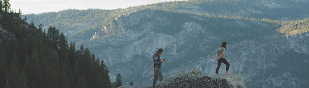
The Lanser Kopf (“Lans Peak”) is a rocky outcropping atop a wooded hill called the Paschberg, situated between Innsbruck, Austria, and the village of Lans. It sits just under 300 meters above the city, and a hike to the top can be done in about an hour. It is one of the few lower hilltops which has not, to my knowledge, been previously excavated.
Übernommen aus einem kürzlich verfassten Beitrag für einen Archäologie Online Kurs an dem ich teilnehme.
Der Lanser Kopf liegt auf dem Paschberg, zwischen Innsbruck und der Dorfgemeinde Lans, knapp 300 Meter über der Stadt, wovon man in ca. eine Stunde eine gemütliche Wanderung machen kann. Er ist eine der wenigen Mittelgebirgsebenen in der Gegend auf der man, so weit ich weiß, keine archäologischen Ausgrabungen durchgeführt wurden.
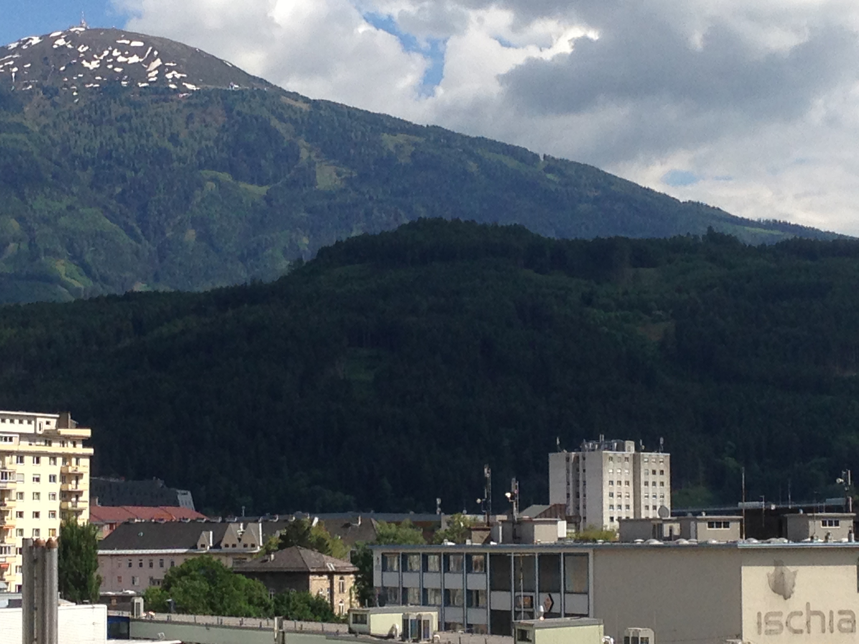 Innsbruck, Paschberg/Lanser Kopf, Patscherkofel (2246 m)
One of the most interesting things about the Lanser Kopf is that there are multiple of evidences of use over time. Schalensteine (rocks with cup markings) can be found on the lower slopes. Unfortunately it is impossible to date them. It is suspected that there may also be markings in the rocks at the peak, but these are partially covered with trees, earth and concrete. The concrete, poured in the middle of the last century, holds park benches and a marble table, and also makes up two WW2 Two flak circles. The circles were abandoned at the end of the war, and now have trees growing inside them.
Eine Besonderheit des Lanser Kopfs liegt in seine vielseitige Nutzung im Laufe der Zeit. Auf dem niedrigeren Hang findet man Schalensteine, die leider nicht datierbar sind. Man vermutet, dass man oben an der Spitze auch Schälchen finden könnte, wenn die Steine nicht mit Erde, Bäumen und Beton verdeckt worden wären. Der Beton wurde in der Mitte des vorigen Jahrhunderts am Kopf gebracht, um Parkbänke und eine runden Marmortafel zu befestigen, und wurde auch im zweiten Welzkrieg für die Herstellung von zwei Plattformen für Fliegerabwehrkanonen (FLAK-Kreise) verwendet. Bäume wachsen jetzt in den leer stehenden Kreisen.
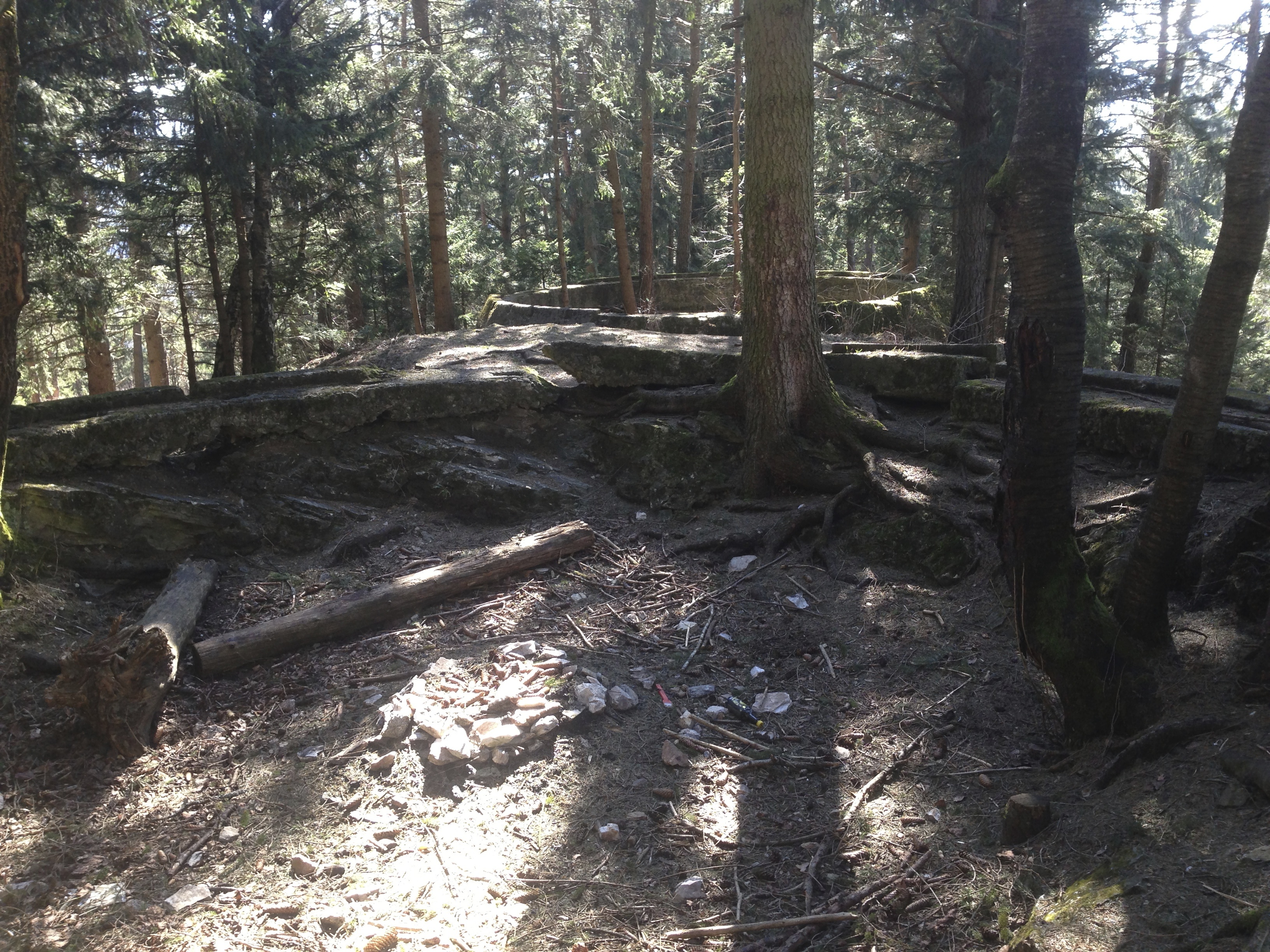 Two WW2- era flak circles at the Lanser Kopf.
The earliest humans artifacts found in this region date back to about 30,000 BCE . Evidence of Bronze Age and Iron Age settlements have been discovered on other nearby hilltops, including stone residential terraces (Hohe Birga, Himmelreich), and sacrificial burning sites (Goldbichl, Bergisel.)
Die älteste prähistorische Artefakte aus dieser Gegend datieren auf 30,000 v. Chr. Neolithische Siedlungen hat man an naheliegenden Hügeln entdeckt, Steinterrassensiedlungen (Hohe Birga, Himmelrich) und auf Brandopferplätze (Goldbichl, Bergisel).
As far as I know, the Lanser Kopf was not used for anything in the Modern Era — with the exception of the wartime use — other than as a place to rest while hiking. There is no obvious evidence of it having been used for farming or settlement. However, it’s use in the last century as a strategic point for sighting enemy planes and firing missiles at them certainly would have roughed up the area somewhat, since it can been assumed that military jeeps or trucks would have been driven at least to the plateau just below the flak circles, and the construction of the circles themselves would have affected any older formation processes.
So weit ich weiß hatte der Lanser Kopf in der jüngeren Geschichte, außer während der Kriegszeit, nie eine besondere Funktion. Es gibt dort keine offensichtlichen Anzeichen von Siedlung oder Landwirtschaft. Er diente als Rastplatz für Wanderer. In den Kriegsjahren war die Gegend mutmaßlich von LKWs und Jeeps überrollt, und die Herstellung der FLAK -Kreise hätte ältere Spuren zerstört.
This, however, brings forward another question — which kinds of artifacts does one wish to find? There may well be modern(ish) war artifacts in the vicinity, from either the Second World War or from the battles against Napoleon’s troops in 1809. There may be man-made objects just below the surfaces. But could be there also be older signs of human settlement below the flak circles? One would unfortunately have to destroy them in order to see what lies below. And while the concrete flak circles may not be of much interest to people today, I find it important that they remain, as an historical testament to Innsbruck’s war involvement in the 1940s. I find that it would not be worth it to remove them in the search for earlier artifacts. The earth-covered level area just below them, however, would be a worthy site for excavation, indeed if such work hasn’t been done already.
Das alles wirft eine Frage auf: Welche Artefakte erwartet man zu finden? Es gibt wahrscheinlich schon genug Kriegsartefakte aus dem zweiten Weltkrieg oder, weiter zurück, vom Tiroler Volksaufstand in 1809. Könnten prähistorische Funde direkt unter den FLAK-Fundamenten liegen? Man müsste diese aber zerstören, wenn man dort richtig graben will. Obwohl sie heutzutage wenige Leute interessieren, würde ich lieber sehen, dass sie intakt bleiben, als historische Zeitzeugnisse der Kriegsjahre Innsbrucks. Hingegen läge auf der kleinen Ebene etwas unterhalb der kreisförmigen Fundamente eine angemessen Stelle für eine Ausgrabung, wenn nicht solche schon durchgeführt wurden.
From evidence gathered by archaeologists, pre-Roman-era settlers in Tirol greatly preferred the high plateaus and hilltops between the Inn (swampy floodplain) and the mountains (rocky, barren). This middle ground was probably ideal for hunting as well as providing safety. Since the arrival of the Christian missionaries in the Middle Ages, many of those hilltops have been adorned with chapels. It has been speculated that these chapels might be sitting atop the remains of pre-christian structures, and often successful excavation work has been done in their immediate vicinity. If such an excavation were done on the Lanser Kopf, one might look for pre-historic arrowheads, ceramics, stone objects, weapon depots and offerings (of which there are many in the Alps) or sacrificial burning sites, all of which have been found elsewhere in the region.
Aus archäologischen Befunden in der Region wissen wir, dass viele vorrömische Siedlungen in den Mittelgebirgen eingerichtet wurden, wo die Ureinwohner mehr Sicherheit und bessere Lebensqualität vorfanden. Seit der Ankunft christlicher Missionare im Frühmittelalter, sind viele dieser einigermaßen höheren Stelle mit Kapellen geschmückt. Man könnte vermuten, dass manche dieser Kapellen möglicherweise auf Resten von früheren, vorchristlichen Bauwerke stehen, und tatsächlich hat man neben solchen Kapellen erfolgreiche Ausgrabungen durchgeführt. Wenn man so eine Ausgrabung auf dem Lanser Kopf unternähme, fände man möglicherweise Artefakten wie Pfeilspitze, Keramik, Steinfiguren, Waffendepots oder Brandopferstätte, welche anderswo in der Region, auf höheren Stellen, bereits gefunden wurden.
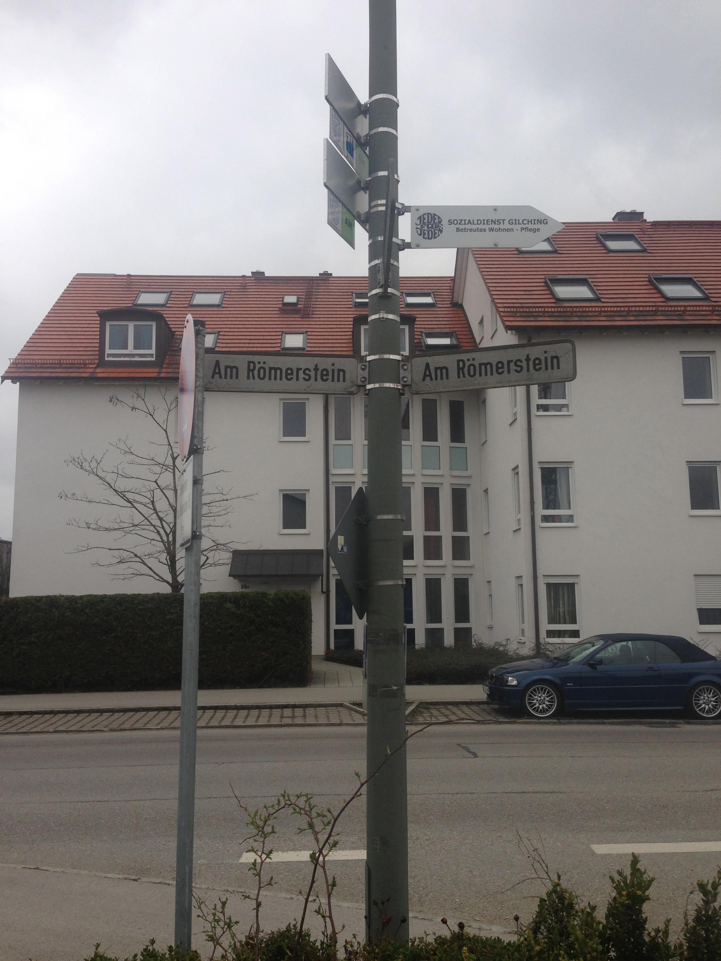
This post’s title is the translation of Am Römerstein, a street in the Bavarian town of Gilching. It’s a road the Beau takes regularly for business. The name always intrigued me — where is, or was, this Roman stone, anyway?
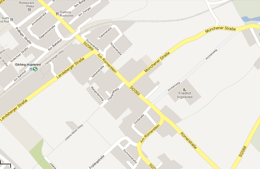
A look at a map of Gilching shows that Am Römerstein intersects (and for a short stretch follows) the old Roman road Via Julia from Salzburg to Augsburg (through Gilching it is named, appropriately, Römerstrasse. Click on the link above to see a simple map of the entire road. Gilching is on the red line just above the area between those two lakes.) So the street got it’s name from being at or near a milestone on the Roman road. Salzburg, not yet the summer destination of the Euro-chic, was important for it’s salt mines, salt in earlier times being a very valuable commodity. (Worth another blog post at a later time. The names of many places in Germany and Austria come from their importance in the salt trade.) Augsburg was Augusta Vindelicorum, the capital city of Roman province Raetia and all the Roman roads in and around the Alps lead not to Rome, but to there.
Back to my milestone. With the help of Zeitspringer (who blogs chiefly about archaeological outings in Bavaria and Baden-Württemberg, and who is a great source of information on the subject, his blog is well worth perusing if you read German), I learned that a stone erected in the 1860s and dedicated to the Roman Road is included in a list of monuments on Gilching, including it’s location. A trip over there brought us to Number 15 Am Römerstein, where we found this monument,
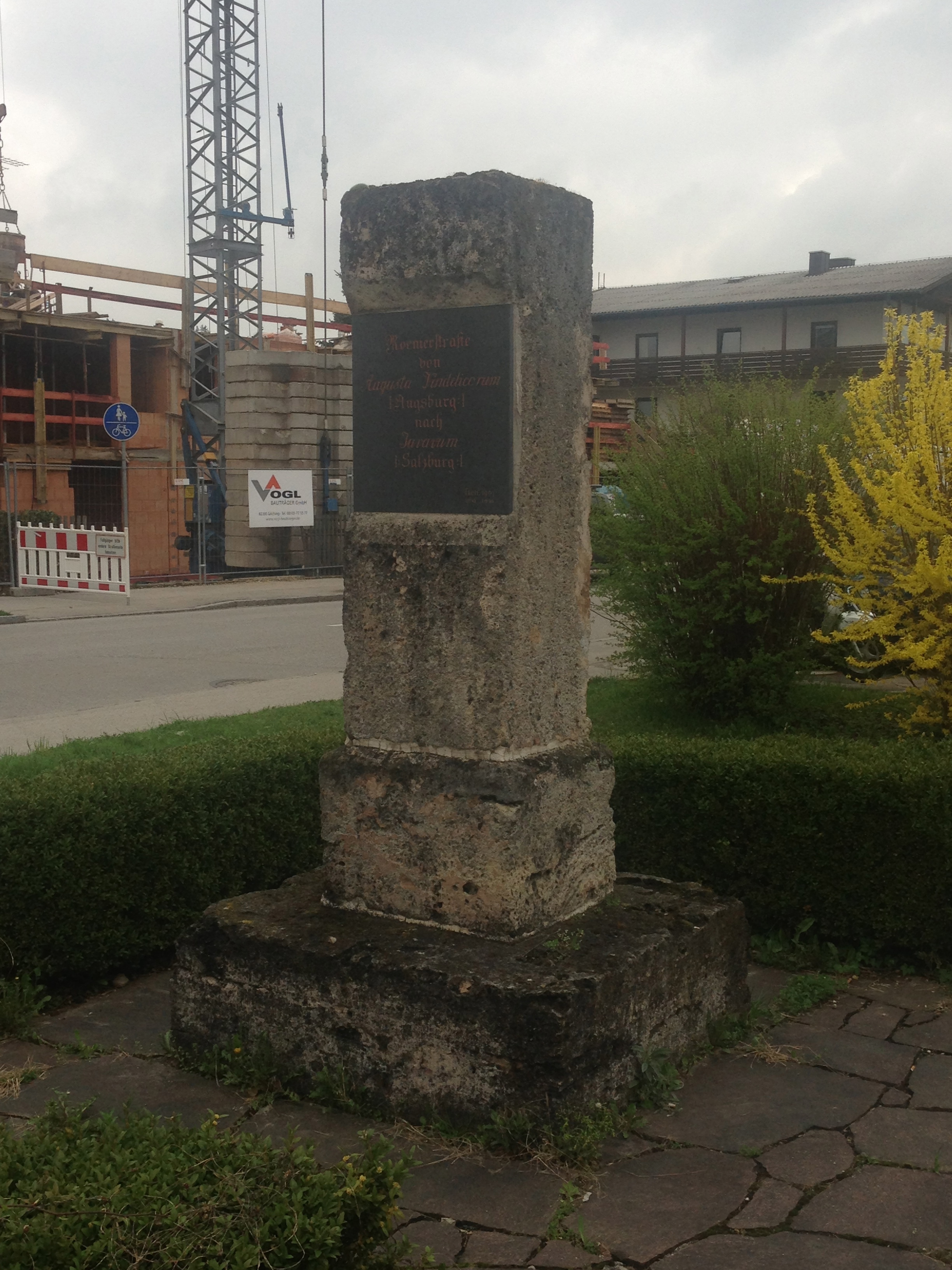
Roman Road
from
Augusta Vindelicorum
(Augsburg)
to
Juvavum
(Salzburg)
This, by the way, is definitely not the same stone mentioned (and shown) in Gilching’s Wikipedia entry (g), a small tube-shaped stone with engraved Latin text, a copy made more recently than the monument at 15 Am Römerstein. So where is the milestone photographed and shown in the Wikipedia entry? Turns out, it’s just a bit further down the road (g), in the center of town.
I assume that the street Am Römerstein, therefor, is named after the 19th-century monument to the Roman road, and not for the site of the Roman milestone (although it’s also entirely possible that the former was erected on the actual site of the original, and the later copy was placed somewhere more convenient and available.) A sign erected near the copy stone gives a very interesting account of the original’s fate. Milestones have been hauled off and used as building stones since the Late Antiquity. This particular stone was taken to Hattenhofen (there are four communities in the area with that name, most likely they mean the one in Fürstenfeldbrück County) in the 16th century, and then used as a cornerstone in Günzlhofen Castle. After the castle fell to ruin it came it Munich, first in the Royal “Antiquarium” and later as part of the Bavarian national collection of prehistoric artifacts, and exhibited with it. Here is where it met it’s ultimate fate, on a date with an Allied bomb in 1944.

Found in the vicinity of the defunct Lechfeld Air Base, between Landsberg and Augsburg, Germany. Upper sign points the way to the base’s shooting range. Lower sign points the way to the war cemetery.
UPDATE: PlayCastle is now Magic Castle, and here is its website, with events and information.
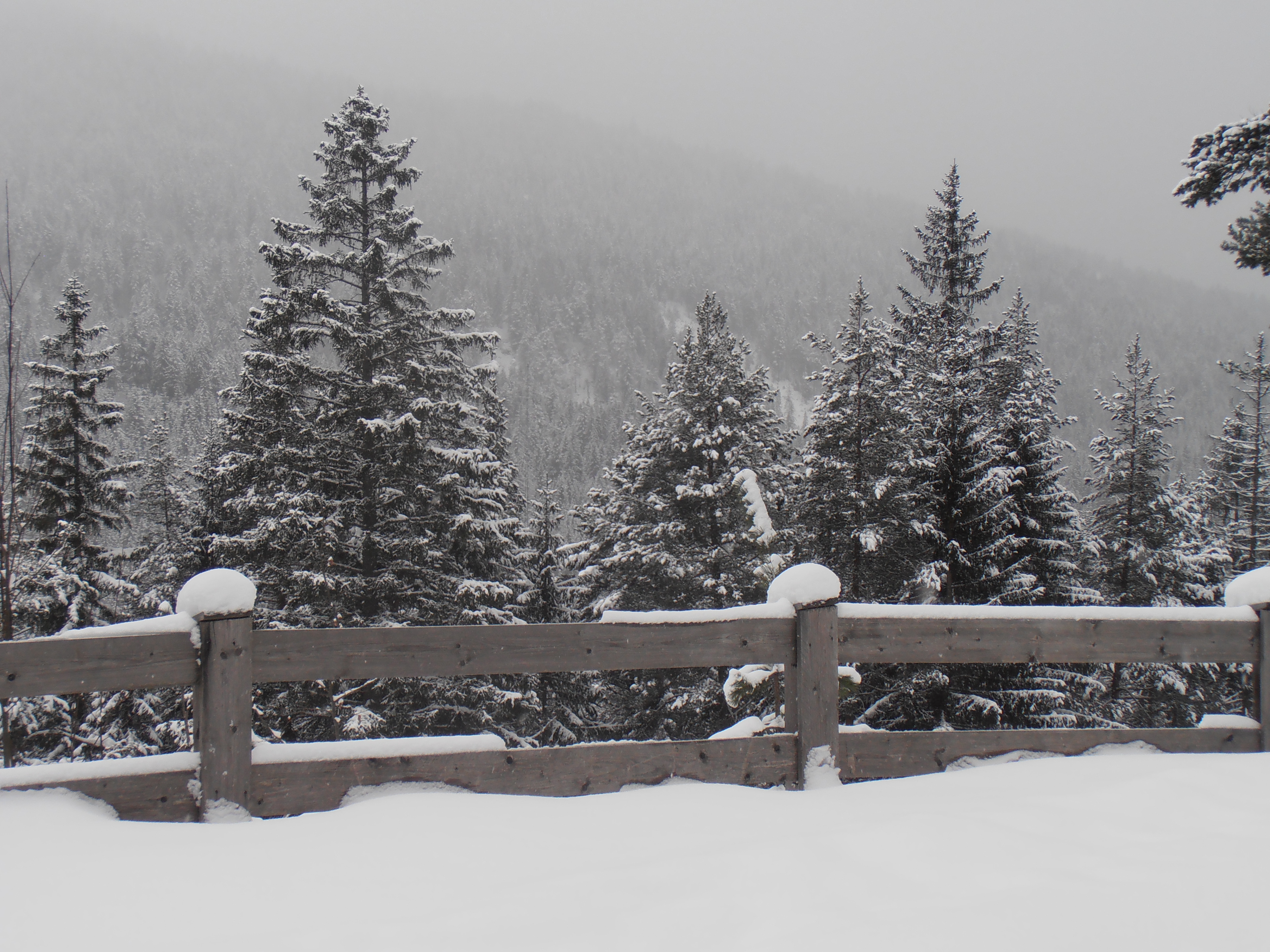
What was I thinking? The snow in Seefeld in Tirol is three feet deep, and where I wanted to go hadn’t been plowed all winter. But on the first official free day in two weeks (three if you factor in that I was actually home sick for those last free days), I was going stir crazy. So even though I was up to my knees in snow, I wasn’t going to let that stop me.
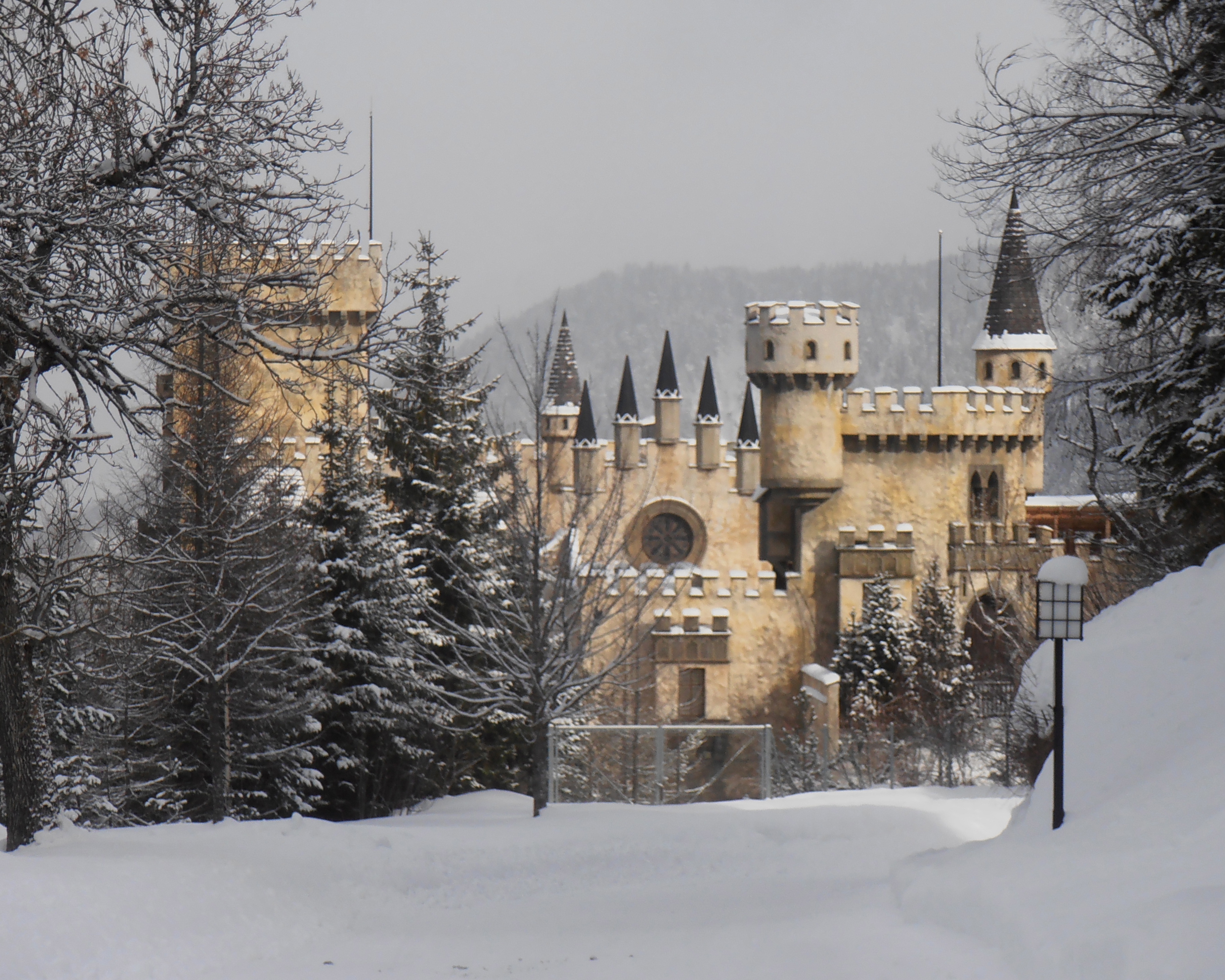
Did you know that Sleeping Beauty’s castle lies in Tirol? Well, not the original (if there were one) but more like the Disney version, sitting alone in the woods, locked up and dark, waiting for a prince with enough capital to come and rescue it. This was actually a 1990s business venture called PlayCastle, a sort of Tirolean Sesame Place, an indoor-outdoor amusement park for children. It had a “Fun Dome” with online skating on three levels, a climbing wall, an “Adventure World” with video simulations, and who knows what else, prominently situated just outside of an alpine tourist resort town. Something for the family to do on a rainy day.They had expected 250,000 to 300,000 visitors annually. The place shut down after one year, and has been closed since I can remember. According to this site it’s currently being used as an events rental space and disco, although nothing looked remotely in use to me.

PlayCastle even has its own little fairy-tale rail station on the Mittenwald line, although in all my travels on that line I have never seen a train stop there. The ÖBB website doesn’t even recognize it as a stop, so I have to assume it’s been discontinued, even though the link directly above advertizes it as a way to get there.
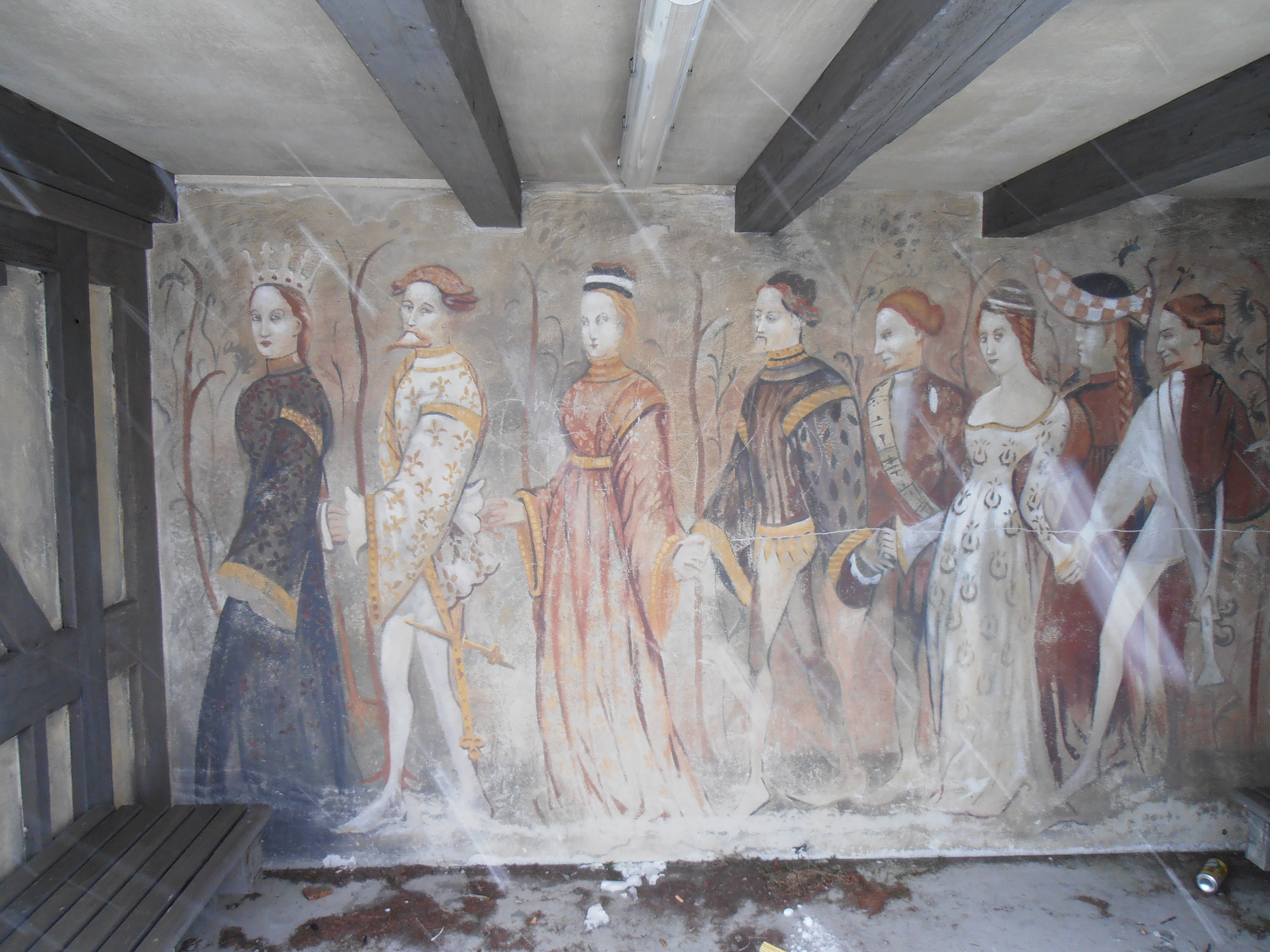
Inside the station, a wannabe-medieval fresco. Local kids are using the station to sit and drink, and who can blame them. At least someone is showing up.

Photos taken in on and around the Via Claudia Augusta, now a hiking trail, between Landeck and Fließ.

It’s clearly late autumn in Tyrol, just before the leaves turn completely. The region is not known for spectacular fall foliage but I find it beautiful in its own, subtle way, the greens and golds mixed with grey and brown.

In Landeck, we had cut through the town to meet up again with the river after it bends south, and came out by chance right above the old “ghost railroad” tunnel, built for the Reschenbahn around 100 years ago. This was to have been a link between Mals (in South Tyrol, Italy) and Landeck over the Reschenpass (an extension of the Vinschgaubahn which runs from Meran to Mals), paralleling the old Roman Road, but plans were abandoned as Austria got caught up in the First World War the plans, started in 1918 and again in 1944, were eventually abandoned (thanks, Paschberg for the correction). It looks as if someone has been getting in. The tunnel (in better days) can also be seen here in the third image.

Wood carvings adorning a house in Fließ.

I dragged a (quite willing) friend along with me on a day excursion to Fliess (around here written Fließ), a village up on a mountainside overlooking the Upper Inn Valley. The main reason was to visit the Archaeological Museum, home of an impressive number of Roman and pre-Roman objects found in the area. While we enjoyed the Museum immensely, the journey there offered a surprising number of delights.

We had planned to take a Postbus from Landeck, but were given some misleading information (we had not realized that we were to take the bus that passes in the valley below, and walk up from there) and so we decided to walk rather than wait, and to take the trail over Landeck Castle. Without planning to, we found ourselves on the old road bed of the Via Claudia Augusta, the Roman road which ran along a portion of the Inn River on its way to Augsburg. The “Claudia” part is for Emperor Claudius, who had it built. His father Drusus, adopted son of Caesar Augustus, was responsible for the Roman march over the Alps and into northern lands.

Heumanderl, or hay racks, in a field. My friend told me a legend about our local hero Andreas Hofer using these “hay men” to make Napoleon’s troops think he had a larger army than he had.

Dramatic Squirrel has an Alpine cousin — and he’s black.

Another reason to come to Fliess was to see the Schalenstein at the Philomena Chapel, just outside the village.

The chapel was built in or around 1749. Inside, directly behind the altar hangs a painting (with reliquary) of the virgin martyr Philomena, “lying in her grave in the catacomb”, according to the information plaque on site, although she appears to be quite comfortably settled in a chaise longue. Philomena is one of those quasi-saints who were not only never canonized, but who was purged from the liturgical calendars in 1961. Her golden pendant is a reliquary for something so tiny that we could not make out what it was — possibly a bone sliver?

Ah, and here, finally, behind the church, the Neolithic Schalenstein with 70-90 markings, one of the most prominent of its kind.
A post on the Archaeological Museum to follow shortly.

In the center of the image, a mountain called the “Kleiner Madron”, just over the border in Bavaria. According to the official trail sign (which saves me from making unsupported hypotheses), it is recognized that this name suggests a Celtic ritual site (presumably with a connection to the word matrone, and possibly the viewing of these three mountains as the tres matrones.) Bronze-Age and Roman artifacts have been found at the bottom of the sheer cliffs below.

And the icing on the cake, so to speak: the church that sits atop this mountain is named for St. Peter, and the mountain is now oft referred to as the Petersberg. Which might have something linguistically to do with the Beten — which in turn has much to do with the matrones. But I’m just riffing…
The church probably built in or around the 12th century. Monks lived next to the church, and pilgrims arrived from the Inn Valley. Today the church belongs to the nearby village of Flintsbach, and the main destination for pilgrims is the restaurant with a pretty view. If you go, proceed to the sunny terrace around the back to escape the pop music.

On the lower slopes, the ruins of the “new” Falkenstein Castle. The old (12th century) Falkenstein Castle also lies in ruin, but is deeper in the forest. Only a wall remains, and so it is referred to on Wikipedia as the Troja des Inntales — Troy of the Inn valley (and while this is what drew me there in the first place, I never found that wall.) The Falkensteins ruled over much of this corner of Bavaria and the surrounding regions during the 11th and 12 centuries.
