Grave Mounds near Grafrath


In the northern part of the ground moraine flatlands near the villages of Grafrath and Mauern, south of Fürstenfeldbruck, stretches one of the largest pre-historic grave mound necropoleis in Bavaria. Systematic surveillance has revealed at least 124 mounds. It is possible that more grave mounds existed outside the forested area, but were worn away over centuries of farming and building.


Research into this grave mound area began in the late 18th century, through the efforts of a local minister who made an early map of the mounds. Some excavations occurred in 1839 and 1870.  Later, in 1893, the Munich historical painter Julius Naue dug out 93 of the graves. Part of the finds are in the Archäological National Collection in Munich.
In the customs of the times, the dead were buried in their traditional clothing along with fine jewelry and vessels containing provisions. Some of  the men were buried with weapons. Some cultures buried cremated remains. The oldest burials are from the middle Bronze Age (1600 B.C.) Later burials occurred in the “Urnfield” culture in the late Bronze Age (1200-800 B.C.) and especially in the early Celtic “Hallstatt” culture (800-500 BC). The most recent, from the Celtic “Latène” era (500-100 BC,) consist of burials in existing mounds.

Thanks to the Fürstenfeldbruck Civic Trust for putting up this information on their nahTourBand walking trail.

Also special thanks to the guy who manages the Kraftvolle Orte website, which lovingly details what appears to be every single Pagan sacred place in Bavaria, including directions and GPS coordinates.. Gotta love those Germans.

Update on the Grave Mounds

OK, I did a little more searching on the internet, and found that there is more to be found under “Grabhügel” than there is under “Hügelgräber” (which is the word used on the Schondorf municipal website.) A lot more. Between the Ammersee and the Lech river alone there are 167 mounds. In Grafrath, just a ways up the road, there are 250 mounds, old stone-age fortress remains, and a sacrificial stone complete with cup markings. In other words, the place is teeming with pre-historic geological archeological finds. So little time!

Pagans in Bavaria: Celtic Grave Mounds

On my hiking map of the Ammersee region, I found two red stars placed on a wooded area north of Schondorf. The map’s key uses this symbol for grave mounds or ringwalls, a number of which are to be found in Bavaria. Surprised to find some just down the road, we set off to look for them. Going mainly by instinct, we turned off the road at the big strawberry between the Aldi and Schondorf and parked there, then headed into the woods on foot.
This was not the ideal entrance point, but we couldn’t find a better one. Trying to walk toward the place indicated by the stars, we veered off the path pretty early. On the other side of some swampy grassland surrounded by forest, I could make out something that looked higher than the rest of the forest floor.

I think this is a mound. The Beau was not entirely convinced. No signs, no path, just strange little hills covered with trees and moss, and a hell of a lot of biting insects (I was wearing shorts — “typisch amerikanisch”, said the Beau — a mistake I won’t make again.)

Here appear to be three. It’s not easy to tell in the photos, but they really were different from the surrounding landscape. (Of course, it’s impossible to tell just by looking — hills like this could have nearly anything underneath them, from old war debris to landfill. ) Local websites mention that there are fourteen such Celtic grave mounds in the area, but nothing more about them. We’ll keep looking.

>Pagans In Tirol: Der Judenbühel

>

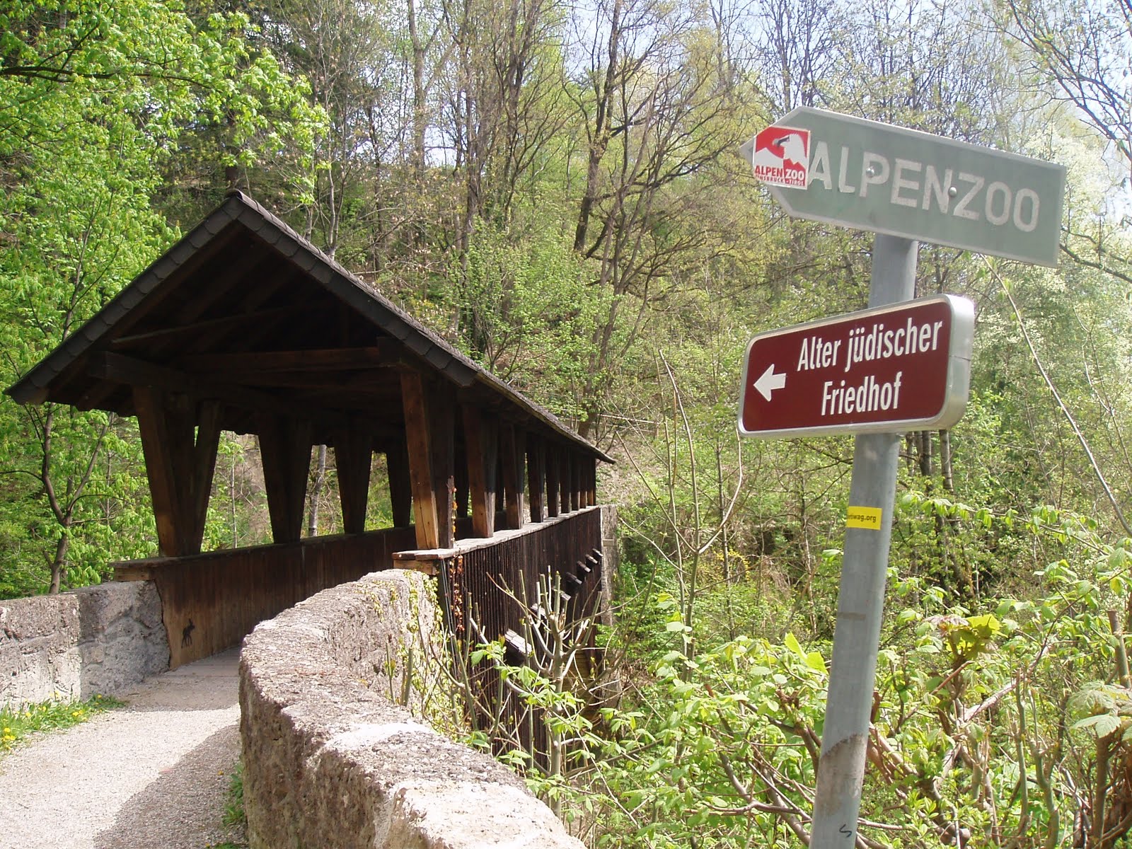
 Below the Alpenzoo, close to the Hungerburgbahn, is a bridge to a hill called the Judenbühel, or literally, Jews’ Hill. From a cursory online search I found that the first written reference to it is from 1598, when a Jewish local man got permission from court to establish a family plot there, “where the old Jewish graves were”. 

  
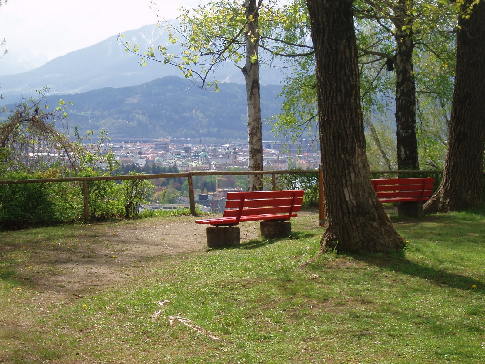
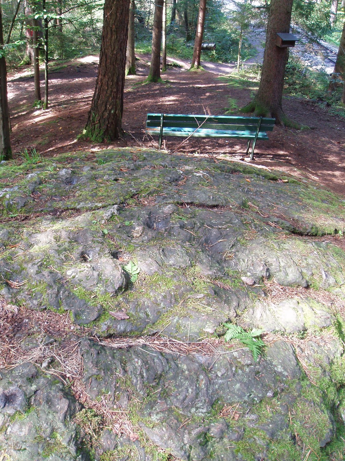
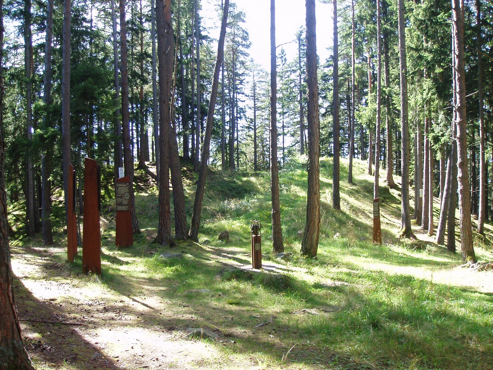
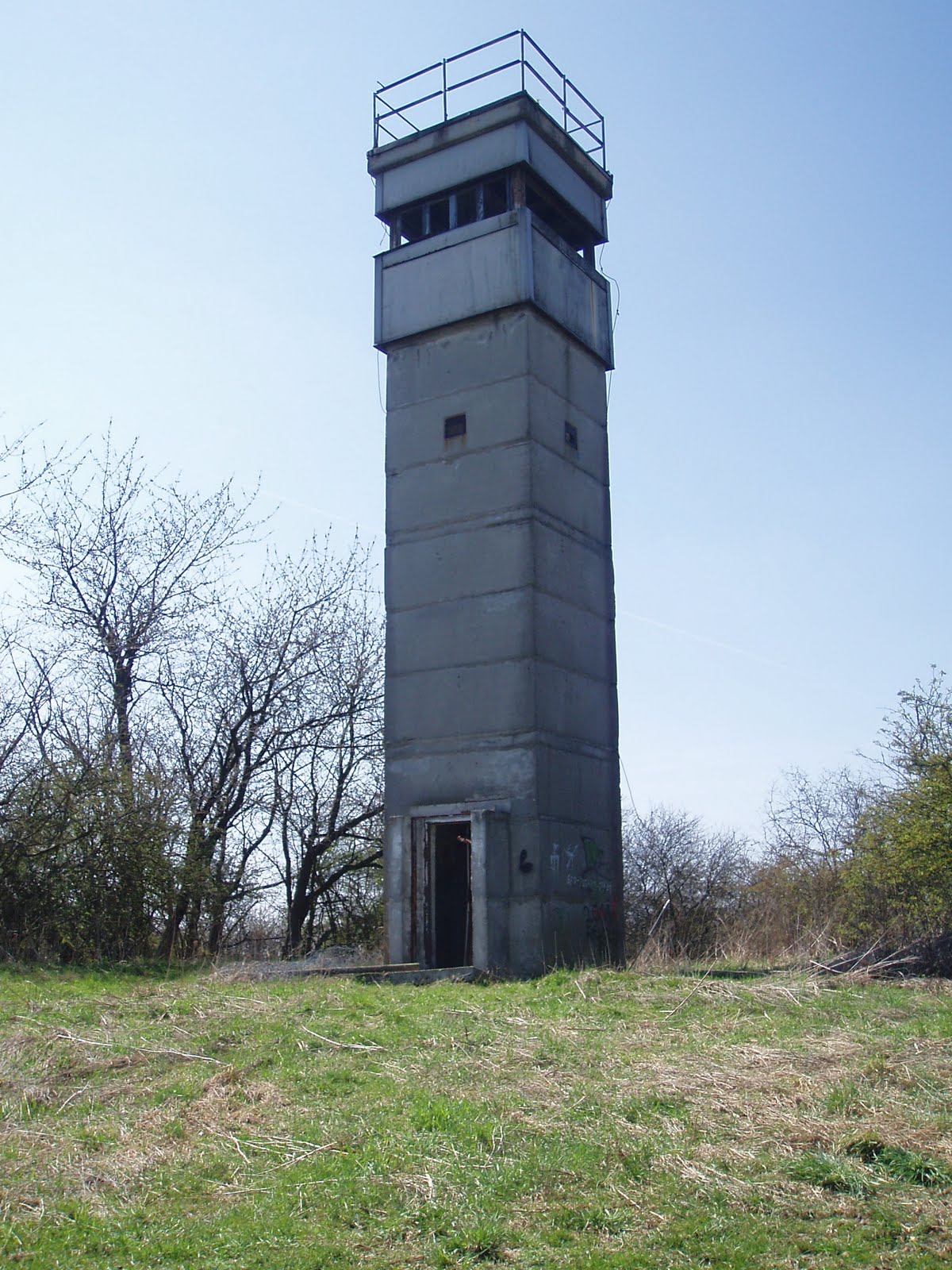
The old Jewish cemetery (rediscovered and now an historical site — the actual cemetery moved to the Westfriedhof in the 19th century) is found on a southern slope, not at the top. The top of the Judelbühel is as flat as a pancake, as wide as a parking lot, and circular. It currently holds a grassy park with a playground.

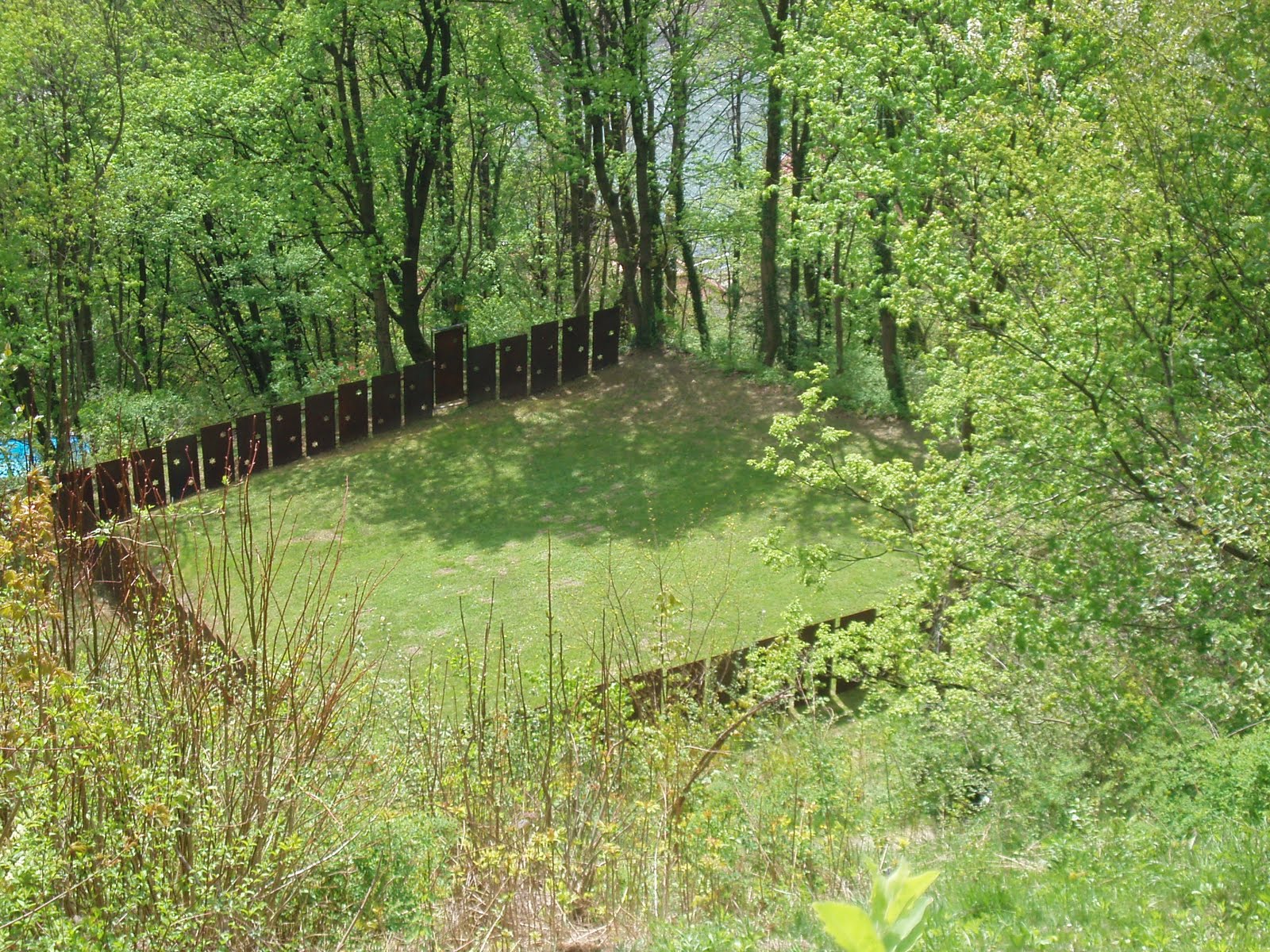
 The sides of the hill are covered with moss and trees, but there are places where the ground is eroding. And here you can see that there are no stones in this ground at all, it’s all just earth and tree roots. Which I find unusual, since this whole region full of rocks and boulders of all sizes. Was it landscaped in the last 100 years, or did it slowly grow, like the altar mound atop the Goldbichl?

 There may be perfectly modern answers about the flat-topped Judelbühel (maybe the top was landscaped for the playground in the last century or two?), but I haven’t found them yet. In the meantime I am left with comparisons to the Hexelbodele near Birgitz, and Schlern, and Bergisl and the Kalvarienberg, and other flat-topped hills which have histories as places of pre-historic communion. 
Which brings me back to Norbert Mantl and a few things he speculated about, in his book about pre-christian relics in the Inn Valley. One was that a few place-names beginning with “Jud-” are morphed from “Haid-” or some medieval version of it, which means “heathen”, which makes sense if you remember that to the early Christians (and in some places today too), Jews were just another kind of heathen. Mantl writes:

‘[The Judenbühel] is supposed to have gotten its name from the old Jewish cemetery which had been here… however it always questionable to view such cases as chapters of Jewish history. The Judenbühel is a “heathen” hill and for this reason only did the Jewish cemetery end up here, because Jews, as arch-heathens, could only be buried where other heathens were buried. One would never have allowed [in the Middle Ages] a Jewish cemetery to be built in such a beautiful place, if the Judenbühel and its neighbor the Ruch* had not already been home to the oldest and most evil form of heathendom. [Here I think he is referring to the Three Bethen.] Stone-age finds were made on the hill, therefor there was a very old settlement here and one can assume with some certainty that the hill was a holy place**, from which it got its name in early Christian times, independent from  later Jewish settlement in Innsbruck.’

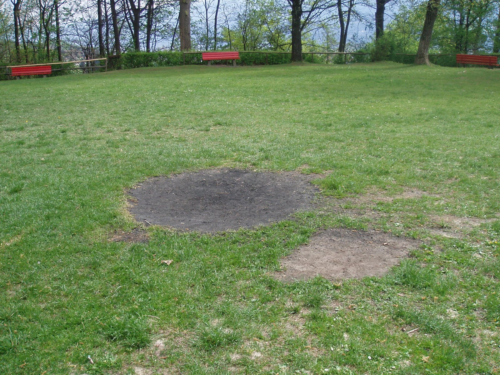
 Smack in the middle, traces of a regular campfire. Who makes these fires? Just squatters? An uneasy thought — I don’t know any local Pagans whom I can ask ( if maybe the fires are ceremonial), but there are elements of the neo-nazi scene which goes in for the Pagan, the mythological, the old ur-Germanic. The idea that they might be “keeping the fires lit” on these ancient meeting grounds does give one pause. Then again, what do I know, it might be the Scouts.
*I don’t know what the “Ruch” is.

** Why? Mantl does this all the time, assumes that because it was used, it was a holy place.
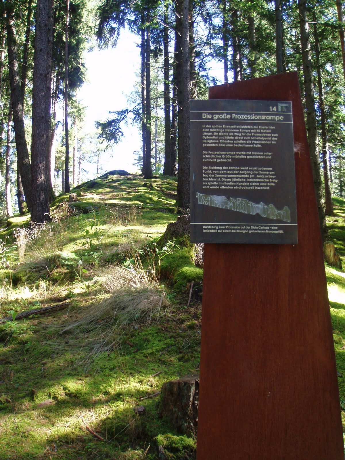
>Forgotten Innsbruck: Osterfeld

>Last week the City Museum hosted a talk on a rather obscure but interesting little corner of Innsbruck, specifically a field at the edge of town called Osterfeld, in Amras. This little piece of land was farmland for a long time, and for the past few decades it’s held community garden plots. But for a couple of years it was the resting place (not so final, it turned out) for the hundreds of victims of the Allied bombing raids on Innsbruck. Plans were underway to make the Osterfeld into a new, central cemetery in Tirol, not only for the air strike victims but for the newcomers from South Tirol, who had no family plots up here. According to an article in ORF, the landowner initially refused to give over his property, so the authorities simply had him reconscripted into the war. He survived, and returned after the war’s end to demand that the bodies be exhumed from his land. They were then transferred into a memorial plot in the cemetery in Pradl.

What seems like something that everyone would remember, ended up being another part of the general amnesia concerning events from that time. Eventually the community garden plots were parceled out, and all was forgotten until 1979, when a woman came upon two small cross pendants in the earth. And then a piece of bone, which upon further inspection was determined to be human. Which means that not everyone made it in one piece into the new cemetery.

I asked Paschberg, an Amras resident, for his take on this story, and he in turn asked his mother if she could remember the field’s use as a wartime cemetery. She remembered a convoy of trucks bearing coffins as it passed her family home, and this must have been even more keenly remembered due to the fact that one of her cousins, a young woman barely 18, lay in one of the coffins. (15.04.11. This I misread; her cousin was indeed killed in that air raid but was buried later in the regular Amras cemetery, not in Osterfeld and so would not have been among the dead transported there.)
She also noted that one did not ask questions at the time, nor speak too pointedly about anything with the neighbors, lest it all be turned around somehow and used against you. It must have been somewhat frustrating for my informant, quite the train enthusiast, to find that another victim of that collective amnesia had been a railway by-pass, not 100 meters from the family home, built to circumvent the (bombed out) train station, and promptly and completely forgotten after the war. As he tells it, describing what the older generation remembered of the line, “[i]t just appeared. One didn’t ask questions, nor did one make trouble to find out when – or even if – trains ran, and afterward it was just another thing to forget as quickly as possible. All in all, a time of deliberate looking away.”

>Ruins

>There’s a blog called After The Final Curtain, by photographer Matt Lambros, dedicated to the documentation of old abandoned movie theaters and news of restorations. The photographs are awesome.

Closer to home: in Phoenixville, Pennsylvania, a group of private citizens fought hard to take over and restore the Colonial Theater, which had been sitting in disrepair for years. The Colonial is now a major draw to the town, showing slightly-off-beat films, old silent movies, and live concerts. “The Blob”, a 1950s horror movie filmed nearby, was the inspiration for the incredibly popular annual “Blobfest” (highlight: the Running Out re-enactment, where lucky volunteer crowds are filmed as they run out of the theater, screaming.)

h/t to Benedikt

>Something Interesting About The Judenstein

>Two years ago I wrote a post about the local tale of Judenstein, or the “Jews’ Stone”, a tale which had been picked up by the Brothers Grimm and made known the world over. Last month I read a very interesting book about pre-Christian finds in Austria (cult stones, altars, that kind of thing) and came across this, which I also have posted as an update to my original post (translated here by me):

The “Judenstein” was without a doubt once an altar, where people had been once ritually sacrificed… According to the legend, after the murder, the Jews hung the boy from a birch tree. “That is a purely heathen story, nothing Christian nor Jewish in it”, writes Norbert Mantl in his 1967 book about pre-Christian cult relics in the Upper Inn Valley.  “The saga deals with the memory of a ages-old fertility sacrifice, whose ritual is still recognizable. Blood was spilled over the stone and the birch, representing the all plant life necessary to humans, received the corpse as an offering. It had to do with fertility and a good harvest, but also for the welfare and prosperity of humans and their animals.”

If true, it fits in well with the general idea that the church sometimes twisted older stories to their advantage (just think of all those saints and martyrs!) and may even have felt in necessary as a war tactic at the time, refitting the story around the more current “enemy”, having dealt sufficiently with the heathens centuries earlier.

>More Pagans In Tirol

>Yes, I know it look like a face in this photo, with a mouth full of pine needles, but that’s a trick of the shadows. There are at least a dozen cup marks in this stone, and they most certainly date back to the Bronze Age. There are various theories floating around as to what purpose these cup marks had. Maybe for ritual offerings, maybe for astronomical purposes or as pre-historic sign posts. Everyone has a theory, no one really knows. There is supposedly another stone nearby, one hill over from the altar mound at Goldbichl. For me it’s fascinating to think that these markings are from modern humans, with just as much intelligence potential as we have today, who lived here in these hills 6000 years ago, probably right where villages still exist today. And that this practice had spread all over Europe, from Merano to Northumberland. What was going on?
Further up the hill, the Lanser Moor, or Lans Marsh, a nature reserve.
Nearby, the Lanser See, a popular swimming hole, deserted already. There’s a chill in the air now, even on sunny days, and swimming season is vorbei. A legend tells of a rich man who envied a farmer’s grove of trees, and took him to court to obtain it. The judge was unfair and the farmer lost his land, but not before he cursed it to sink under water. Which it did, and now we have the Lanser See to swim in.

Pagans In Tirol: Goldbichl

>Thanks to a recent post by a fellow local blogger, I was diverted from my studies by a desire to see a nearby ancient sacrificial burning site, just minutes up the road from town.

Sacrificial burning was, in the Bronze and Iron Ages and into antiquity, a fairly common pratice. The ancient Hebrews did it, and the Greeks, and so did the people of Tirol. Just as the funeral pyre allowed the deceased to leave his or her earthly shell and head off for the great beyond, the ritual sacrifice operated on the same premise; that the sacrificed animal — or object — would lose its material composition and rise as smoke for the gods to receive.
The oldest ritual sacrificial burnings found on the Goldbichl (Bichl is an old alpine word for hill) date back to 2000-1500 B.C. The first altars were clay/mud platforms ringed by stone blocks. Later, a high stone altar was built over the platforms. As clay was necessary to ritual cleansing of the fires, more was applied each time. In this way, the altar grew in height over time.
In the photo above, the level at which the metal signs are found is the natural height of the hill. The mound beyond it is the altar site.


At some point the site fell out of use — possibly its people moved on or were forced away. After a few centuries of disuse, the Raeti crossed the Brenner Pass and settled in. They revived the ritual fires on the Goldbichl, and did some work on the place — they added ramparts, and rose the altar site to a 7-meter-high pyramid. To this height they added a 40-meter-long ramp up the side, which was used as a processional path to the top and led directly to the altar. The ramp lines up exactly with the point at which the sun rises on the summer solstice. Cool, no? I imagine a dawn procession, where the sun rose right up over the fire. Very theatrical.

Archaeologists discovered one Bronze-Age grave within the walls of the site. It contained the burnt remains of a young woman, along with broken pot shards and an intentionally smashed stone loom weight. Beyond its use in looms, which was to keep the vertical threads taut, the loom weight had symbolic value. In Greek mythology, spinning and weaving were analogous to the unfolding of destiny. Zeus’ daughter spun the thread of each human’s life. With this in mind, it is possible to imagine that the woman here was perhaps a priestess.

This is a rock which was covered with molten slag. The fire on the Goldbichl reached 1200°C (over 2000°F) which melted nearby rocks. It really must have been quite a show.

The site was destroyed around the time when the Romans pulled in. Drusus and Tiberius, stepsons of Caesar Augustus, led their legions through here on their way to the upper Danube in 15 B.C. It seems that the Raeti, like their Celtic neighbors just to the north, lived on as a subjects, and sent men to fight as soldiers in the Roman army. What happened to them after that, I don’t know. They mingled with everyone else in the Dark Ages and came out as Swiss, and probably there’s some Raeti in modern day Tiroleans as well.
Just up the road toward Patsch we lunched at the oh-so-nice Hotel Grünwalderhof, which has a pretty impressive view. I’m pretty sure we’re looking at the Stubaier Glacier, right above the sails.

More information about the Goldbichl, as well as archaeological finds on display, can be found at the tourist office in Igls.

>Up In The Border Guard Tower

>On the way back from Freiberg, we took a detour off the Autobahn and went hunting for the old East-West border, which is now just a state line again. We knew there were still guard towers standing, we could see them in the distance from the highway. After a few miles of country roads and a a farm path or two, we found them.
Twenty one years of neglect had taken its toll on the towers, but it was clear that we weren’t the only ones to have come up here. Probably the local kids use it as a secret hangout. We were delighted to find them open and climbed up to the top floor.
Nice view up here. I keep telling the beau that this area reminds me of Pennsylvania.
In the photo above, you can see the next tower, center right on the horizon. (It has a satellite dish erected on the roof.) So the space between this tower and that one would have been part of the border, complete with barbed wire and death strip. Not a trace of it is left except for the towers, which are probably too much trouble to dismantle.